
Wandelkaart 216 Welshpool & Montgomery Powys - OSI
Shropshire Hills- Clun Forest & Westbury Churchtown
Korte omschrijving
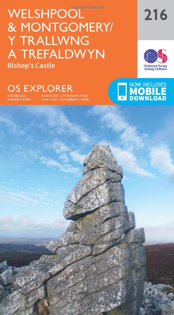
Wandelkaart Welshpool & Montgomery - Powys Wales Omvat ook: Bishop’s Castle. Productbeschrijving: Kaart nummer 216 in de OS Explorer kaarten reeks heeft betrekking op Montgomery (Trefald...

Specificaties
- Uitgever: Ordnance Survey
- ISBN-13: 9780319244098
- HOOFDCATEGORIEËN: Wandelkaart
- Activiteiten: Wandelen, Hiking & Trekking
- Regio: Powys, Wales
- Land: Wales
- Schaal: 1:25000
- Afmeting: 13x23
- Taal: Engels
- Reeks: Explorer Series
Volledige omschrijving
Wandelkaart Welshpool & Montgomery - Powys Wales
Omvat ook: Bishop’s Castle.
Productbeschrijving: Kaart nummer 216 in de OS Explorer kaarten reeks heeft betrekking op Montgomery (Trefaldwyn). Bishop's Castle en Welshpool (Trallwng). Hoogtepunten van het gebied: de Shropshire Hills, de rivier de Severn, Clun Forest, Westbury, Churchtoewn, Argoed en de Stiperstones. Ook ziet u een gedeelte van Offa's Dyke Path en de Glynd'r Way. De OS Explorer kaart voor Welshpool & Montgomery is beschikbaar in zowel de standaard papieren versie als de weerbestendige 'Actief' versie.
Productdiscription: Map sheet number 216 in the OS Explorer series covers Montgomery (Trefaldwyn). Bishop's Castle, and Welshpool (Trallwng). Highlights of the area include: the Shropshire Hills, River Severn, Clun Forest, Westbury, Churchtoewn, Argoed, and the Stiperstones. Also shows part of Offa’s Dyke Path and Glyndwr’s Way. The OS Explorer map for Welshpool & Montgomery is available in both the standard paper version and weatherproof 'Active' version.
Locatie op kaart
Gekoppelde artikelen

Wandelkaart 216 Welshpool & Montgomery Powys - OSI • 9780319244098
standaard versieWandelkaart Welshpool & Montgomery - Powys Wales Omvat ook: Bishop’s Castle. Productbeschrijving: Kaart nummer 216 in de OS Explorer kaarten reeks heeft betrekking op Montgomery (Trefaldwyn). Bishop's Castle en Welshpool (Trallwng). Hoogtepunten van het gebied: de Shropshire Hills, de rivier de Severn, Clun Forest, Westbury, Churchtoewn, Argoed en de Stiperstones. Ook ziet u een gedeel…

Wandelkaart 216 Welshpool & Montgomery - Wales - OSI • 9780319470886
weatherproof versieWandelkaart Welshpool & Montgomery - Powys Wales Omvat ook: Bishop’s Castle. Productbeschrijving: Kaart nummer 216 in de OS Explorer kaarten reeks heeft betrekking op Montgomery (Trefaldwyn). Bishop's Castle en Welshpool (Trallwng). Hoogtepunten van het gebied: de Shropshire Hills AONB, rivier Severn, Clun Forest, Westbury, Churchtoewn, Argoed en de Stiperstones. Ook vind u een gedeelt…
Overzichtskaarten

OSI Explorer & Explorer Active - Wales
OSI Explorer & Explorer Active - Wales

Producten op de overzichtskaart
Klik op een product om naar de detailpagina te gaan.
- Wandelkaart 151 Cardiff & Bridgend- Wales - OSI
- Wandelkaart 152 Newport & Pontypool- South Wales - OSI
- Wandelkaart 164 Gower AONB & Gwyr- South Wales - OSI
- Wandelkaart 165 Swansea & Abertawe- South Wales - OSI
- Wandelkaart 166 Rhondda & Merthyr Tydfil - OSI
- Wandelkaart 177 Carmarthen & Kidwelly- Wales - OSI
- Wandelkaart 178 Llanelli- Ammanford & Rhydaman - OSI
- Wandelkaart 185 Newcastle & Emly- Northumberland - OSI
- Wandelkaart 186 Llandeilo- Brechfa Forest- Wales - OSI
- Wandelkaart 187 Llandovery- South Wales - OSI
- Wandelkaart 188 Builth Wells & Llanfair-ym-Muallt - OSI
- Wandelkaart 189 Hereford & Ross-on-Wye- England - OSI
- Wandelkaart 198 Cardigan & New Quay- Wales - OSI
- Wandelkaart 199 Lampeter- Wales - OSI
- Wandelkaart 200 Llandrindod Wells & Elan Valley - OSI
- Wandelkaart 201 Knighton & Presteigne- Wales - OSI
- Wandelkaart 202 Leominster & Bromyard Hererfordshire - OSI
- Wandelkaart 203 Ludlow & Shropshire Hills AONB - OSI
- Wandelkaart 213 Aberystwyth & Cwm Rheidol - Wales - OSI
- Wandelkaart 214 Llanidloes- Newtown & Y Drenewydd - OSI
- Wandelkaart 215 Newtown & Machynlleth- Powys Wales - OSI
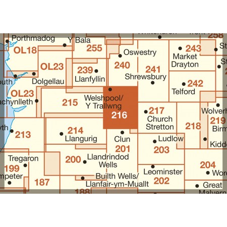
- Wandelkaart 216 Welshpool & Montgomery- Powys - OSI
- Wandelkaart 217 Long Mynd & Wenlock Edge - OSI
- Wandelkaart 239 Lake Vyrnwy & Efyrnwy- North Wales - OSI
- Wandelkaart 240 Oswestry & Croesoswallt- Shropshir - OSI
- Wandelkaart 241 Shrewsbury- shropshire England - OSI
- Wandelkaart 253 Lleyn Peninsula West Wales - OSI
- Wandelkaart 254 Lleyn Peninsula East- Wales - OSI
- Wandelkaart 255 Llangollen & Berwyn- West Wales - OSI
- Wandelkaart 256 Wrexham- Wrecsam & Llangollen - OSI
- Wandelkaart 257 Crewe & Nantwich & Cheshire East - OSI
- Wandelkaart 262 Anglesey West- Wales AONB - OSI
- Wandelkaart 263 Anglesey East AONB- Wales - OSI
- Wandelkaart 264 Vale of Clwyd & Dyffryn Clwyd - OSI
- Wandelkaart 265 Clwydian Range & Bryniau Clwyd - OSI
- Wandelkaart 266 Wirral- Chester & Caer- Merseyside - OSI
- Wandelkaart 267 Northwich & Delamere Forest - OSI
- Wandelkaart 275 Liverpool- South West England - OSI
- Wandelkaart OL12 Brecon Beacons NP- West & Central - OSI
- Wandelkaart OL13 Brecon Beacons NP - Eastern area - OSI
- Wandelkaart OL17 Snowdon & Conwy Valley area - OSI
- Wandelkaart OL35 North Pembrokeshire Wales - OSI
- Wandelkaart OL36 South Pembrokeshire- Wales - OSI
Artikelen uit dezelfde regio
Wandelkaart 160 Brecon Beacons NP - Powys Wales - OSI • 9780319262580
Wandelkaart Brecon Beacons NP - Powys Wales Productbeschrijving: OS Landranger kaart 160 is een all purpose kaart volgepakt met informatie om u het gebied Brecon Beacons National Park in Zuid-Wales te helpen leren kennen. Het iconische landschap van Brecon Beacons staat vol bossen, watervallen, en de hoogste piek in zuidelijk Groot-Brittannië (Pen y Fan) die tot 886 meter stijgt. De regio …
Wandelkaart 16 Black Mountains & Brecon Beacons NP - OSI • 9780319474846
Wandelkaart 161- The Black Mountains & Brecon Beacons NP Productbeschrijving: Landranger kaart 161 toont Abergavenny en de Black Mountains. De Black Mountain range is fysiek gescheiden van de rest van de Brecon Beacons door de rivier Wye. Offa's Dyke path en Sugar Loaf mountain trekken veel wandelaars en adrenalinezoekers aan de iconische Welsh regio. U kunt ook een bezoek brengen aan de p…

Wandelkaart 215 Newtown & Machynlleth- Powys Wales - OSI • 9780319244081
Wandelkaart Newtown & Machynlleth - Powys Wales Omvat ook: Llanfair Caereinion Productomschrijving: OS Explorer kaart 215 is een dubbel zijdige kaart die van Machynlleth naar Newtown loopt (Y Drenewydd) met een deel van Glyndwr's Way (Llwybr Glynd'r). De meeste paden volgen de valleien, hoewel steilere paden kunnen worden gevonden via de bosgebieden. De OS Explorer kaart voor Newtown &…

Wandelkaart 201 Knighton & Presteigne Wales - OSI • 9780319470732
Wandelkaart Knighton & Presteigne- Powys Wales Productbeschrijving: Kaart nummer 201 in de OS Explorer reeks omvat Knighton, Presteigne (Llanandras), Knighton (Tref-y-Clawdd) en Hay-on-Wye. Hoogtepunten van het gebied zijn onder andere: Shropshire Hills gebied van uitzonderlijke natuurlijke schoonheid AONB, rivier Lugg, River Wye, Wye Valley, Brecon Beacons National Park, Brecons, Brecon h…
Wandelkaart 161 Black Mountains & Brecon Beacons NP - OSI • 9780319262597
Wandelkaart 161 - Black Mountains & Brecon Beacons NP Productbeschrijving: De Black Mountains range, is fysiek gescheiden van de rest van de Brecon Beacons door de rivier Wye. De Offa's Dyke path en Sugar Loaf Mountain trekt veel wandelaars en adrenaline asielzoekers aan de iconische Welsh regio. U kunt ook een bezoek brengen aan de pittoreske stad van Abergavenny, die slechts 20 mijl vana…