
Wandelkaart 240 Isle Royale NP- Michigan - Nat Geo
Er leven zo'n duizend elanden en ongeveer vijfentwintig wolven
Korte omschrijving
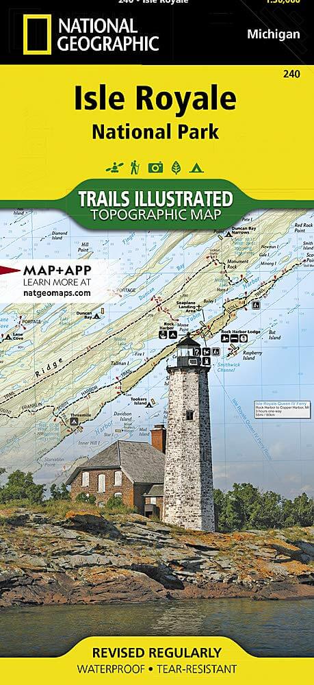
TOPO Wandelkaart 240 - Isle Royale NP- Michigan - Nat Geo Productomschrijving: Het Isle Royale National Park is een nationaal park in de Amerikaanse staat Michigan. Het bestaat uit Isle Roya...

Specificaties
- Uitgever: National Geographic
- ISBN-13: 9781566953672
- HOOFDCATEGORIEËN: Wandelkaart
- Regio: MIchigan, USA
- Land: Verenigde Staten van Amerika (USA)
- Nationale parken: Isle Royale NP, Michigan USA
- Schaal: 1:50000
- Afmeting: 10x19
- Taal: Engels
Volledige omschrijving
TOPO Wandelkaart 240 - Isle Royale NP- Michigan - Nat Geo
Productomschrijving: Het Isle Royale National Park is een nationaal park in de Amerikaanse staat Michigan. Het bestaat uit Isle Royale en 450 kleinere eilanden in het Bovenmeer. In 1940 werd het gebied tot nationaal park uitgeroepen. Het park is het kleinste van alle nationale parken in de Verenigde Staten. Er leven zo'n duizend elanden en ongeveer vijfentwintig wolven. In de zomer is Isle Royale per boot te bereiken vanuit Houghton.
Engelse omschrijving: A rugged and isolated island on Lake Superior, Isle Royale offers unparalleled opportunities for hiking, backpacking, boating, paddling, and scuba diving in solitude, far from the sights and sounds of civilization. National Geographic's Trails Illustrated map of Isle Royale National Park delivers unmatched detail and valuable information to assist you in your exploration of this remote wilderness. Created in partnership with local land management agencies, this expertly researched map features key areas of interest including Passage Island, Rock Harbor, Windigo, and many shipwreck sites.
Whether day hiking or backpacking to remote campsites, the map's clearly marked trails with mileage between intersections will help you choose the route that's right for you. The map base includes contour lines and elevations for summits and lakes, as well as soundings of Lake Superior. Boaters will appreciate the handy water mileage chart. Recreation features are clearly marked, including campgrounds, interpretive trails, lighthouses, lookout towers, ferry routes, docks, and seaplane anchorages. A variety of helpful information about camping, fishing, and boating in the region is included as well. Every Trails Illustrated map is printed on "Backcountry Tough" waterproof, tear-resistant paper. A full UTM grid is printed on the map to aid with GPS navigation.
Other features found on this map include: Blake Point, Cumberland Point, Feldtmann Ridge, Isle Royale, Siskiwit Bay, Sugar Mountain.
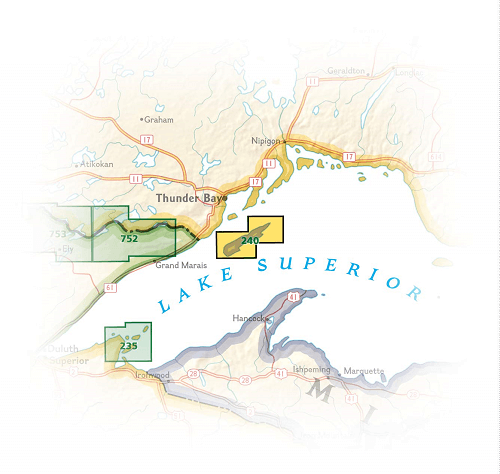
Locatie op kaart
Artikelen uit dezelfde regio

Wandelgids Great Lakes & Midwest USA NP - Lonely Planet • 9781838696108
Great Lakes & Midwest USA NP - Lonely Planet Productomschrijving: Lonely Planet's Great Lakes and the Midwest USA's National Parks is uw paspoort voor het meest relevante, up-to-date advies over wat te zien en over te slaan. Zwerf door het idyllische Isle Royale, zeil in Voyageurs en verken Wind Cave, allemaal met je vertrouwde reisgenoot. Duik in het hart van de nationale parken van de Gr…