
Wandelkaart 300 Howardian Hills AONB - OSI
Omvat delen van de Howardian Hills AONB en The Wolds
Korte omschrijving
Wandelkaart Howardian Hills AONB & Malton - North Yorkshire Productbeschrijving: Gecentreerd rond Malton, bevat OS Explorer kaart 300 delen van de Howardian Hills AONB en The Wolds. Met veel...

Specificaties
- Uitgever: Ordnance Survey
- ISBN-13: 9780319471722
- HOOFDCATEGORIEËN: Wandelkaart
- Activiteiten: Wandelen, Hiking & Trekking
- Regio: North Yorkshire, Engeland
- Land: England
- Waterafstotende kaart: Ordnance Survey ACTIVE Explorer Weatherproof Maps
- AONB - Area of Outstanding Beauty: Howardian Hills, Helmsley AONB
- Schaal: 1:25000
- Afmeting: 13x24
- Taal: Engels
- Reeks: Explorer ACTIVE
Volledige omschrijving
Wandelkaart Howardian Hills AONB & Malton - North Yorkshire
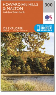
Productbeschrijving: Gecentreerd rond Malton, bevat OS Explorer kaart 300 delen van de Howardian Hills AONB en The Wolds. Met veel mogelijkheden voor het verkennen van zowel het platteland (met inbegrip van het deel van de Yorkshire Wolds Way) en de historische gebouwen zoals Castle Howard, is het ideaal om te wandelen, of te fietsen. De OS Explorer kaart voor Howardian Hills & Malton is beschikbaar in zowel de standaard papieren versie als de weerbestendige 'Actief' versie.
Productdiscription: Centred around Malton, OS Explorer Map 300 contains parts of the Howardian Hills AONB and The Wolds. With ample opportunities for exploring both the countryside (including part of the Yorkshire Wolds Way) and historic buildings such as Castle Howard, it's ideal for walking, bycycling or horse riding. The OS Explorer map for Howardian Hills & Malton is available in both the standard paper version and weatherproof 'Active' version.
Locatie op kaart
Gekoppelde artikelen

Wandelkaart 300 Howardian Hills AONB & Malton - OSI • 9780319245521
standaard versieWandelkaart Howardian Hills AONB & Malton - North Yorkshire 300 / Howardian Hills AONB & Malton, North Torkshire, England - Kaart nummer 300 is een all purpose kaart vol gepakt met informatie om u het gebied te helpen leren kennen. De 204 Landranger-kaarten bestrijken het land. Elke kaart heeft een oppervlakte van 40 km door 40 km (25 mijl door 25 mijl) en zoals andere kaarten van Ordnance…

Wandelkaart 300 Howardian Hills AONB - OSI • 9780319471722
weatherproof versieWandelkaart Howardian Hills AONB & Malton - North Yorkshire Productbeschrijving: Gecentreerd rond Malton, bevat OS Explorer kaart 300 delen van de Howardian Hills AONB en The Wolds. Met veel mogelijkheden voor het verkennen van zowel het platteland (met inbegrip van het deel van de Yorkshire Wolds Way) en de historische gebouwen zoals Castle Howard, is het ideaal om te wandelen, of te fiet…
Overzichtskaarten

Area's of Outstanding Natural Beauty - AONB's UK
Area's of Outstanding Natural Beauty - AONB's UK

Producten op de overzichtskaart
Klik op een product om naar de detailpagina te gaan.
- Wandelgids - Guide to the Cotswolds AONB - AA
- Wandelkaart 24 - Chilterns AONB - AA
- Fietskaart- en Mtb kaart - The Cotswolds - Goldeneye
- Wandelgids - Cotswold classic walks guidebook - Goldeneye
- Wandelkaart - Cotswold South AONB - Goldeneye
- Wandelgids - Exploring the Cotswolds - Goldeneye
- Wandelgids - Cotswold Classic Walks - Goldeneye
- Wandelkaart - Cotswolds- Malverns & Forest of Dean - Goldeneye
- Wandelgids - The Cotswold Way 30 classic routes - Cicerone
- Wandelgids - Kent walking guide - Cicerone
- Wandelgids - North Downs Way Nat. trail - Cicerone
- Wandelgids - Chilterns walking guide - Cicerone
- Wandelgids - Suffolk coast & Heaths walks - Cicerone
- Wandelgids - North Downs Way - Map Booklet - Cicerone
- Wandelgids - North Pennines AONB walking guide - Cicerone
- Wandelgids - Ridgeway National Trail - Cicerone
- Wandelgids - Forest of Bowland & Pendle - Cicerone
- Wandelgids - Hampshire's Test Way walking guide - Cicerone
- Wandelgids & Fietsgids - The Cotswold AONB - Cicerone
- Wandelgids - Walking on the Gower - Cicerone
- Wandelgids - North Wessex Downs - Cicerone Press
- Wandelgids - Walking on the North Wessex Downs - Cicerone
- Wandelgids - Silverdale & Arnside AONB - Cicerone
- Wandelgids - The Kennet and Avon Canal walking guide - Cicerone
- Wandelgids - North Downs Way- 246 km - Trailblazer
- Wandelkaart OL2 - Yorkshire Dales- Southern & Western Areas - OSI
- Wandelkaart OL19 - Howgill Fells and Upper Eden Valley - OSI
- Wandelkaart OL21 - South Pennines - Yorkshire - OSI
- Wandelkaart OL31 - North Pennines- Teesdale & Weardale - OSI
- Wandelkaart OL40 - The Broads - OSI
- Wandelkaart OL41 - Forest of Bowland & Ribblesdale - OSI
- Wandelkaart OL45 - The Cotswolds AONB- Gloucestershire - OSI
- Wandelkaart 108 - Lower Tamer Valley & Plymouth- Cornwall- OSI
- Wandelkaart 115 - Exmouth & Sidmouth- Devon - OSI
- Wandelkaart 137 - Ashford- Kent downs AONB- England - OSI
- Wandelkaart 140 - Quantock Hills AONB- Somerset - OSI
- Wandelkaart 140 - Quantock Hills AONB & Bridgwater- Devon - OSI
- Wandelkaart 147 - Sevenoaks & Tonbridge- Kent - OSI
- Wandelkaart 164 - Gower AONB & Gwyr- South Wales - OSI
- Wandelkaart 164 - Gower AONB & Gwyr- Wales - OSI
- Wandelkaart 171 - Chiltern Hills West & Henley-on-Thames OSI
- Wandelkaart 171 - Chiltern Hills West AONB- Wycombe - OSI
- Wandelkaart 172 - Chiltern Hills East AONB- Wycombe - OSI
- Wandelkaart 181 - Chiltern Hills AONB North- England - OSI
- Wandelkaart 181 - Chiltern Hills North AONB- Wycombe - OSI
- Wandelkaart 190 - Malvern Hills & Bredon Hill - OSI
- Wandelkaart 190 - Malvern Hills AONB & Bredon Hill - OSI
- Wandelkaart 203 - Ludlow- Shropshire Hills AONB - OSI
- Wandelkaart 217 - Long Mynd & Wenlock Edge- Schropshire- OSI
- Wandelkaart 254 - Lleyn Peninsular East- North Wales - OSI
- Wandelkaart 261 - Boston- Lincolnshire AONB - OSI
- Wandelkaart 262 - Anglesey West- Wales AONB - OSI
- Wandelkaart 263 - Anglesey East AONB- Wales - OSI
- Wandelkaart 273 - Lincolnshire Wolds South AONB - OSI
- Wandelkaart 282 - Lincolnshire Wolds North AONB - OSI
- Wandelkaart 298 - Nidderdale AONB- Yorkshire - OSI
- Wandelkaart 298 - Nidderdale AONB North Yorkshire - OSI
- Wandelkaart 300 - Howardian Hills AONB - OSI
- Wandelkaart 300 - Howardian Hills AONB & Malton - OSI
- Wandelkaart - Mourne Mountains N. Ireland - Harvey maps
- Wandelkaart - Fietskaart Forest of Bowland - Harvey maps
- Wandelkaart XT40 - Anglesey Coastal Path N. Wales - Harvey Maps
- Wandelkaart XT40 - Pennine Way Noord - Harvey Maps
- Wandelkaart XT40 - Pennine Way Zuid - Harvey Maps
- Wandelgids Cotswold - Way Two-way trekking guide - Knife Edge
- Reisgids Oxford & the Cotswolds AONB - Edicola
- Reisgids Cotswolds England - Rough Guides
- Reisgids Go Slow- Sussex & the South Downs- Weald & Coast - Bradt
- Travelguide Oxford & The Cotswolds pocket guide - Lonely Planet
- Wandelgids - The Ridgeway National trail - Trailblazer
Artikelen uit dezelfde regio

Wandelkaart OL26 North York Moors Western area - OSI • 9780319469446
Wandelkaart North York Moors - North Yorkshire England Productbeschrijving: Kaart nummer OL26 in de OS Explorer reeks heeft betrekking op de Cleveland Hills, het westelijke deel van de North York Moors en een klein deel van de Howardian hills. Hoogtepunten van het gebied zijn onder andere: Saltburn-by-the-Sea, Guisborough, Helmsley en Hunt Topping. Productdiscription: Map sheet number …

Wandelkaart 100 Malton & Pickering Yorkshire - OSI • 9780319261989
Wandelkaart Malton & Pickering - North Yorkshire England - OSI Productbeschrijving: Landranger kaart 100 bestrijkt van het zuidwesten van het North York Moors National Park, en omvat de steden Malton, Pickering, Helmsley en Easingwold. De start van de Cleveland Way (of einde) in Helmsley is 177km lang, of volg verschillende wandelpaden langs de pittoreske rivier Derwent. De OS Landrang…

Wandelkaart OL26 North York Moors NP England - OSI • 9780319468302
Wandelkaart North York Moors NP - England Productomschrijving: OL26 - North York Moors, Western area - kaart nummer OL26 in de OS Explorer reeks heeft betrekking op de Cleveland Hills, het westelijke deel van de North York Moors en een klein deel van de Howardian Hills. Hoogtepunten van het gebied zijn onder andere: Saltburn-by-the-Sea, Guisborough, Helmsley en Hunt Topping. OL26 -…

Wandelkaart 100 Malton & Pickering Yorkshire - OSI • 9780319474235
Wandelkaart Malton & Pickering - North Yorkshire England - OSI Productbeschrijving: Landranger kaart 100 bestrijkt het zuidwesten van het North York Moors National Park, en omvat de steden Malton, Pickering, Helmsley en Easingwold. De start van de Cleveland Way die (eindigt) in Helmsley en 177km lang is, of die verschillende wandelpaden volgt langs de pittoreske rivier Derwent. De kaart OS…

Wandelgids Trekking the Coast to Coast Path - Knife Edge • 9781912933143
Trekking the Coast to Coast Path - Knife Edge Productomschrijving: Deze beroemde wandelroute van om en bij de 290 km, loopt door 3 nationale parken, 3 wereldbekende nationale parken die elk appart hun eigen specifieke voordelen bieden. Route: St-Beest to Robin Hood's Bay Engelse omschrijving: The definitive two-way guide to the Coast to Coast Path: both eastbound and westbound rou…