
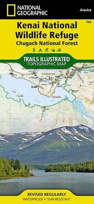
Wandelkaart 760 Kenai National Wildlife Refuge - Alaska - Nat Geo
Omvat eveneens het Chugach National Forest
Korte omschrijving
TOPO Wandelkaart 760 - Kenai National Wildlife Refuge - Alaska Productomschrijving: The Kenai National Wildlife Refuge is a 1.92-million-acre (7,770 km2) wildlife habitat preserve located on...

Specificaties
- Uitgever: National Geographic
- ISBN-13: 9781566953733
- HOOFDCATEGORIEËN: Wandelkaart
- Regio: Alaska, USA
- Land: Verenigde Staten van Amerika (USA)
- Regionale parken: Chugach National Forest, Alaska USA, Kenai National Wildlife Refuge, Alaska USA
- Schaal: 1:105600
- Afmeting: 10x19
- Taal: Engels
Volledige omschrijving
TOPO Wandelkaart 760 - Kenai National Wildlife Refuge - Alaska
Productomschrijving: The Kenai National Wildlife Refuge is a 1.92-million-acre (7,770 km2) wildlife habitat preserve located on the Kenai Peninsula of Alaska, United States. It is adjacent to Kenai Fjords National Park.
Engelse omschrijving: National Geographic's Trails Illustrated map of Kenai National Wildlife Refuge was created for all outdoor enthusiasts adventuring in this diverse area on the Kenai Peninsula in Alaska. Created in cooperation with U.S. Fish and Wildlife, U.S. Forest Service, National Park Service and others, this expertly researched map contains an abundance of information about the recreational opportunities available in the area. Coverage includes Kenai NWR, Wilderness and Mountains; Chugach Nation Forest, Tustumena, Kenai and Swan Lakes; Skilak Lake and Wildlife Recreation Area; Seward and Sterling Highways; Kenai, Swanson and Resurrection Rivers; Turnagain Arm; Iditarod National Historical Trail; and a number of State Recreation Areas and Sites.
Let the map guide you over land and water with mapped hiking, equestrian, Nordic ski and ATV trails, bike paths, canoe routes and a complete road network, including numbered Forest Service roads and scenic byways. Trails are labeled according to designated usage and are shown with mileage markers as is the Swanson River canoe route. Your navigation will be aided by the map's contour lines, elevations, labeled passes, peaks and summits, water features and glaciers, as well as boating hazard areas, soundings and nautical beacons. Among the recreation and adventure features pinpointed are campgrounds, trailheads, interpretive trails, anchorage points, boat ramps, dog mushing areas, wildlife viewing areas and scenic viewpoints. Background information and regulations of the area is also provided as well as QR codes for fishing and hunting licensing and current weather conditions. Every Trails Illustrated map is printed on "Backcountry Tough" waterproof, tear-resistant paper. A full UTM grid is printed on the map to aid with GPS navigation.
Other features found on this map include: Chugach National Forest, Kenai Lake, Skilak Lake, Turnagain Arm, Tustumena Lake.
Locatie op kaart
Overzichtskaarten

NAT GEO Alaska trails map
NAT GEO Alaska trails map

Producten op de overzichtskaart
Klik op een product om naar de detailpagina te gaan.
- Wandelkaart 231 Kenai Fjords NP- Alaska - Nat Geo
- Wandelkaart 248 Katmai NP- Alaska - Nat Geo
- Wandelkaart 254 Chilkoot Trail - Klondike Gold Rush - Nat Geo
- Wandelkaart 255 Glacier Bay NP- Alaska - Nat Geo
- Wandelkaart 257 Gates of the Arctic NP- Alaska - Nat Geo
- Wandelkaart 760 Kenai National Wildlife Refuge - Alaska - Nat Geo
- Wandelkaart 761 Prince William Sound West - Alaska - Nat Geo
- Wandelkaart 763 Kachemak Bay State Park - Alaska - Nat Geo
Artikelen uit dezelfde regio

Wandelkaart 763 Kachemak Bay State Park - Alaska - Nat Geo • 9781566950749
Wandelkaart Kachemak Bay State Park, Homer Alaska Omvat: Anchor Point, Chugach Islands, Fox River, Gore Point, Kachemak Bay, Kalgin Island, Kenai Fjords National Park, Kennedy Entrance, Nuka Bay, Nuka Island, Point Adam, Point Pogibshi, Port Dick, Tustumena Lake. Engelse omschrijving: Outdoor enthusiasts exploring the various public recreation lands in the southwestern part of the Kena…

Reisgids Alaska - Lonely Planet • 9781787015180
Reisgids Alaska - Lonely Planet Productomschrijving: Alaska is zoals men in de USA zegt, The last frontier", de onherbergzame natuur en bijhorende wildernis. Deze gloed nieuwe Lonely Planet gids, biedt een diepgaande inkijk in het Amerikaanse leven ver weg van Amerika ozgenaamd. Beren groter dan bizons, nationale parken zo groot als naties, en gletsjers groter dan andere Amerikaanse staten…

Wandelkaart 764 Chugach State Park- Anchorage - Natgeo • 9781566956789
TOPO Wandelkaart 764 - Chugach State Park- Anchorage - Natgeo Productomschrijving: Chugach State Park omvat een dikke 2004 M² KM, direct ten oosten van Anchorage Bowl in south-central Alaska. Engelse omschrijving: National Geographic's Trails Illustrated map of Chugach State Park and Anchorage combines unmatched detail with helpful information to offer an invaluable tool for making the…

Wandelkaart 249 Wrangell St.Elias NP - Nat.Geo. • 9781566953825
Wrangell St.Elias NP - National Geographic Productomschrijving: Met 13,2 miljoen hectare, zou Wrangell-St. Elias binnen de grenzen passen van Yellowstone, Grand Canyon, Glacier, Olympic en Yosemite National Parks met zelf nog ruimte over. Het strekt zich uit van een van de hoogste toppen van Noord-Amerika > Mount Stain Elias, tot aan de oceaan. Meer dan een kwart van het park is bedekt met…

Reisgids Alaska - Insight Guides ENG • 9781789198713
Reisgids Alaska USA - Insight Guides Productomschrijving: Van het beslissen wanneer te gaan, om te kiezen wat te zien als je aankomt, deze Insight Guides uitgave is alles wat je nodig hebt om uw reis te plannen en ervaar het beste van Alaska, met diepgaande inside-informatie over must-see, top attracties zoals Denali en verborgen culturele juweeltjes zoals Flattop Mountain. Engelse om…