
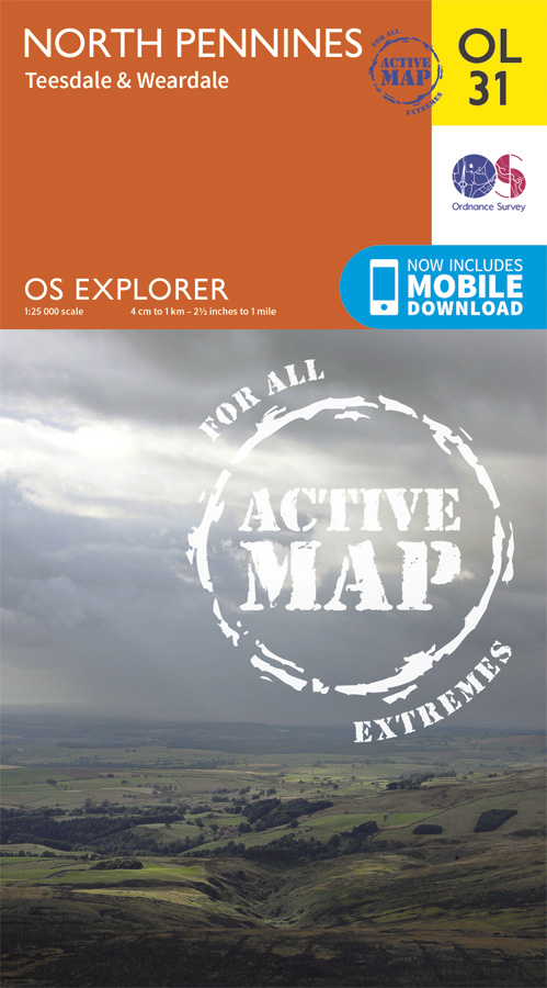
Wandelkaart OL31 North Pennines- Teesdale & Weardale - OSI
Hamsterley Forest- Middleton- Milburn Forest & Cow green
Korte omschrijving
Wandelkaart North Pennines- Teesdale & Weardale - England Omvat ook: Teesdale & Weardale Productbeschrijving: Kaart nummer OL31 in de OS Explorer kaarten reeks, omvat de North Pennines A...

Specificaties
- Uitgever: Ordnance Survey
- ISBN-13: 9780319469491
- HOOFDCATEGORIEËN: Wandelkaart
- Activiteiten: Wandelen, Hiking & Trekking
- Regio: Yorkshire, England
- Land: England
- Waterafstotende kaart: Ordnance Survey ACTIVE Explorer Weatherproof Maps
- AONB - Area of Outstanding Beauty: Western Pennines AONB
- Schaal: 1:25000
- Afmeting: 13x24
- Taal: Engels
- Reeks: Explorer ACTIVE
Volledige omschrijving
Wandelkaart North Pennines- Teesdale & Weardale - England
Omvat ook: Teesdale & Weardale
Productbeschrijving: Kaart nummer OL31 in de OS Explorer kaarten reeks, omvat de North Pennines AONB, Barnard Castle, Alton en Allenheads. Hoogtepunten van het gebied zijn onder andere: Hamsterley community Forest, Middleton, Milburn Forest, Cow green en Burnhope Reservoirs, Weardale en een deel van de Pennine Way. De OS Explorer kaart voor North Pennines is beschikbaar in zowel de standaard papieren versie en weerbestendige 'Actief' versie
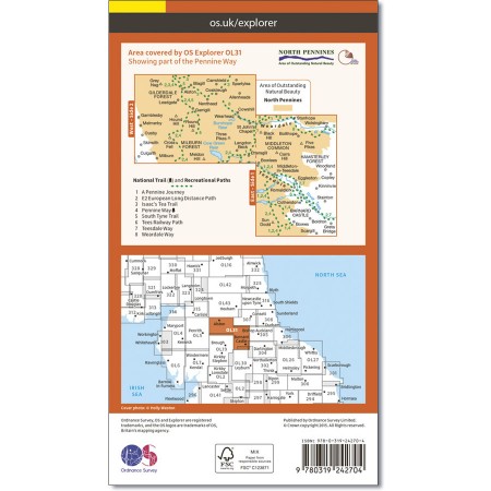
Kaart nummer OL31 is een all purpose kaart vol gepakt met informatie om u het gebied te helpen leren kennen. De kaarten bestrijken het land. Elke kaart heeft een oppervlakte van 40 km door 40 km (25 mijl door 25 mijl) en zoals andere kaarten van Ordnance Survey, National Grid-vierkanten worden verstrekt zodat elke functie een unieke referentienummer kan worden gegeven.
Productdiscription: Map sheet number OL31 in the OS Explorer series covers an area of the North Pennines AONB, Barnard Castle, Alton, and Allenheads. Highlights of the area include: Hamsterley Forest, Middleton Common, Milburn Forest, Cow Green and Burnhope Reservoirs, River Tees, Teesdale, River Wear, Weardale and a section of the Pennine Way. The OS Explorer map for North Pennines is available in both the standard paper version and weatherproof 'Active' version
Locatie op kaart
Gekoppelde artikelen

Wandelkaart OL31 North Pennines- Teesdale & Weardale - OSI • 9780319469491
weatherproof versieWandelkaart North Pennines- Teesdale & Weardale - England Omvat ook: Teesdale & Weardale Productbeschrijving: Kaart nummer OL31 in de OS Explorer kaarten reeks, omvat de North Pennines AONB, Barnard Castle, Alton en Allenheads. Hoogtepunten van het gebied zijn onder andere: Hamsterley community Forest, Middleton, Milburn Forest, Cow green en Burnhope Reservoirs, Weardale en een deel va…
Overzichtskaarten

Area's of Outstanding Natural Beauty - AONB's UK
Area's of Outstanding Natural Beauty - AONB's UK

Producten op de overzichtskaart
Klik op een product om naar de detailpagina te gaan.
- Wandelgids - Guide to the Cotswolds AONB - AA
- Wandelkaart 24 - Chilterns AONB - AA
- Fietskaart- en Mtb kaart - The Cotswolds - Goldeneye
- Wandelgids - Cotswold classic walks guidebook - Goldeneye
- Wandelkaart - Cotswold South AONB - Goldeneye
- Wandelgids - Exploring the Cotswolds - Goldeneye
- Wandelgids - Cotswold Classic Walks - Goldeneye
- Wandelkaart - Cotswolds- Malverns & Forest of Dean - Goldeneye
- Wandelgids - The Cotswold Way 30 classic routes - Cicerone
- Wandelgids - Kent walking guide - Cicerone
- Wandelgids - North Downs Way Nat. trail - Cicerone
- Wandelgids - Chilterns walking guide - Cicerone
- Wandelgids - Suffolk coast & Heaths walks - Cicerone
- Wandelgids - North Downs Way - Map Booklet - Cicerone
- Wandelgids - North Pennines AONB walking guide - Cicerone
- Wandelgids - Ridgeway National Trail - Cicerone
- Wandelgids - Forest of Bowland & Pendle - Cicerone
- Wandelgids - Hampshire's Test Way walking guide - Cicerone
- Wandelgids & Fietsgids - The Cotswold AONB - Cicerone
- Wandelgids - Walking on the Gower - Cicerone
- Wandelgids - North Wessex Downs - Cicerone Press
- Wandelgids - Walking on the North Wessex Downs - Cicerone
- Wandelgids - Silverdale & Arnside AONB - Cicerone
- Wandelgids - The Kennet and Avon Canal walking guide - Cicerone
- Wandelgids - North Downs Way- 246 km - Trailblazer
- Wandelkaart OL2 - Yorkshire Dales- Southern & Western Areas - OSI
- Wandelkaart OL19 - Howgill Fells and Upper Eden Valley - OSI
- Wandelkaart OL21 - South Pennines - Yorkshire - OSI
- Wandelkaart OL31 - North Pennines- Teesdale & Weardale - OSI
- Wandelkaart OL40 - The Broads - OSI
- Wandelkaart OL41 - Forest of Bowland & Ribblesdale - OSI
- Wandelkaart OL45 - The Cotswolds AONB- Gloucestershire - OSI
- Wandelkaart 108 - Lower Tamer Valley & Plymouth- Cornwall- OSI
- Wandelkaart 115 - Exmouth & Sidmouth- Devon - OSI
- Wandelkaart 137 - Ashford- Kent downs AONB- England - OSI
- Wandelkaart 140 - Quantock Hills AONB- Somerset - OSI
- Wandelkaart 140 - Quantock Hills AONB & Bridgwater- Devon - OSI
- Wandelkaart 147 - Sevenoaks & Tonbridge- Kent - OSI
- Wandelkaart 164 - Gower AONB & Gwyr- South Wales - OSI
- Wandelkaart 164 - Gower AONB & Gwyr- Wales - OSI
- Wandelkaart 171 - Chiltern Hills West & Henley-on-Thames OSI
- Wandelkaart 171 - Chiltern Hills West AONB- Wycombe - OSI
- Wandelkaart 172 - Chiltern Hills East AONB- Wycombe - OSI
- Wandelkaart 181 - Chiltern Hills AONB North- England - OSI
- Wandelkaart 181 - Chiltern Hills North AONB- Wycombe - OSI
- Wandelkaart 190 - Malvern Hills & Bredon Hill - OSI
- Wandelkaart 190 - Malvern Hills AONB & Bredon Hill - OSI
- Wandelkaart 203 - Ludlow- Shropshire Hills AONB - OSI
- Wandelkaart 217 - Long Mynd & Wenlock Edge- Schropshire- OSI
- Wandelkaart 254 - Lleyn Peninsular East- North Wales - OSI
- Wandelkaart 261 - Boston- Lincolnshire AONB - OSI
- Wandelkaart 262 - Anglesey West- Wales AONB - OSI
- Wandelkaart 263 - Anglesey East AONB- Wales - OSI
- Wandelkaart 273 - Lincolnshire Wolds South AONB - OSI
- Wandelkaart 282 - Lincolnshire Wolds North AONB - OSI
- Wandelkaart 298 - Nidderdale AONB- Yorkshire - OSI
- Wandelkaart 298 - Nidderdale AONB North Yorkshire - OSI
- Wandelkaart 300 - Howardian Hills AONB - OSI
- Wandelkaart 300 - Howardian Hills AONB & Malton - OSI
- Wandelkaart - Mourne Mountains N. Ireland - Harvey maps
- Wandelkaart - Fietskaart Forest of Bowland - Harvey maps
- Wandelkaart XT40 - Anglesey Coastal Path N. Wales - Harvey Maps
- Wandelkaart XT40 - Pennine Way Noord - Harvey Maps
- Wandelkaart XT40 - Pennine Way Zuid - Harvey Maps
- Wandelgids Cotswold - Way Two-way trekking guide - Knife Edge
- Reisgids Oxford & the Cotswolds AONB - Edicola
- Reisgids Cotswolds England - Rough Guides
- Reisgids Go Slow- Sussex & the South Downs- Weald & Coast - Bradt
- Travelguide Oxford & The Cotswolds pocket guide - Lonely Planet
- Wandelgids - The Ridgeway National trail - Trailblazer

OSI Explorer & Explorer Active - Noord Engeland - Lake District
OSI Explorer & Explorer Active - Noord Engeland - Lake District

Producten op de overzichtskaart
Klik op een product om naar de detailpagina te gaan.
- Wandelkaart 275 Liverpool- South West England - OSI
- Wandelkaart 276 Bolton- Wigan & Warrington- Machester - OSI
- Wandelkaart 277 Manchester & Salford - OSI
- Wandelkaart 278 Sheffield & Barnsley- South Yorkshire - OSI
- Wandelkaart 279 Doncaster- South Yorkshire - OSI
- Wandelkaart 280 Isle of Axholme- Lincolnshire - OSI
- Wandelkaart 281 Ancholme Valley- Lincolnshire - OSI
- Wandelkaart 283 Louth & Mablethorpe- Lincolnshire - OSI
- Wandelkaart 284 Grimsby- Cleethorpes & Immingham - OSI
- Wandelkaart 285 Southport & Chorley- Merseyside - OSI
- Wandelkaart 286 Blackpool & Preston- Lancashire - OSI
- Wandelkaart 287 West Pennine Moors- Lankashire - OSI
- Wandelkaart 288 Bradford & Huddersfield- West Yorkshire - OSI
- Wandelkaart 289 Leeds- Harrogate- Wetherby & Pontefract - OSI
- Wandelkaart 290 York- Selby & Tadcaster- North Yorkshire - OSI
- Wandelkaart 291 Goole & Gilberdyke- Yorkshire - OSI
- Wandelkaart 292 Withernsea & Spurn Head- East Riding - OSI
- Wandelkaart 293 Kingston upon Hull & Beverley - OSI
- Wandelkaart 294 Market Weighton & central Yorkshire Wolds - OSI
- Wandelkaart 295 Bridlington- Driffield & Hornsea - OSI
- Wandelkaart 296 Lancaster- Morecambe & Fleetwood - OSI
- Wandelkaart 297 Lower Wharfedale & Washburn Valley - OSI
- Wandelkaart 298 Nidderdale AONB- Yorkshire - OSI
- Wandelkaart 299 Ripon & Boroughbridge- North Yorkshire - OSI
- Wandelkaart 300 Howardian Hills AONB & Malton - OSI
- Wandelkaart 301 Scarborough- Bridlington & Flamborough
- Wandelkaart 302 Northallerton & Thirsk- North Yorkshire
- Wandelkaart 303 Whitehaven & Workington - OSI
- Wandelkaart 304 Darlington & Richmond- North Cleveland
- Wandelkaart 305 Bishop Auckland & Durham - OSI
- Wandelkaart 306 Middlesbrough & Hartlepool - OSI
- Wandelkaart 307 Consett & Derwent reservoir - OSI
- Wandelkaart 308 Durham & Sunderland- England - OSI
- Wandelkaart 314 Solway Firth- Wigton & Silloth - OSI
- Wandelkaart 315 Carlisle- Brampton- Longtown - OSI
- Wandelkaart 316 Newcastle upon Tyne- Northumberland- OSI
- Wandelkaart OL2 Yorkshire Dales- Southern & Western Areas - OSI
- Wandelkaart OL19 Howgill Fells and Upper Eden Valley - OSI
- Wandelkaart OL21 South Pennines - Yorkshire - OSI
- Wandelkaart OL26 North York Moors - Western area - OSI
- Wandelkaart OL27 North York Moors- Eastern area - OSI
- Wandelkaart OL30 Yorkshire Dales - Yorkshire England - OSI
- Wandelkaart OL31 North Pennines- Teesdale & Weardale - OSI
- Wandelkaart OL41 Forest of Bowland & Ribblesdale - OSI
- Wandelkaart OL43 Hadrian's Wall - OSI
Artikelen uit dezelfde regio

Wandelgids The Cleveland Way & Yorkshire Wolds Way - Cicerone • 9781852848231
Wandelgids - The Cleveland Way & Yorkshire Wolds Way - Cicerone Omschrijving: De Cleveland Way National Trail biedt een 250km wandelroute rond de North York Moors National Park, genieten van het landschap van open Heides, de Yorkshire Moors, de zachte dales, de interessante steden en dorpen, en dramatische cliff kustlijn. De Tabular Hills Walk is een 50 mijl regionaal route tussen Scalby M…

Wandelgids Guide to Yorkshire - AA • 9780749579470
Wandelgids - Guide to Yorkshire - AA Productomschrijving: Yorkshire, een regio's waar prachtige heuvelachtige plaatsen van komen, en een plaats waar de rust zelf tot rust komt. Een locatie in bezit van ondermeer "The Yorkshire Dales" en locatie langs de kust die elke old timer de welverdiende rust geeft die hij zoekt. Een gids, die u de natuur toont, als ook de fauna, de Flora, de keuken v…

Fietskaart Yorkshire Dales - Harvey maps • 9781851374014
Fietskaart Yorkshire Dales - Harvey maps Productomschrijving: 8 ritten in de Yorkshire Dales variërend in lengte van 11 tot 23 mijl. Bevat gedetailleerde kaarten en geschreven routebeschrijving. Informatie over lokale punten van belang en sites om te bezoeken. Telefoonnummers van toeristische informatiecentra en andere nuttige contacten. Nieuwe generatie HARVEY Superwalker, XT25 water…

Wandelkaart XT40 Yorkshire Wolds Way Yorkshire - Harvey Maps • 9781851375929
Wandelkaart XT40 - Yorkshire Wolds Way Yorkshire - Harvey Maps Productomschrijving: De Yorkshire Wolds Way, (127km) is een National Trail in Yorkshire, Engeland. De route loopt van Hessle naar Filey, rond de Yorkshire Wolds. Bij Filey Brigg verbindt hij met de Cleveland Way, een ander National Trail. In 2007 vierde de Yorkshire Wolds Way de 25ste verjaardag van de officiële opening die pla…

Wandelkaart Cleveland Way - Across North York NP - Harvey maps • 9781851374892
Wandelkaart Cleveland Way - Across North York NP - Harvey maps Productomschrijving: 174km (109 mijl) van Helmsley over het North York Moors National Park naar Saltburn en langs de kust via Scarborough eindigend met Filey. Informatie over het vinden van accommodatie, camping, voedsel. Routebeschrijving naar het begin. Ook Ranger Service contacten met nummers en uitbreidingen van steden/dorp…