
Wandelgids Dark Peak Walks in the Peak District - Cicerone
Het Nationaal park Peak District- is een zeer heuvelrijk park
Korte omschrijving
Wandelgids - Dark Peak Walks in the Peak District - Cicerone Productomschrijving: Het Nationaal park Peak District, is een zeer heuvelrijk nationaal park in het noorden van Engeland. Meestal...

Specificaties
- Uitgever: CICERONE Press
- ISBN-13: 9781852845193
- HOOFDCATEGORIEËN: Wandelgids
- Activiteiten: Wandelen, Hiking & Trekking
- Auteur: Paul Besley
- Regio: Midlands, England
- Land: England
- Nationale parken: Peak District NP, Derbyshire UK
- Blz.: 224
- Afmeting: 12x17
- Editie: 1
- Taal: Engels
Volledige omschrijving
Wandelgids - Dark Peak Walks in the Peak District - Cicerone
Productomschrijving: Het Nationaal park Peak District, is een zeer heuvelrijk nationaal park in het noorden van Engeland. Meestal wordt het onderverdeeld in het noordelijke Dark Peak, waar vooral veel heidegebieden zijn en het zuidelijke White Peak, waar de meeste mensen wonen.
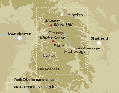
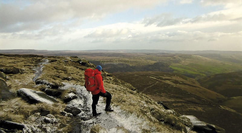
Product description: Located in the Peak District and distinguished from the neighbouring White Peak by the layer of gritstone which covers its limestone bed, the Dark Peak features a wild landscape of sweeping moorland and big skies. Easily accessible from Sheffield, it boasts a wealth of natural, geological, historical and cultural interest – and some great walking.
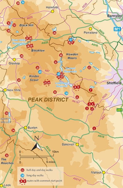
This guidebook describes 40 walks in the Dark Peak. Ranging from short strolls to full-day adventures, they showcase the region's unique character. Dramatic waterfalls, striking gritstone edges, heath and woodland are just some of the delights encountered, with many of the routes venturing off-path to explore hidden cloughs and valleys. Detailed route description is provided for 35 walks, accompanied by 1:50,000 OS mapping and interesting facts about local points of interest, then a further five longer walks (of 25-45km) are summarised in the final section, including a classic circuit of the Kinder Scout skyline.
Seasons:
The high moorlands in winter and summer; the gritstone edges in spring and summer; the valleys in autumn; the cloughs in spring.
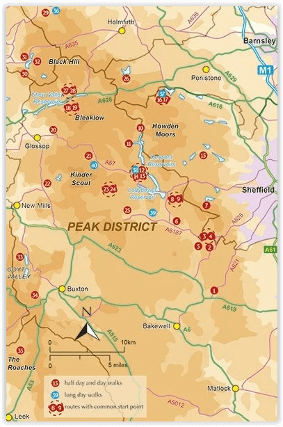
Centres:
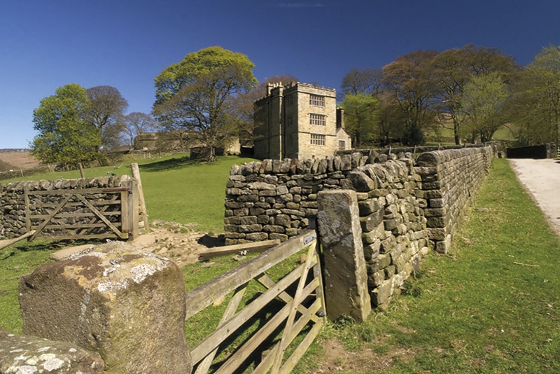
Hathersage, Grindleford, Langsett, Marsden, Dove Stones, Edale, Upper Derwent Valley, Castleton, Greenfield, Chatsworth, Sheffield, Hayfield, Crowden, Hope, Dunford Bridge.
Difficulty:
Walking in the Dark Peak requires good navigational skills, especially in winter, and a good level of hillcraft. Having the correct equipment and clothing and knowing how to use it is paramount when venturing out onto the high moors.
Must See:
Kinder Scout, the highest point in the Peak District; Bleaklow, the second highest; Howden and Derwent Edges; Black Hill and the Wessenden Moors; the gritstone edges of Derwent, Bamford, Stanage, Burbage, Froggatt, Curbar, Birchen, Gardoms and the Roaches; the Eastern Moors; the Goyt Valley, Shutlingsloe and Wildboarclough.
Locatie op kaart
Artikelen uit dezelfde regio

Wandelgids White Peak walks Southern Dales - Cicerone • 9781852845186
Wandelgids - White Peak walks Southern Dales - Cicerone Productomschrijving: Deze gids gaat over wandelen in de zuidelijke dales van de witte piekoppervlakte van het Peak District, tussen Ashbourne, Matlock, Buxton en Leek. 30 gemakkelijke circulaire routes doorsteken de hoge plateau en volgen de Dove, Manifold en Hamps rivieren door de dales in het UK's eerste Nationaal Park. Eén van twee…

Wandelgids Ostliche Midlands & East Anglia - Rother • 9783763345298
Wandelgids England- Ostliche Midlands & East Anglia - Rother Productomschrijving: Een wandelgids vol tips en 55 wandlroutes in- en rond de mooie regio van oost-Midland's en East Anglia in het oosten van Engeland. Deze regio is gelegen rechts op het continent van Engeland boven de hoofdstad London. Deze gids biedt u 55 routes en een variatie aan bezienswaardigheden langs de routes. Een goei…

Wandelkaart Cotswold Way - Harvey maps • 9781851374182
Wandelkaart Cotswold Way - Chipping Campden to Bath - Harvey maps Productomschrijving: Toont de gehele 166km (103miles) van The Cotswold Way, door de Cotswolds van Chipping Campden naar Bath, Broadway, Winchcombe, Stroud, Wooton-under-Edge en Chipping Sodbury passeren. Informatie over het vinden van accommodatie, camping, voedsel. Routebeschrijving naar het begin. Ook Ranger Service en…

Wandelgids Peak District & South Yorkshire - Cicerone • 9781852842574
Wandelgids - Peak District & South Yorkshire - Cicerone Productomschrijving: Een gids naar 52 korte circulaire wandelingen in het Peak District en Zuid-Yorkshire, in Noord-Engeland, aangepast door plaatselijke Sheffield krant "The Star Weekend walking kolom". Routes zijn 2 tot 3 uur lang, dus ideaal voor gezinnen. Winnaar van de beste gids van COLA/OWG 1998. Allemaal binnen een uur van She…