
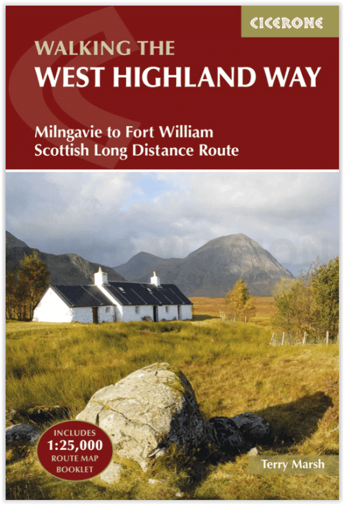
Wandelgids West Highland Way - Cicerone
From Milngavie to Fort William
Korte omschrijving
The West Highland Way Schotland - Cicerone Productomschrijving: Wandelgids over de West Highland Way National Trail, een Schotse lange-afstandsroute van 152 km van Milngavie bij Glasgow naar...

Specificaties
- Uitgever: CICERONE Press
- ISBN-13: 9781852848576
- HOOFDCATEGORIEËN: Wandelgids
- Activiteiten: Wandelen, Hiking & Trekking
- Auteur: Terry Marsch
- Regio: Highlands, Schotland
- Land: Schotland
- Lange afstand wandelroutes: West Highland Way, Schotland (152 km)
- Blz.: 144
- Afmeting: 12x17
- Editie: 4
- Taal: Engels
Volledige omschrijving
The West Highland Way Schotland - Cicerone
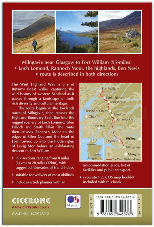
Productomschrijving: Wandelgids over de West Highland Way National Trail, een Schotse lange-afstandsroute van 152 km van Milngavie bij Glasgow naar Fort William, langs Loch Lomond en over Rannoch Moor. Suggesties voor routes van 6 tot 9 dagen. Inclusief accommodatiegids en uittrekbaar 1:25K OS kaartenboekje.
Engelse omschrijving: Guidebook to walking the West Highland Way National Trail, a 95 mile Scottish long-distance route from Milngavie near Glasgow to Fort William, passing Loch Lomond and crossing Rannoch Moor. Suggested itineraries over 6 to 9 days. Includes accommodation guide and pull-out 1:25K OS map booklet.
Seasons:
May-June and September-October avoid the worst of the midges, but suitably experienced backpackers can do this walk at any time of year.
Centres:
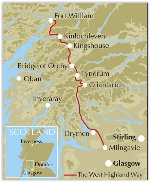
The walk traditionally starts in Milngavie, on the outskirts of Glasgow (accessible by rail), and concludes at Fort William (likewise). There are few towns or villages en route where supplies can be had: Drymen, Crianlarich, Tyndrum and Kinlochleven.
Difficulty:
The walking is not difficult for anyone accustomed to regular walks longer than 10 miles, although there is ample scope to shorten almost all of the days, and to offload the pack carrying onto an independent service that will transport your baggage for you.
Must See:
The West Highland Way embraces diversity, from the urbanity of Milngavie to the days in the company of Loch Lomond, and then the striding splendour of Rannoch Moor. The haul from Glencoe, under the gaze of Buachaille Etive Mòr, up the Devil's Staircase, then into the hidden valley of Lairig Mòr, are stages to be savoured.
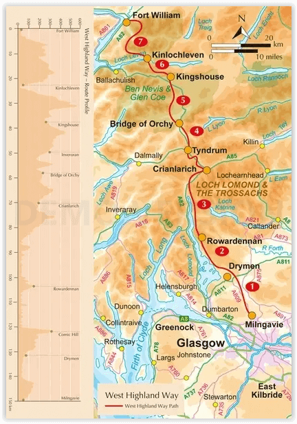
Stage 1 Milngavie to Drymen
Stage 2 Drymen to Rowardennan
Stage 3 Rowardennan to Crianlarich
Stage 4 Crianlarich to Bridge of Orchy
Stage 5 Bridge of Orchy to Kingshouse
Stage 6 Kingshouse to Kinlochleven
Stage 7 Kinlochleven to Fort William
Artikelen uit dezelfde regio

Wandelkaart 450 Wick & The Flow Country- Schotland - OSI • 9780319473023
Wandelkaart Wick & The Flow Country - Highland's Schotland Omvat ook: Lybster, Latheron & Dunbeath. Productbeschrijving: OS Explorer kaart 450 behandelt Wick en Moray Firth, met inbegrip van Lybster, Latheron en Dunbeath. Wick bestaat al sinds ten minste 1266 en biedt de wereld kortste straat, Ebenezer plaats. De Flow Country is een groot gebied van moerassig, laaggelegen land; het For…

Wandelkaart 399 Loch Arkaig- Schotland - OSI • 9780319472590
Wandelkaart Loch Arkaig - Highlands Schotland Omvat ook: Fort William & Corpach Gairlochy, Achnacarry & Kingie. Productbeschrijving: OS Explorer kaart 399 toont Quoich Loch, Loch Arkaig Loch Lochy en Loch Eil. Dit gebied omvat ook deel van de Great Glen Way, evenals 2 Munro's: Gairich en Gaor Bheinn. De OS Explorer kaart voor Loch Arkaig is beschikbaar in zowel de standaard papieren ve…


Wandelkaart 36 Grantown & Aviemore Cairngorms NP - OSI • 9780319473597
Wandelkaart Grantown & Aviemore - Cairngorms NP Schotland Productbeschrijving: Kaart nummer 36 in de OS Landranger kaarten reeks is de ideale kaart voor de planning excursies en vakanties in Cairngorms National Park, de Cairgorm mountains, de Grampian Mountains en het gebied rond Aviemore. Ook op de kaart staat de Speyside Way, Ben Macdui (Beinn MacDuibh), Meall, Bhuachaille, Strathavon, K…

Wandelkaart 40 Mallaig & Glenfinnan- Highland's - OSI • 9780319261385
Wandelkaart Mallaig & Glenfinnan - Highland's Schotland Productbeschrijving: De haven van Mallaig ligt langs de beroemde weg naar de eilanden en is een uitstekende uitvalsbasis om de hooglanden en Loch Morar vanuit te verkennen. Op de oevers van Loch Shiel gelegen is Glenfinnan, een kleine maar mooi dorp met een prachtig landschap. De OS Landranger kaarten reeks heeft betrekking op Gro…

Wandelkaart 392 Ben Nevis- Highland's Schotland - OSI • 9780319472552
Wandelkaart Ben Nevis- Highland's Schotland - OSI The Mamores & The Grey Corries Kinlochleven & Spean Bridge. Productbeschrijving: Kaart nummer 392 in de OS Explorer kaart reeks is de perfecte kaart om te gebruiken bij het verkennen van het bergachtige gebied van Ben Nevis, bij Fort William, The Mamores en The Grey Corries Kinlochleven Spean Bridge. Het gebied word bezocht door bergbek…