
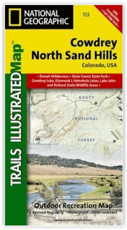
Wandelkaart 113 Cowdrey- North Sand Hills Colorado - Nat Geo
Geniet van de overvloedige recreatieve n het noorden van Colorado
Korte omschrijving
Cowdrey- North Sand Hills Colorado - Nat Geo Productomschrijving: Geniet van de overvloedige recreatieve mogelijkheden in het noorden van Colorado met de hulp van National Geographic's Trail...

Specificaties
- Uitgever: National Geographic
- ISBN-13: 9781566952880
- HOOFDCATEGORIEËN: Wandelkaart
- Activiteiten: Wandelen, Hiking & Trekking
- Regio: Colorado, USA
- Land: Verenigde Staten van Amerika (USA)
- Schaal: 1:40000
- Afmeting: 10x19
- Taal: Engels
Volledige omschrijving
Cowdrey- North Sand Hills Colorado - Nat Geo
Productomschrijving: Geniet van de overvloedige recreatieve mogelijkheden in het noorden van Colorado met de hulp van National Geographic's Trails Illustrated kaart van Cowdrey en North Sand Hills. Deskundig onderzocht en gemaakt in samenwerking met de U.S. Forest Service, Bureau of Land Management, Colorado State Parks en anderen, zal de kaart u van de gebaande paden leiden en weer terug met ongeëvenaarde details van het gebied. Het omvat populaire recreatiegebieden, zoals Roosevelt en Routt National Forests, Platte River en Rawah Wilderness gebieden, Lake John, Richard, Cowdrey Lake en Diamond J State Wildlife Areas, State Forest State Park, Medicine Bow Mountains, en North Platte River.
Engelse omschrijving: Enjoy the abundant recreational opportunities in northern Colorado with the help of National Geographic's Trails Illustrated map of Cowdrey and North Sand Hills. Expertly researched and created in cooperation with the U.S. Forest Service, Bureau of Land Management, Colorado State Parks and others, the map will guide you off the beaten path and back on again with unparalleled detail of the area. Coverage includes popular recreation spots, such as Roosevelt and Routt National Forests, Platte River and Rawah Wilderness areas, Lake John, Richard, Cowdrey Lake and Diamond J State Wildlife Areas, State Forest State Park, Medicine Bow Mountains, and North Platte River.
Mapped trails, Forest Service roads and BLM routes are marked for hiking, road or mountain bike, snowmobile, OHV or motorized use. To aid in your navigation, the map also includes contour lines, elevations, labeled peaks, summits and passes, water features, areas of wooded cover, selected waypoints and clear color-coded boundaries between different land management agencies. Some additional recreation features pinpointed are campgrounds, picnic areas, river access points, boat launches, fishing areas, RV dump stations and wildlife viewing. Additionally, wilderness regulations, survival tips, Leave No Trace guidelines and essential contact information is provided.
Every Trails Illustrated map is printed on "Backcountry Tough" waterproof, tear-resistant paper. A full UTM grid is printed on the map to aid with GPS navigation.
Other features found on this map include: Independence Mountain, Lake John, Medicine Bow Mountains, Rawah Wilderness, Roosevelt National Forest, Routt National Forest.
Locatie op kaart
Artikelen uit dezelfde regio

Wandelkaart 110 Leadville & Fairplay - Colorado - Nat Geo • 9781566953641
TOPO Wandelkaart 110 - Leadville & Fairplay - Colorado - National Geographic Productomschrijving: Leadville & Fairplay zijn locaties in de Amerikaanse staat Colorado. De dorpen liggen op een hoogte van 3000 meter, en zijn daarmee een van de hoogstgelegen steden van Colorado. In het begin van de tijd van de goudkoorts ontstond de nederzetting, in het jaar 1859. Het is een meestal rustige st…

Wandelkaart 127 Aspen - Independence Pass - Colorado USA • 9781566953580
TOPO Wandelkaart 127 - Aspen - Independence Pass - Colorado USA Productomschrijving: Independence Pass in Aspen Colorado is een uitmuntende wandellocatie. Deze omvat een topografische wandelkaart die echt tot de verbeelding spreekt. Een subliem exemplaar als het over wandelen gaat. Engelse omschrijving: Independence Pass, originally known as Hunter Pass, is a high mountain pass in cen…

Wandelkaart 141 Telluride- Silverton- Ouray & Lake City - Nat Geo • 9781566953405
Wandelkaart Telluride- Silverton- Ouray & Lake City - Nat Geo Productomschrijving: De National Geographic Trails Illustrated kaart van Telluride, Silverton, Ouray, en Lake City is deskundig onderzocht en gemaakt in samenwerking met lokale landbeheerders. Het is een ongeëvenaard hulpmiddel voor het verkennen van deze adembenemende regio van Colorado. Ongeacht het seizoen is deze kaart een h…

Reisgids Colorado - Insight Guides ENG • 9781786715319
Colorado - Insight Guides ENG Productomschrijving: The Rocky Mountain State of Colorado offers soaring peaks, world-class skiing and vibrant cities that lure travellers from all over the world to America's alpine heartland. Be inspired to visit by the new edition of Insight Guide Colorado, a comprehensive full-colour guide to the state. Inside Insight Guide Colorado: A fully-overh…

Wandelkaart 140 Weminuche Wilderness Colorado USA - Nat Geo • 9781566952910
Wandelkaart Weminuche Wilderness Colorado USA - Nat Geo Productomschrijving: De Weminuche Wilderness overspant de Continental Divide en is met bijna een half miljoen hectare het grootste wildernisgebied in Colorado. Deskundig onderzocht en gemaakt in samenwerking met lokale landbeheerders, biedt National Geographic's Trails Illustrated kaart van de Weminuche Wilderness een ongeëvenaard hul…