
Wandelkaart 298 Nidderdale AONB- Yorkshire - OSI
North Yorkshire rond Nidderdale AONB
Korte omschrijving
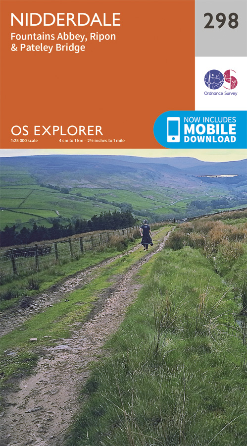
Wandelkaart Nidderdale AONB - Yorkshire England Omvat ook: Fountains Abbey, Ripon & Pateley Bridge Productomschrijving: Kaart nummer 298 in de OS Explorer kaarten serie heeft een oppervl...

Specificaties
- Uitgever: Ordnance Survey
- ISBN-13: 9780319245507
- HOOFDCATEGORIEËN: Wandelkaart
- Activiteiten: Wandelen, Hiking & Trekking
- Regio: Yorkshire, England
- Land: England
- Nationale parken: Yorkshire Dales NP, England
- AONB - Area of Outstanding Beauty: Nidderdale AONB
- Schaal: 1:25000
- Afmeting: 13x23
- Taal: Engels
- Reeks: Explorer Series
Volledige omschrijving
Wandelkaart Nidderdale AONB - Yorkshire England
Omvat ook: Fountains Abbey, Ripon & Pateley Bridge
Productomschrijving: Kaart nummer 298 in de OS Explorer kaarten serie heeft een oppervlakte van North Yorkshire rond Nidderdale. De Nidderdale way en Ripon Rowel lopen door dit pittoreske gebied, die ook een deel van het Yorkshire Dales National Park heeft. Hoogtepunten van het gebied zijn onder andere: Ripon, Pateley Bridge en Fountains Abbey. De OS Explorer kaart voor Nidderdale is beschikbaar in zowel de standaard papieren versie en weerbestendige 'Actief' versie
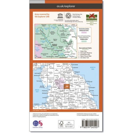
Kaart nummer 298 is een all purpose kaart vol gepakt met informatie om u het gebied te helpen leren kennen. De kaarten bestrijken het land. Elke kaart heeft een oppervlakte van 40 km door 40 km (25 mijl door 25 mijl) en zoals andere kaarten van Ordnance Survey, National Grid-vierkanten worden verstrekt zodat elke functie een unieke referentienummer kan worden gegeven.
Productdiscription: Map sheet number 298 in the OS Explorer series covers an area of North Yorkshire around Nidderdale. The Nidderdale Way and Ripon Rowel Walk run through this picturesque area, which also has a section of the Yorkshire Dales National Park. Highlights of the area include: Ripon, Pateley Bridge and Fountains Abbey. The OS Explorer map for Nidderdale is available in both the standard paper version and weatherproof 'Active' version
Locatie op kaart
Gekoppelde artikelen

Wandelkaart 298 Nidderdale AONB- Yorkshire - OSI • 9780319245507
standaard versieWandelkaart Nidderdale AONB - Yorkshire England Omvat ook: Fountains Abbey, Ripon & Pateley Bridge Productomschrijving: Kaart nummer 298 in de OS Explorer kaarten serie heeft een oppervlakte van North Yorkshire rond Nidderdale. De Nidderdale way en Ripon Rowel lopen door dit pittoreske gebied, die ook een deel van het Yorkshire Dales National Park heeft. Hoogtepunten van het gebied zij…

Wandelkaart 298 Nidderdale AONB North Yorkshire - OSI • 9780319471708
weatherproof versieWandelkaart Nidderdale AONB - North Yorkshire England Omvat ook: Fountains Abbey, Ripon & Pateley Bridge. Productbeschrijving: Kaart nummer 298 in de OS Explorer kaarten reeks beslaat een gebied van Noord-Yorkshire rond Nidderdale. De Nidderdale Way en Ripon Rowel pad, voeren uit door dit schilderachtige gebied, die ook een deel van de Yorkshire Dales National Park heeft. Hoogtepunten …
Overzichtskaarten

Area's of Outstanding Natural Beauty - AONB's UK
Area's of Outstanding Natural Beauty - AONB's UK

Producten op de overzichtskaart
Klik op een product om naar de detailpagina te gaan.
- Wandelgids - Guide to the Cotswolds AONB - AA
- Wandelkaart 24 - Chilterns AONB - AA
- Fietskaart- en Mtb kaart - The Cotswolds - Goldeneye
- Wandelgids - Cotswold classic walks guidebook - Goldeneye
- Wandelkaart - Cotswold South AONB - Goldeneye
- Wandelgids - Exploring the Cotswolds - Goldeneye
- Wandelgids - Cotswold Classic Walks - Goldeneye
- Wandelkaart - Cotswolds- Malverns & Forest of Dean - Goldeneye
- Wandelgids - The Cotswold Way 30 classic routes - Cicerone
- Wandelgids - Kent walking guide - Cicerone
- Wandelgids - North Downs Way Nat. trail - Cicerone
- Wandelgids - Chilterns walking guide - Cicerone
- Wandelgids - Suffolk coast & Heaths walks - Cicerone
- Wandelgids - North Downs Way - Map Booklet - Cicerone
- Wandelgids - North Pennines AONB walking guide - Cicerone
- Wandelgids - Ridgeway National Trail - Cicerone
- Wandelgids - Forest of Bowland & Pendle - Cicerone
- Wandelgids - Hampshire's Test Way walking guide - Cicerone
- Wandelgids & Fietsgids - The Cotswold AONB - Cicerone
- Wandelgids - Walking on the Gower - Cicerone
- Wandelgids - North Wessex Downs - Cicerone Press
- Wandelgids - Walking on the North Wessex Downs - Cicerone
- Wandelgids - Silverdale & Arnside AONB - Cicerone
- Wandelgids - The Kennet and Avon Canal walking guide - Cicerone
- Wandelgids - North Downs Way- 246 km - Trailblazer
- Wandelkaart OL2 - Yorkshire Dales- Southern & Western Areas - OSI
- Wandelkaart OL19 - Howgill Fells and Upper Eden Valley - OSI
- Wandelkaart OL21 - South Pennines - Yorkshire - OSI
- Wandelkaart OL31 - North Pennines- Teesdale & Weardale - OSI
- Wandelkaart OL40 - The Broads - OSI
- Wandelkaart OL41 - Forest of Bowland & Ribblesdale - OSI
- Wandelkaart OL45 - The Cotswolds AONB- Gloucestershire - OSI
- Wandelkaart 108 - Lower Tamer Valley & Plymouth- Cornwall- OSI
- Wandelkaart 115 - Exmouth & Sidmouth- Devon - OSI
- Wandelkaart 137 - Ashford- Kent downs AONB- England - OSI
- Wandelkaart 140 - Quantock Hills AONB- Somerset - OSI
- Wandelkaart 140 - Quantock Hills AONB & Bridgwater- Devon - OSI
- Wandelkaart 147 - Sevenoaks & Tonbridge- Kent - OSI
- Wandelkaart 164 - Gower AONB & Gwyr- South Wales - OSI
- Wandelkaart 164 - Gower AONB & Gwyr- Wales - OSI
- Wandelkaart 171 - Chiltern Hills West & Henley-on-Thames OSI
- Wandelkaart 171 - Chiltern Hills West AONB- Wycombe - OSI
- Wandelkaart 172 - Chiltern Hills East AONB- Wycombe - OSI
- Wandelkaart 181 - Chiltern Hills AONB North- England - OSI
- Wandelkaart 181 - Chiltern Hills North AONB- Wycombe - OSI
- Wandelkaart 190 - Malvern Hills & Bredon Hill - OSI
- Wandelkaart 190 - Malvern Hills AONB & Bredon Hill - OSI
- Wandelkaart 203 - Ludlow- Shropshire Hills AONB - OSI
- Wandelkaart 217 - Long Mynd & Wenlock Edge- Schropshire- OSI
- Wandelkaart 254 - Lleyn Peninsular East- North Wales - OSI
- Wandelkaart 261 - Boston- Lincolnshire AONB - OSI
- Wandelkaart 262 - Anglesey West- Wales AONB - OSI
- Wandelkaart 263 - Anglesey East AONB- Wales - OSI
- Wandelkaart 273 - Lincolnshire Wolds South AONB - OSI
- Wandelkaart 282 - Lincolnshire Wolds North AONB - OSI
- Wandelkaart 298 - Nidderdale AONB- Yorkshire - OSI
- Wandelkaart 298 - Nidderdale AONB North Yorkshire - OSI
- Wandelkaart 300 - Howardian Hills AONB - OSI
- Wandelkaart 300 - Howardian Hills AONB & Malton - OSI
- Wandelkaart - Mourne Mountains N. Ireland - Harvey maps
- Wandelkaart - Fietskaart Forest of Bowland - Harvey maps
- Wandelkaart XT40 - Anglesey Coastal Path N. Wales - Harvey Maps
- Wandelkaart XT40 - Pennine Way Noord - Harvey Maps
- Wandelkaart XT40 - Pennine Way Zuid - Harvey Maps
- Wandelgids Cotswold - Way Two-way trekking guide - Knife Edge
- Reisgids Oxford & the Cotswolds AONB - Edicola
- Reisgids Cotswolds England - Rough Guides
- Reisgids Go Slow- Sussex & the South Downs- Weald & Coast - Bradt
- Travelguide Oxford & The Cotswolds pocket guide - Lonely Planet
- Wandelgids - The Ridgeway National trail - Trailblazer

OSI Explorer & Explorer Active - Noord Engeland - Lake District
OSI Explorer & Explorer Active - Noord Engeland - Lake District

Producten op de overzichtskaart
Klik op een product om naar de detailpagina te gaan.
- Wandelkaart 275 Liverpool- South West England - OSI
- Wandelkaart 276 Bolton- Wigan & Warrington- Machester - OSI
- Wandelkaart 277 Manchester & Salford - OSI
- Wandelkaart 278 Sheffield & Barnsley- South Yorkshire - OSI
- Wandelkaart 279 Doncaster- South Yorkshire - OSI
- Wandelkaart 280 Isle of Axholme- Lincolnshire - OSI
- Wandelkaart 281 Ancholme Valley- Lincolnshire - OSI
- Wandelkaart 283 Louth & Mablethorpe- Lincolnshire - OSI
- Wandelkaart 284 Grimsby- Cleethorpes & Immingham - OSI
- Wandelkaart 285 Southport & Chorley- Merseyside - OSI
- Wandelkaart 286 Blackpool & Preston- Lancashire - OSI
- Wandelkaart 287 West Pennine Moors- Lankashire - OSI
- Wandelkaart 288 Bradford & Huddersfield- West Yorkshire - OSI
- Wandelkaart 289 Leeds- Harrogate- Wetherby & Pontefract - OSI
- Wandelkaart 290 York- Selby & Tadcaster- North Yorkshire - OSI
- Wandelkaart 291 Goole & Gilberdyke- Yorkshire - OSI
- Wandelkaart 292 Withernsea & Spurn Head- East Riding - OSI
- Wandelkaart 293 Kingston upon Hull & Beverley - OSI
- Wandelkaart 294 Market Weighton & central Yorkshire Wolds - OSI
- Wandelkaart 295 Bridlington- Driffield & Hornsea - OSI
- Wandelkaart 296 Lancaster- Morecambe & Fleetwood - OSI
- Wandelkaart 297 Lower Wharfedale & Washburn Valley - OSI
- Wandelkaart 298 Nidderdale AONB- Yorkshire - OSI
- Wandelkaart 299 Ripon & Boroughbridge- North Yorkshire - OSI
- Wandelkaart 300 Howardian Hills AONB & Malton - OSI
- Wandelkaart 301 Scarborough- Bridlington & Flamborough
- Wandelkaart 302 Northallerton & Thirsk- North Yorkshire
- Wandelkaart 303 Whitehaven & Workington - OSI
- Wandelkaart 304 Darlington & Richmond- North Cleveland
- Wandelkaart 305 Bishop Auckland & Durham - OSI
- Wandelkaart 306 Middlesbrough & Hartlepool - OSI
- Wandelkaart 307 Consett & Derwent reservoir - OSI
- Wandelkaart 308 Durham & Sunderland- England - OSI
- Wandelkaart 314 Solway Firth- Wigton & Silloth - OSI
- Wandelkaart 315 Carlisle- Brampton- Longtown - OSI
- Wandelkaart 316 Newcastle upon Tyne- Northumberland- OSI
- Wandelkaart OL2 Yorkshire Dales- Southern & Western Areas - OSI
- Wandelkaart OL19 Howgill Fells and Upper Eden Valley - OSI
- Wandelkaart OL21 South Pennines - Yorkshire - OSI
- Wandelkaart OL26 North York Moors - Western area - OSI
- Wandelkaart OL27 North York Moors- Eastern area - OSI
- Wandelkaart OL30 Yorkshire Dales - Yorkshire England - OSI
- Wandelkaart OL31 North Pennines- Teesdale & Weardale - OSI
- Wandelkaart OL41 Forest of Bowland & Ribblesdale - OSI
- Wandelkaart OL43 Hadrian's Wall - OSI
Artikelen uit dezelfde regio

Wandelkaart 289 Leeds Harrogate Wetherby & Pontefract - OSI • 9780319244869
Wandelkaart Leeds- Harrogate- Wetherby & Pontefract England Productbeschrijving: OS Explorer kaart 289 dekt Harrogate tot Pontefract, met inbegrip van Leeds en de rivieren Nidd, rivier, Aire en Calder. Hoogtepunten omvatten de Dales Way en de Trans Pennine Trail. De OS Explorer kaart voor Leeds is beschikbaar in zowel de standaard papieren versie en weerbestendige 'Actief' versie. Prod…

Wandelgids North Yorkshire historic walks - Cicerone • 9781852843892
Wandelgids - North Yorkshire historic walks - Cicerone Productomschrijving: Een gids over historische wandelingen in North Yorkshire, in 20 meestal circulaire routes. Zij brengen u van open heidegebied en blootgestelde delen van heuvel en kliffen naar de meer beschutte dales en de straten van York. Wandelingen bevatten Skipton Castle, Ripon en Fountains Abbey, Ripley Castle, Castle Howard,…

Wandelkaart OL30 Yorkshire Dales - Yorkshire England - OSI • 9780319475379
Wandelkaart Yorkshire Dales - Yorkshire England Omvat ook: Wensleydale & Swaledale Productbeschrijving: Kaart nummer OL30 in de OS Explorer kaarten reeks is de ideale kaart voor mensen die een bezoek willen brengen aan de noordelijke en centrale gebieden van de Yorkshire Dales, met inbegrip van Wensleydale & Swaledale. Er is een schat van landschappen in dit deel van het Yorkshire Dale…

Reisgids Go Slow Yorkshire Dales NP - Bradt Travel guides • 9781784776091
Reisgids Yorkshire Dales - Bradt Productomschrijving: Deze nieuwe, grondig bijgewerkte editie van de Yorkshire Dales, onderdeel van Bradt's serie kenmerkende 'Slow guides' voor lokale Britse regio's, blijft de meest uitgebreide gids voor het gebied en beslaat het geheel van het onlangs uitgebreide Yorkshire Dales National Park, Nidderdale Area of Outstanding Natural Beauty AONB en enkele '…

Wandelkaart 07 Yorkshire Dales Centraal - AA • 9780749573157
Wandelkaart 07 - Yorkshire Dales Centraal - AA Productomschrijving: AA, in samenwerking met Ordinance Survey, heeft een reeks kaarten ontwikkeld die zich op populaire toeristische bestemmingen van de UK richten, zodat meerdere OS-kaarten niet vereist zijn. Deze kaart richt zich op de centrale Yorkshire Dales uit Lofthouse in het oosten aan Settle in het westen en uit Malham in de Zuid-toLa…