
Wandelgids 19 routes England- Schotland & Wales - Cicerone
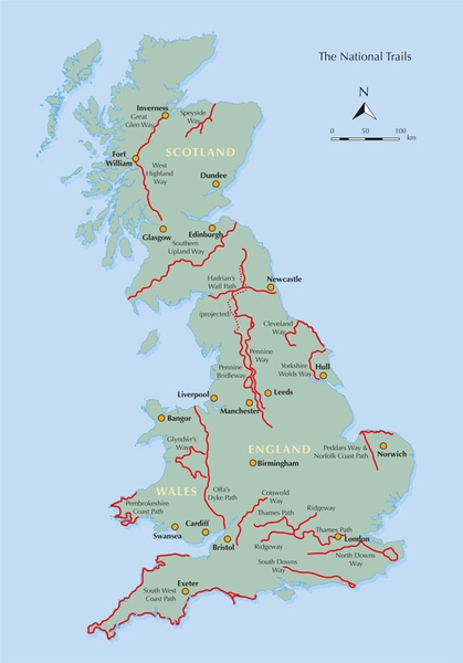
19 National Trails in de UK in Wales- England & Schotland
Korte omschrijving
Wandelgids - 19 routes England- Schotland & Wales - Cicerone Productomschrijving: Deze inspirerende gids kijkt naar elk van de 19 National Trails in het Verenigd Koninkrijk, met informatie d...

Specificaties
- Uitgever: CICERONE Press
- ISBN-13: 9781852847883
- HOOFDCATEGORIEËN: Wandelgids
- Activiteiten: Wandelen, Hiking & Trekking
- Regio: Engeland, Schotland, Wales
- Land: England, Schotland, Wales
- Blz.: 272
- Afmeting: 17x24
- Editie: 2
- Taal: Engels
Volledige omschrijving
Wandelgids - 19 routes England- Schotland & Wales - Cicerone
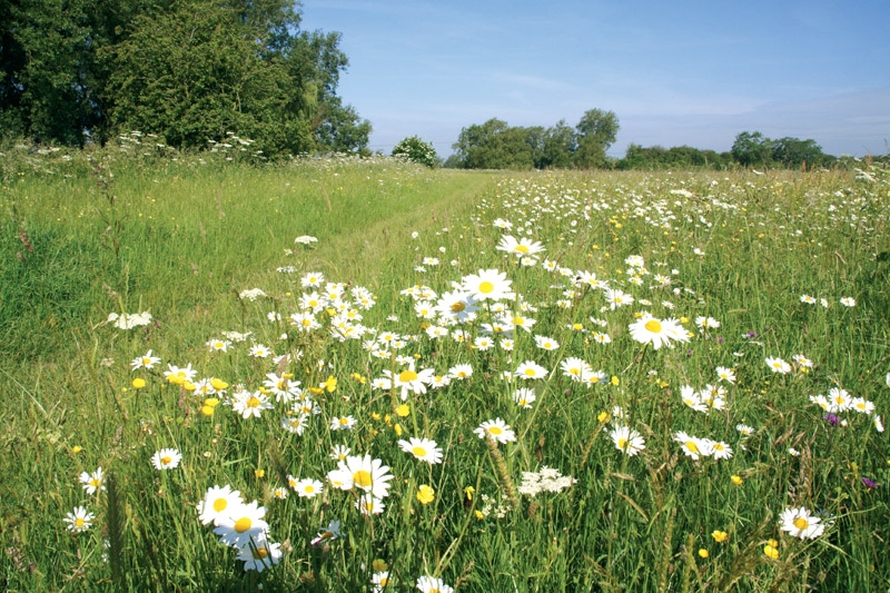
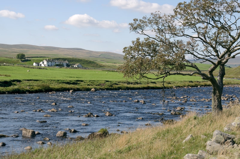
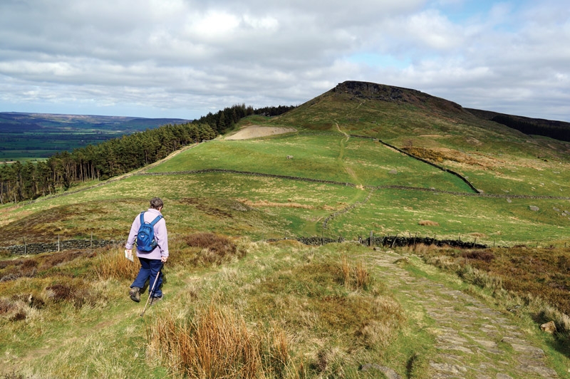
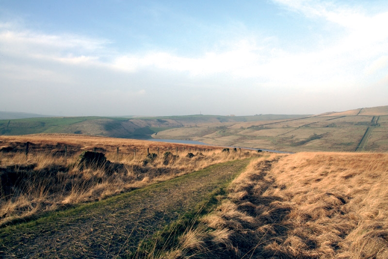
Productomschrijving: Deze inspirerende gids kijkt naar elk van de 19 National Trails in het Verenigd Koninkrijk, met informatie die het gemakkelijk maakt om vergelijking en contrast te vinden, inspiratie bij het vinden van, en tot het nemen van een lange afstandsuitdaging. Sommige Trails zijn kort en gemakkelijk, anderen veel langer, velen hebben sterke thema's - ze kunnen een kustlijn volgen, of heuvelruggen oversteken.
Engelse omschrijving: This inspirational guidebook looks at each of the UK's 19 National Trails, with information that allows ease of comparison and contrast, inspiring you to find out more and to take up a long-distance challenge. Some Trails are short and easy, others much longer, many have strong themes - they may follow a coastline, or traverse ranges of hills.
Seasons:
All trails can be tackled throughout the year, though many of the northern and Scottish routes can be challenging in winter conditions. Avoid the Hadrian's Wall Path in winter, as the ground is soft and underlying archaeology easily damaged.
Difficulty:
The routes vary in both length and technical difficulty, the longest being the South West Coast Path and the most difficult possibly the Pennine Way.
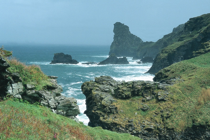
Must See:
Broad views and unspoilt landscapes in some of Britain's best walking areas - from thunderous breaking waves against the cliffs on the South West Coast Path to Buachaille Etive Mor at the gateway to Glen Coe.
Artikelen uit dezelfde regio

Reisgids L'essentiel de l'Angleterre et du Pays de Galle - LP • 9782816179422
L'essentiel de l'Angleterre et du Pays de Galle - LP Productomschrijving: De Lonely Planet-gids voor de basis, om het beste van Engeland en Wales te ontdekken - Een volledig opnieuw ontworpen versie, zodat je tijdens uw reis naar Engeland en Wales geen enkele must-haves hoeft te missen. Een kleurrijke gids, geïllustreerd met tientallen foto's. Onmisbare locaties (Londen, Stonehenge, Salisb…

Reisgids Wales - Rough Guides • 9780241306376
Reisgids Wales - Rough Guides Productomschrijving: Discover this beautiful country with the most incisive and entertaining guidebook on the market. Whether you plan to hike through the wilds of Snowdonia, follow in Wordsworth’s footsteps at Tintern Abbey or explore Welsh music and theatre in Swansea, The Rough Guide to Wales will show you the ideal places to sleep, eat, drink and shop alon…

Wandelkaart 114 Anglesey & Ynys Môn N.W. Wales - OSI • 9780319262122
Wandelkaart Anglesey & Ynys Môn North West Wales - OSI Productbeschrijving: Kaart nummer 114 is een all purpose kaart vol gepakt met informatie om u het gebied te helpen leren kennen. De 204 Landranger-kaarten bestrijken het land. Elke kaart heeft een oppervlakte van 40 km door 40 km (25 mijl door 25 mijl) en zoals andere kaarten van Ordnance Survey, National Grid-vierkanten worden verstr…

Reisgids Essentiel de l'Angleterre & pays de Galles - LP • 9782816193176
Reisgids England en Wales - Lonely Planet Productomschrijving: De Lonely Planet gids voor het beste van Engeland en Wales Een volledig vernieuwde collectie om er zeker van te zijn dat u geen van de must-sees mist tijdens een reis naar Engeland en Wales. Een full-colour gids, geïllustreerd met tientallen foto's. Uitgebreide verslaggeving van Wales, van zuid naar noord, van Cardiff, de hoofd…

Reisgids Wales - Lonely Planet • 9781787013674
Wales van Lonely Planet Productomschrijving: De uitdrukking 'goede dingen komen in kleine pakjes' mag dan een cliché zijn, maar in het geval van Wales is het onmiskenbaar waar. Lonely Planet brengt u naar het hart van Wales, met verbazingwekkende reiservaringen en het beste planningsadvies. Lonely Planet Wales is uw paspoort voor het meest relevante, actuele advies over wat u moet zien…