
Wandelgids North York Moors walking guide - Cicerone
Een dikke 50 wandelingen doorheen dit nationale park

Korte omschrijving
Wandelgids - North York Moors walking guide - Cicerone Productomschrijving: Dit zeer bekende nationale park behoort tot de mooiste van Engeland. Het park is waliswaar zonder hoge bergtoppen,...

Specificaties
- Uitgever: CICERONE Press
- ISBN-13: 9781852849511
- HOOFDCATEGORIEËN: Wandelgids
- Activiteiten: Wandelen, Hiking & Trekking
- Auteur: Paddy Dylan
- Regio: Yorkshire, England
- Land: England
- Nationale parken: North York Moors NP, England
- Blz.: 256
- Afmeting: 15x17
- Editie: 2
- Taal: Engels
Volledige omschrijving
Wandelgids - North York Moors walking guide - Cicerone
Productomschrijving: Dit zeer bekende nationale park behoort tot de mooiste van Engeland. Het park is waliswaar zonder hoge bergtoppen, maar is en blijft een prachtig gebied, waar de Engelsen goed voor zorgen. Deze gids brengt u een dikke 50 wandelingen doorheen de North York Moors Nationaal Park. Kies er éne uit en neem een duik in de Engelse binnenlandse fauna & flora.
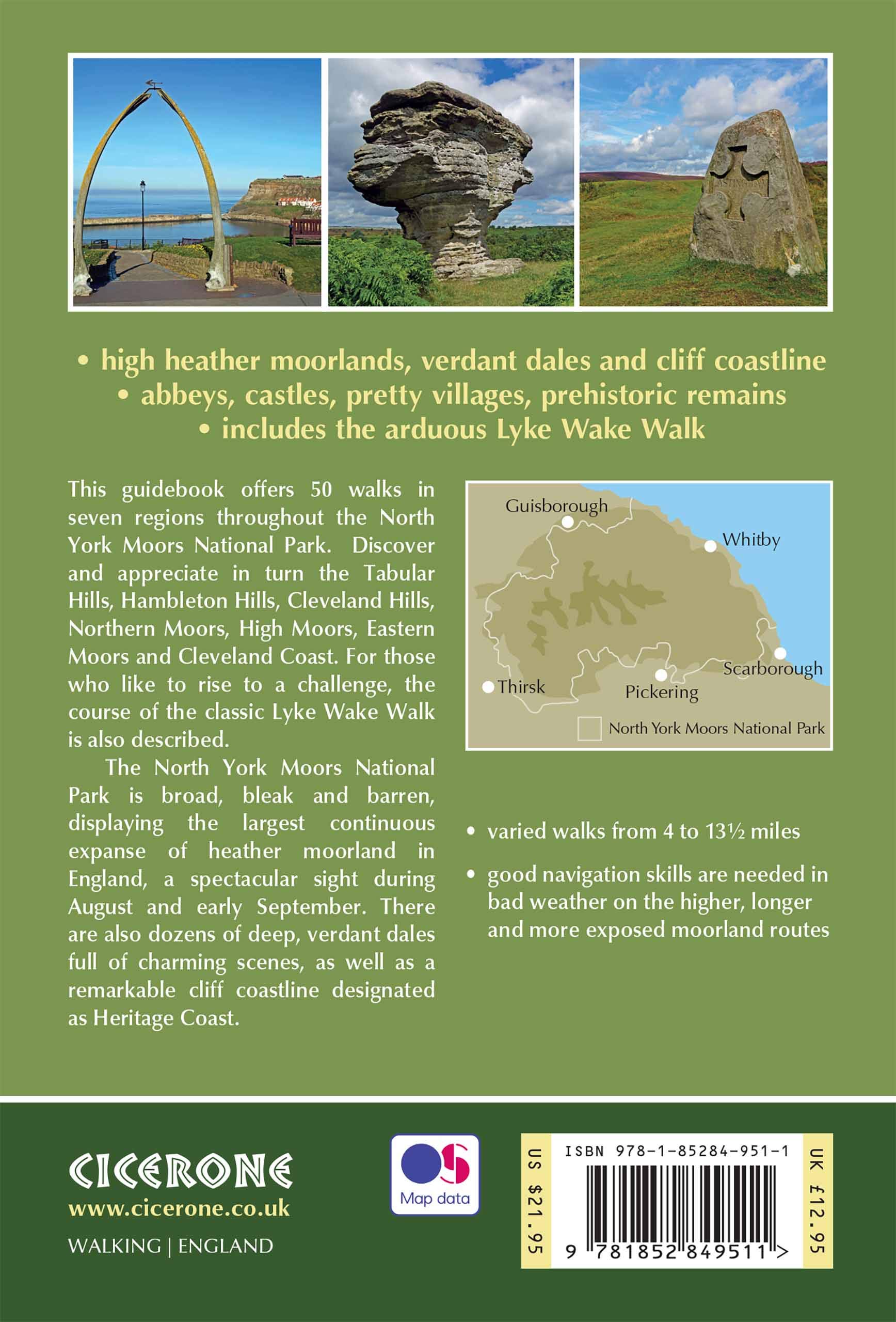
Product description : This guidebook describes 50 circular day walking routes in the North York Moors. The moors offer no great height but cover seven regions; the Tabular Hills, Hambleton Hills, Cleveland Hills, Northern Moors, High Moors, Eastern Moors and Cleveland Coast. There is also a four-day route following the classic Lyke Wake Walk.
Regions; the Tabular Hills, Hambleton Hills, Cleveland Hills, Northern Moors, High Moors, Eastern Moors and Cleveland Coast. There is also a four-day route following the classic Lyke Wake Walk. Seasons: Spring and autumn are ideal to explore the North York Moors. Weather an issue on unsheltered moorland in winter; and accommodation is busy in summer.Centres: Great Ayton, Helmsley, Hutton-le-Hole, Pickering, Whitby, Osmotherley, Scarborough, Thisk, Guisborough.
Difficulty: Varied walks from 4 to 14 miles. Exposed moorland walks to coastal strolls.
Must See: Rievaulx Abbey, Kilburn white horse, industrial archaeology, the high moors, coastal path Whitby – Robin Hood’s Bay.

Locatie op kaart
Artikelen uit dezelfde regio

Wandelkaart OL2 Yorkshire Dales- Southern & Western Areas - OSI • 9780319475331
Wandelkaart Yorkshire Dales- Southern & Western Areas - OSI Productomschrijving: Kaart nummer OL2 in de OS Explorer kaartenserie is de ideale kaart om te gebruiken bij het verkennen van de zuidelijke en westelijke gebieden van de Yorkshire Dales, waaronder Whernside, Ingleborough en Pen-y-ghent. Hoogtepunten: De drie pieken van Yorkshire, The Devils Bridge bij Kirkby Lonsdale, Leeds to Liv…

Wandelkaart XT40 Yorkshire Wolds Way Yorkshire - Harvey Maps • 9781851375929
Wandelkaart XT40 - Yorkshire Wolds Way Yorkshire - Harvey Maps Productomschrijving: De Yorkshire Wolds Way, (127km) is een National Trail in Yorkshire, Engeland. De route loopt van Hessle naar Filey, rond de Yorkshire Wolds. Bij Filey Brigg verbindt hij met de Cleveland Way, een ander National Trail. In 2007 vierde de Yorkshire Wolds Way de 25ste verjaardag van de officiële opening die pla…

Reisgids Yorkshire England - Rough Guides • 9781789194159
Reisgids Yorkshire England - Rough Guides Productomschrijving: The Rough Guide to Yorkshire was the first comprehensive guidebook to England’s largest county. Detailed coverage of the ruggedly beautiful Dales and Moors, the magnificent North Sea coast and historic York rubs shoulders with penetrating insights into the multi-cultural cities of Leeds and Sheffield, the resurgent port of Hull…

Wandelgids Cleveland Way - Trailblazer • 9781905864911
The 177 km long Cleveland Way -Trailblazer Productomschrijving: The Cleveland Way is een Nationaal Trail in de omgeving van historisch Cleveland in noord England. De route een dikke 177 km tussen Helmsley en the Brigg bij Filey, strelend aan de North York Moors National Park. De route is een historische route die de geschiedenis van de regio in kaart brengt, en uiteraard een nationaal park…

Wandelkaart Cleveland Way - Across North York NP - Harvey maps • 9781851374892
Wandelkaart Cleveland Way - Across North York NP - Harvey maps Productomschrijving: 174km (109 mijl) van Helmsley over het North York Moors National Park naar Saltburn en langs de kust via Scarborough eindigend met Filey. Informatie over het vinden van accommodatie, camping, voedsel. Routebeschrijving naar het begin. Ook Ranger Service contacten met nummers en uitbreidingen van steden/dorp…