
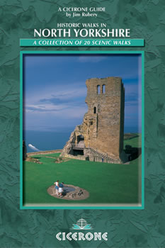
Wandelgids North Yorkshire historic walks - Cicerone
Omvat Skipton Castle- Ripon en Fountains Abbey & Ripley Castle
Korte omschrijving
Wandelgids - North Yorkshire historic walks - Cicerone Productomschrijving: Een gids over historische wandelingen in North Yorkshire, in 20 meestal circulaire routes. Zij brengen u van open ...

Specificaties
- Uitgever: CICERONE Press
- ISBN-13: 9781852843892
- HOOFDCATEGORIEËN: Wandelgids
- Activiteiten: Wandelen, Hiking & Trekking
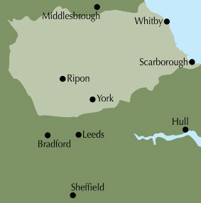
- Regio: North & North East England, Yorkshire, England
- Land: England
- Historische wandelroutes: North Yorkshire Historic walks
- Blz.: 160
- Afmeting: 12x17
- Editie: 1
- Taal: Engels
Volledige omschrijving
Wandelgids - North Yorkshire historic walks - Cicerone
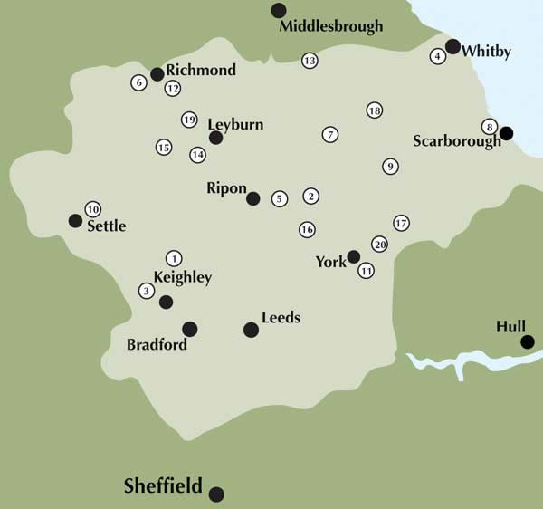
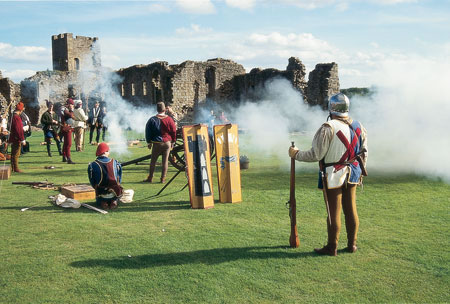
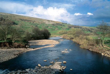
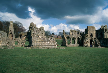
Productomschrijving: Een gids over historische wandelingen in North Yorkshire, in 20 meestal circulaire routes. Zij brengen u van open heidegebied en blootgestelde delen van heuvel en kliffen naar de meer beschutte dales en de straten van York. Wandelingen bevatten Skipton Castle, Ripon en Fountains Abbey, Ripley Castle, Castle Howard, Whitby Abbey, Bolton Abbey en de Romeinse stad Aldborough. Historische wandelingen in North Yorkshire nemen een poging om wat pracht van dit land, de ruime akkers te onthullen. Vergezeld door OS (Ordnance Servey kaarten) toewijzing en geïllustreerd met kleurenfoto's, combineren de serie van wandelingen, landschap met architectuur, natuurlijke schoonheid met geschiedenis, en ons erfgoed, met onze diverse en complexe cultuur.
Product description: The historic past makes its presence felt in virtually every fold and turn of the north Yorkshire landscape, and the walks in this guidebook have been chosen for their combination of scenic and historical appeal.
- The guide contains 20 walks, 4.5 to 12 miles in length. - The walks take in a variety of scenery, including open moorland, hillside, gentle dales and coastal cliffs.- The visit numerous historical towns, such as Richmond and York, and a variety of historical sites, including castles, churches
- The guide is in full colour throughout, and each route is accompanied by Ordnance Survey mapping.
Locatie op kaart
Overzichtskaarten

Hystorische wandel- en fietsroutes
Hystorische wandel- en fietsroutes

Producten op de overzichtskaart
Klik op een product om naar de detailpagina te gaan.
- Wandelkaart - South Downs Way - Harvey maps
- Wandelgids - North Yorkshire historic walks - Cicerone
- Wandelkaart OL13 - Brecon Beacons NP - Eastern area - OSI
- Wandelgids - Pilgrim Pathways walking guide - Trailblazer
- Wandelgids - The Great Glen Way - Trailblazer
- Wandelgids - Hadrian's wall Path - Knife Edge
- Wandelgids - Hadrian's Wall Path - Trailblazer
- Wandelkaart XT40 - Offa's Dyke Path - Harvey Maps
- Wandelkaart OL43 - Hadrian's Wall - OSI
- Wandelgids - Cleveland Way - Trailblazer
- Wandelkaart 351 - Dunbar & North Berwick- Schotland - OSI
- Wandelgids - Walking in the Forest of Dean - Cicerone
- Wandelkaart 130 - Salisburry & Stonehenge- Wiltshire - OSI
- Wandelkaart 256 - Wrexham- Wrecsam & Llangollen - OSI
- Wandelkaart 130 - Salisbury & Stonehenge- Wiltshire - OSI
- Wandelgids - John Muir Trail - Cicerone
- Wandelkaart - Rob Roy Way National trail - Harvey maps
- Wandelkaart - Hadrian's Wall Path - Harvey maps
- Wandelkaart - Offa's Dyke Path- Route Map Booklet - Cicerone
Artikelen uit dezelfde regio

Wandelkaart 289 Leeds Harrogate Wetherby & Pontefract - OSI • 9780319244869
Wandelkaart Leeds- Harrogate- Wetherby & Pontefract England Productbeschrijving: OS Explorer kaart 289 dekt Harrogate tot Pontefract, met inbegrip van Leeds en de rivieren Nidd, rivier, Aire en Calder. Hoogtepunten omvatten de Dales Way en de Trans Pennine Trail. De OS Explorer kaart voor Leeds is beschikbaar in zowel de standaard papieren versie en weerbestendige 'Actief' versie. Prod…

Wandelkaart OL30 Yorkshire Dales - Yorkshire England - OSI • 9780319475379
Wandelkaart Yorkshire Dales - Yorkshire England Omvat ook: Wensleydale & Swaledale Productbeschrijving: Kaart nummer OL30 in de OS Explorer kaarten reeks is de ideale kaart voor mensen die een bezoek willen brengen aan de noordelijke en centrale gebieden van de Yorkshire Dales, met inbegrip van Wensleydale & Swaledale. Er is een schat van landschappen in dit deel van het Yorkshire Dale…

Wandelgids Park Rangers Favourite Walks Yorkshire Dales - Collins • 9780008462659
Park Rangers Favourite Walks Yorkshire Dales - Collins Productomschrijving: Wandelgids voor het Yorkshire Dales National Park, met 20 beste routes uitgekozen door de parkwachters. Elke wandeling varieert in lengte van 2 tot 10 km en kan in minder dan 4 uur worden afgelegd. Engelse omschrijving: Walking guide to the Yorkshire Dales National Park, with 20 best routes chosen by the park r…

Wandelgids The Pennine Way - Cicerone • 9781852849061
Wandelgids - The Pennine Way - Cicerone Productomschrijving: De Pennine Way National Trail met OS kaart boekje. De route van de 320 km van Edale naar Kirk Yetholm duurt drie weken om te lopen en is geschikt voor fit en langeafstand ervaren wandelaars. De route doorkruist het Peak District NP, de Yorkshire Dales NP en de North Pennines nationale parken. Bevat afzonderlijk boekje van de rout…

Wandelgids Cleveland Way - Trailblazer • 9781905864911
The 177 km long Cleveland Way -Trailblazer Productomschrijving: The Cleveland Way is een Nationaal Trail in de omgeving van historisch Cleveland in noord England. De route een dikke 177 km tussen Helmsley en the Brigg bij Filey, strelend aan de North York Moors National Park. De route is een historische route die de geschiedenis van de regio in kaart brengt, en uiteraard een nationaal park…