
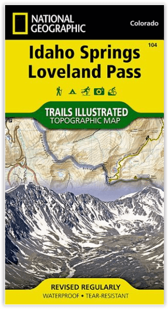
Wandelkaart 104 Idaho Springs & Loveland Pass - Nat Geo
Grays Peak National Recreation Trail & Continental Divide trail
Korte omschrijving
Wandelkaart Idaho Springs & Loveland Pass Colorado Productomschrijving: Deskundig onderzocht en gemaakt in samenwerking met lokale landbeheerders, biedt National Geographic's Trails Illustr...

Specificaties
- Uitgever: National Geographic
- ISBN-13: 9781566952491
- HOOFDCATEGORIEËN: Wandelkaart
- Activiteiten: Wandelen, Hiking & Trekking
- Regio: Colorado, USA
- Land: Verenigde Staten van Amerika (USA)
- Schaal: 1:40000
- Afmeting: 10x19
- Taal: Engels
Volledige omschrijving
Wandelkaart Idaho Springs & Loveland Pass Colorado
Productomschrijving: Deskundig onderzocht en gemaakt in samenwerking met lokale landbeheerders, biedt National Geographic's Trails Illustrated kaart van Idaho Springs, Loveland Pass een ongeëvenaard hulpmiddel voor het verkennen van deze schilderachtige regio. Ongeacht het seizoen, zult u deze kaart handig vinden voor het uitoefenen van een groot aantal recreatieve activiteiten, van skiën en sneeuwscooteren tot wandelen en kamperen. Deze kaart bevat vele belangrijke punten van belang,
Omvat: Arapaho, White River, and Pike national forests, Echo Lake, Mount Evans Wilderness, Guanella Pass Scenic Byway and the Keystone, Loveland.
Engelse omschrijving: Expertly researched and created in partnership with local land management agencies, National Geographic's Trails Illustrated map of Idaho Springs, Loveland Pass provides an unparalleled tool for exploring this scenic region. Whatever the season, you'll find this map handy for pursuing a host of recreational activities from skiing and snowmobiling to hiking and camping. This map features many key points of interest including Arapaho, White River, and Pike national forests, Echo Lake, Mount Evans Wilderness, Guanella Pass Scenic Byway and the Keystone, Loveland, and Arapahoe Basin ski areas.
With miles of trails including Grays Peak National Recreation Trail and portions of the Colorado and Continental Divide trails, this map can guide you off the beaten path and back again. Hiking, equestrian, bike, snowmobile, and ski trails are clearly marked, as well as a variety of recreational features including fishing areas, trailheads, campgrounds, and picnic areas. The map base includes contour lines and elevations for summits, passes and many lakes.
Every Trails Illustrated map is printed on "Backcountry Tough" waterproof, tear-resistant paper. A full UTM grid is printed on the map to aid with GPS navigation.
Other features found on this map include: Arapaho National Forest, Chief Mountain, Front Range, Ganley Mountain, Grays Peak, Loveland Pass, Mount Bierstadt, Mount Evans, Mount Evans Wilderness, Pike National Forest, Torreys Peak, White River National Forest.
Locatie op kaart
Artikelen uit dezelfde regio

Wandelkaart 119 Yampa & Gore Pass Colorado USA - Nat Geo • 9781566953931
Yampa & Gore Pass Colorado USA - Nat Geo Productomschrijving: Outdoor enthousiastelingen die het hele jaar door willen genieten van de recreatieve mogelijkheden in en rond het zuiden van Routt National Forest zullen zich verbazen over National Geographic's Trails Illustrated kaart van Yampa en Gore Pass. Gemaakt in samenwerking met de U.S. Forest Service, Bureau of Land Management en ander…

Reisgids Colorado - Gallimard • 9782742433438
Reisgids Colorado USA - Gallimard Productomschrijving: Van Denver, de "koningin van de Great Plains", tot Creede, een klein mijnstadje dat zich vastklampt aan de zijkant van de San Juan Mountains, van Aspen, het skioord van de sterren, tot Steamboat Rock, een ontmoetingsplaats voor rafting-liefhebbers aan de samenvloeiing van de Yampa en de Green Rivers, van Pawnee National Grassland, een…

Wandelkaart 131 Crested Butte- Pearl Pass - Nat geo • 9781566952477
TOPO Wandelkaart 131 - Crested Butte- Pearl Pass Colorado, USA - National geographic Productomschrijving: Crested Butte is een rustige wandel- en MTB uitvalsbasis in Gunnison County, Colorado, United States. Omvat de oude kool industrie, en noemt nu "the last great Colorado ski town". Crested Butte is aeveneens een locatie voor skiërs & mountainbiking, als ook een verzameling van andere ou…

Wandelkaart 127 Aspen - Independence Pass - Colorado USA • 9781566953580
TOPO Wandelkaart 127 - Aspen - Independence Pass - Colorado USA Productomschrijving: Independence Pass in Aspen Colorado is een uitmuntende wandellocatie. Deze omvat een topografische wandelkaart die echt tot de verbeelding spreekt. Een subliem exemplaar als het over wandelen gaat. Engelse omschrijving: Independence Pass, originally known as Hunter Pass, is a high mountain pass in cen…

Wandelkaart 301 Longs Peak -Trails Illustrated N. Trails - Nat Geo • 9781566954310
Wandelkaart 301 Longs Peak - Nat Geo Productomschrijving: Engelse omschrijving: Towering over the Rocky Mountains stands the 14,259 foot high Longs Peak. National Geographic's Trails Illustrated map of Longs Peak and the surrounding south-east areas of Rocky Mountain National Park is designed to meet the needs of those who are looking for a phenomenal climbing experience as well as fo…