
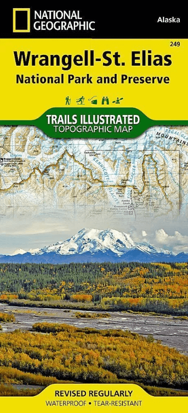
Wandelkaart 249 Wrangell St.Elias NP - Nat.Geo.
Van Noord-Amerika tot Mount Stain Elias- tot aan de oceaan
Korte omschrijving
Wrangell St.Elias NP - National Geographic Productomschrijving: Met 13,2 miljoen hectare, zou Wrangell-St. Elias binnen de grenzen passen van Yellowstone, Grand Canyon, Glacier, Olympic en Y...

Specificaties
- Uitgever: National Geographic
- ISBN-13: 9781566953825
- HOOFDCATEGORIEËN: Wandelkaart
- Activiteiten: Wandelen, Hiking & Trekking
- Regio: Alaska, USA
- Land: United States of America
- Waterafstotende kaart: Nat Geo waterproof series
- Schaal: 1:400000
- Afmeting: 11x24
- Taal: Engels
Volledige omschrijving
Wrangell St.Elias NP - National Geographic
Productomschrijving: Met 13,2 miljoen hectare, zou Wrangell-St. Elias binnen de grenzen passen van Yellowstone, Grand Canyon, Glacier, Olympic en Yosemite National Parks met zelf nog ruimte over. Het strekt zich uit van een van de hoogste toppen van Noord-Amerika > Mount Stain Elias, tot aan de oceaan. Meer dan een kwart van het park is bedekt met gletsjers, waaronder de Hubbard-gletsjer, de piëmont Malaspina-gletsjer en de Nabesna-gletsjer.
Engelse omschrijving: At 13.2 million acres, Wrangell-St. Elias could fit Yellowstone, Grand Canyon, Glacier, Olympic, and Yosemite National Parks within its borders with plenty of room to spare. It stretches from one of the tallest peaks in North America, Mount Stain Elias at 18,008 feet, to to the ocean. More than a quarter of the park is covered with glaciers, including the tidewater Hubbard Glacier, piedmont Malaspina Glacier, and valley Nabesna Glacier.
Arrive in the area using one of only two paved roads or use the mapped landing areas, seaplane bases and anchorage sites and continue your exploration with mapped hiking trails and primitive routes. Two insets show detailed access to the Kennicott Valley and Nabesna. Explore the backcountry using the map's contour lines, elevations, labeled peaks and summits, water features, selected waypoints, areas of wooded cover and color-coded boundaries between different land designations. Other recreation and adventure points of interest include ranger stations, campgrounds, trail shelters, public cabins, restrooms and scenic viewpoints. Some additional map features are background information of the various public lands in the area, wilderness safety tips, bear encounter guidelines and essential contact information.
Every Trails Illustrated map is printed on "Backcountry Tough" waterproof, tear-resistant paper. A full UTM grid is printed on the map to aid with GPS navigation.
Other features found on this map include: Allen Glacier, Bagley Ice Valley, Barnard Glacier, Bering Glacier, Bering Lake, Bremner Glacier, Bremner River, Cape Saint Elias, Cape Suckling, Chisana Glacier, Chistochina River, Chitina Glacier, Chitina River, Chugach Mountains, Chugach National Forest, Columbus Glacier, Copper Lake, Copper River, Dadina River, Gakona River, Granite Range, Gulkana River, Guyot Glacier, Hanagita Peak, Hawkins Glacier, Heney Glacier, Hubbard Glacier, Icy Bay, Jatahmund Lake, Jefferies Glacier, Kaliakh River, Kanak Island, Kayak Island, Kennicott Glacier, Klutina River, Klutlan Glacier, Logan Glacier, Long Glacier, Lucia Glacier, Malaspina Glacier, Martin River, Martin River Glacier, Mentasta Mountains, Miles Glacier, Miles Lake, Mount Augusta, Mount Bear, Mount Blackburn, Mount Bona, Mount Churchill, Mount Drum, Mount Jarvis, Mount Sanford, Mount Wrangell, Nabesna Glacier, Nizina River, Nutzotin Mountains, Ocean Cape, Oily Lake, Point Manby, Point Riou, Regal Glacier, Robinson Mountains, Root Glacier, Russell Fiord, Russell Fjord Wilderness, Russell Glacier, Saint Elias Mountains, Schwan Glacier, Seward Glacier, Sheridan Glacier, Steller Glacier, Tana Glacier, Tana River, Tanada Lake, Tazlina River, Tebay Lakes, Tiekel River, Tongass National Forest, Tonsina Lake, Tonsina River, Tyndall Glacier, Walsh Glacier, Wernicke Glacier, Wingham Island, Woodworth Glacier, Wrangell Mountains, Wrangell-St. Elias National Park, Wrangell-St. Elias National Preserve, Yahtse Glacier, Yakutat Bay.

Locatie op kaart
Artikelen uit dezelfde regio

Reisgids Alaska - Eyewitness • 9780241411520
Reisgids Alaska - Eyewitness Productomschrijving: Tour the mighty Mendenhall Glacier, ride the Alaska Marine Highway or brave the cold to catch a glimpse of the mesmerising Northern Lights (Aurora Borealis): everything you need to know is clearly laid out within colour-coded chapters. Discover the best of Alaska with this indispensable travel guide. Inside DK Eyewitness Travel Guide Al…

Wandelkaart 257 Gates of the Arctic NP- Alaska - Nat Geo • 9781566953764
TOPO Wandelkaart 257 - Gates of the Arctic NP - Alaska Productomschrijving: Het Gates of the Arctic National Park and Preserve is een nationaal park ten noorden van de noordpoolcirkel in de Amerikaanse staat Alaska. Het is het meest noordelijk gelegen en op een na grootste nationale park van de Verenigde Staten. Met een oppervlakte van 34.287 km² is het park iets kleiner dan Zwitserland. …

Wandelkaart 255 Glacier Bay NP- Alaska - Nat Geo • 9781566953863
TOPO Wandelkaart 255 - Glacier Bay NP- Alaska - Nat Geo Productomschrijving: Glacier Bay National Park and Preserve is een nationaal park ter grootte van 13.287 km² in het zuiden van Alaska in de Verenigde Staten. Het park kan alleen over water of door de lucht worden bereikt omdat er geen wegen naartoe lopen. Desondanks bezoeken jaarlijks gemiddeld 380.000 bezoekers het park. Engelse…

Wandelkaart 248 Katmai NP- Alaska - Nat Geo • 9781566952903
TOPO Wandelkaart 248 - Katmai NP- Alaska - Nat Geo Productomschrijving: Katmai National Park is een Amerikaans nationaal park in het zuiden van de staat Alaska, gelegen op het Alaska-schiereiland. Het ligt ongeveer 450 kilometer ten zuidwesten van de stad Anchorage. Het gebied is alleen per boot of vliegtuig te bereiken. Engelse omschrijving: Known for its large population of bears an…

Wandelkaart 764 Chugach State Park- Anchorage - Natgeo • 9781566956789
TOPO Wandelkaart 764 - Chugach State Park- Anchorage - Natgeo Productomschrijving: Chugach State Park omvat een dikke 2004 M² KM, direct ten oosten van Anchorage Bowl in south-central Alaska. Engelse omschrijving: National Geographic's Trails Illustrated map of Chugach State Park and Anchorage combines unmatched detail with helpful information to offer an invaluable tool for making the…