
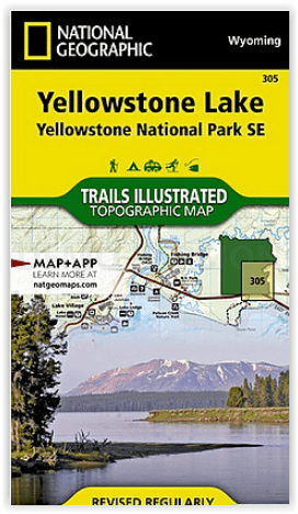
Wandelkaart 305 Yellowstone Lake - Yellowstone NP - Nat Geo
Big Game Ridge- Colter Peak- Eagle Peak- Heart Lake & Lewis Lake

Korte omschrijving
Yellowstone Lake - Yellowstone NP - Nat Geo Omvat: Big Game Ridge, Colter Peak, Eagle Peak, Heart Lake, Lewis Lake, Mount Hancock, Mount Sheridan, North Absaroka Wilderness, Red Mountains, S...

Specificaties
- Uitgever: National Geographic
- ISBN-13: 9781566954365
- HOOFDCATEGORIEËN: Wandelkaart
- Activiteiten: Wandelen, Hiking & Trekking
- Regio: Idaho, USA, Montana, USA, Wyoming, USA
- Land: Noord-Amerika (USA & Canada)
- Waterafstotende kaart: Nat Geo waterproof series
- Nationale parken: Yellowstone NP, Wyoming USA
- Schaal: 1:70000
- Afmeting: 10x19
- Editie: 7
- Taal: Engels
Volledige omschrijving
Yellowstone Lake - Yellowstone NP - Nat Geo
Omvat: Big Game Ridge, Colter Peak, Eagle Peak, Heart Lake, Lewis Lake, Mount Hancock, Mount Sheridan, North Absaroka Wilderness, Red Mountains, Shoshone National Forest, Teton National Forest, Teton Wilderness, Thorofare Plateau, Washakie Wilderness, Yellowstone Lake, Yellowstone National Park.
Engelse omschrijving: National Geographic's Trails Illustrated map of the Yellowstone Lake area of Yellowstone National Park is designed to meet the needs of outdoor enthusiasts with unmatched detail of the south-east section of the national park. Expertly researched and created in partnership with local land management agencies, this map features key points of interest including Yellowstone lake shown with contours and bathe metric shading, Lake Village, Grant Village, East Entrance Station, Heart Lake, Bridger-Teton National Forest, Shoshone National Forest, Teton Wilderness, and North Absaroka Wilderness.
With many miles of mapped trails and marked Bear Management Zones the Yellowstone Lake map can guide you off the beaten path and back again. The clearly marked trails include mileages between intersections. The map base includes contour lines and elevations for summits, passes and many lakes. Some of the many recreation features include: visitor centers, campgrounds, boat ramps, trailheads, and interpretive trails.
Every Trails Illustrated map is printed on "Backcountry Tough" waterproof, tear-resistant paper. A full UTM grid is printed on the map to aid with GPS navigation.
Locatie op kaart
Overzichtskaarten

NAT GEO Wyoming trail map
NAT GEO Wyoming trail map

Producten op de overzichtskaart
Klik op een product om naar de detailpagina te gaan.
- Wandelkaart 201 Yellowstone NP- Wyoming - Nat Geo
- Wandelkaart 202 Grand Teton NP- Wyoming - Nat Geo
- Wandelkaart 302 Yellowstone NP & Old Faithful - Nat Geo
- Wandelkaart 303 Mammoth Hot Springs- Yellowstone - Nat Geo
- Wandelkaart 304 Tower & Canyon Yellowstone NP - Nat Geo
- Wandelkaart 305 Yellowstone Lake - Yellowstone NP - Nat Geo
Artikelen uit dezelfde regio

Wandelkaart 215 Glacier & Waterton Lakes NP - Montana - Nat Geo • 9781566953184
TOPO Wandelkaart 215 - Glacier & Waterton Lakes NP Productomschrijving: Glacier National Park is een nationaal park in de Amerikaanse staat Montana. Het park sluit nadeloos aan op het Canadese Waterten Lakes NP net over de grens in Alberta Canada. Het park ligt in de Rocky Mountains op de grens met Canada. Zes bergtoppen bereiken er een hoogte van meer dan 3000 meter. Engelse omschrijv…

Wandelkaart 201 Yellowstone NP- Wyoming - Nat Geo • 9781566952958
TOPO Wandelkaart 201 - Yellowstone NP- Wyoming - Nat geo Productomschrijving: Yellowstone National Park, wat een prachtig concept voor een nationaal park, een par van formaat, en een nationaal park in de Verenigde Staten, hoofdzakelijk in Wyoming, maar met kleine gedeeltes in de aangrenzende staten Montana en Idaho. Engelse omschrijving: National Geographic's Trails Illustrated map of …

Wandelgids Rocky Mountains & Pacific Northwest NP - Lonely Planet • 9781838696085
Rocky Mountains & Pacific Northwest NP - Lonely Planet Productomschrijving: Lonely Planet's Rocky Mountains and the Pacific Northwest's National Parks is uw paspoort voor het meest actuele advies over wat je moet zien en overslaan. Beklim Grand Teton, bespioneer wilde dieren en kampeer bij Crater Lake, allemaal met je vertrouwde reisgenoot. Duik in het hart van de Rocky Mountains en de nat…

Wandelkaart 725 Bob Marshall Wilderness - Natgeo • 9781597756266
TOPO Wandelkaart 725 - Bob Marshall Wilderness - Natgeo Productomschrijving: The Bob Marshall Wilderness Area is een op kaart gemaakte wilderness area gelegen in western Montana in de United States. Dit wildernis, samen met de aanpalende bossen Scapegoat- en Great Bear wildernes, maken samen het "Bob Marshall Wilderness Complex". Engelse omschrijving: Located just north of Yellowstone…

Wandelkaart 303 Mammoth Hot Springs- Yellowstone - Nat Geo • 9781566954341
TOPO Wandelkaart 303 - Mammoth Hot Springs - Yellowstone Productomschrijving: Mammoth Hot Springs is een groot hot springs complex op een travertijn heuvel in Yellowstone National Park behorend tot Fort Yellowstone en de Mammoth Hot Springs Historic District. Engelse omschrijving: National Geographic's Trails Illustrated map of the Mammoth Hot Springs area of Yellowstone National Park …