
Wandelkaart 324 Liddesdale & Kershope Forest - Schotland
Omvat Hermitage Castle in de buurt van Liddel Water
Korte omschrijving
Wandelkaart Liddesdale & Kershope Forest - Schotsich borders Omvat ook: Newcastleton & Canonbie. Productbeschrijving: Aan de Schots / engelsee grens, omvat OS Explorer kaart 324 de omgev...

Specificaties
- Uitgever: Ordnance Survey
- ISBN-13: 9780319475324
- HOOFDCATEGORIEËN: Wandelkaart
- Activiteiten: Wandelen, Hiking & Trekking
- Regio: Dumfries & Galloway, Schotland
- Land: Schotland
- Waterafstotende kaart: Ordnance Survey ACTIVE Explorer Weatherproof Maps
- Schaal: 1:25000
- Afmeting: 13x24
- Taal: Engels
- Reeks: Explorer ACTIVE Series OSI
Volledige omschrijving
Wandelkaart Liddesdale & Kershope Forest - Schotsich borders
Omvat ook: Newcastleton & Canonbie.
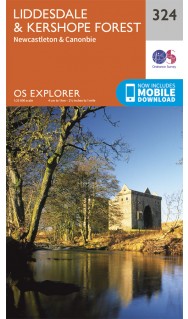
Productbeschrijving: Aan de Schots / engelsee grens, omvat OS Explorer kaart 324 de omgevingen van Kershope bos en het Liddel Water. De Hermitage Castle in de buurt van Liddel Water is één van de best bewaarde in Schotland. De OS Explorer kaart voor Liddesdale & Kershope Forest is beschikbaar in zowel de standaard papieren versie als de weerbestendige 'Actief' versie.
Productdiscription: On the Scotland - England border, OS Explorer map 324 covers Liddesdale, Kershope Forest and the Liddel Water. The Hermitage Castle near Liddel Water is one of the better preserved in Scotland. The OS Explorer map for Liddesdale & Kershope Forest is available in both the standard paper version and weatherproof 'Active' version.
Locatie op kaart
Gekoppelde artikelen

Wandelkaart 324 Liddesdale & Kershope Forest - OSI • 9780319263297
standaard versieWandelkaart Liddesdale & Kershope Forest - Schotish borders Productbeschrijving: Aan de Schotse - Engelse grens, omvat OS Explorer kaart 324 Liddesdale, Kershope forest en het Liddel Water. De Hermitage Castle in de buurt van Liddel Water, die er ene is van de best bewaarde in Schotland. De OS Explorer kaart voor doorverwijspagina & Kershope Forest is beschikbaar in zowel de standaard papi…

Wandelkaart 324 Liddesdale & Kershope Forest - Schotland • 9780319475324
weatherproof versieWandelkaart Liddesdale & Kershope Forest - Schotsich borders Omvat ook: Newcastleton & Canonbie. Productbeschrijving: Aan de Schots / engelsee grens, omvat OS Explorer kaart 324 de omgevingen van Kershope bos en het Liddel Water. De Hermitage Castle in de buurt van Liddel Water is één van de best bewaarde in Schotland. De OS Explorer kaart voor Liddesdale & Kershope Forest is beschikba…
Artikelen uit dezelfde regio

Wandelkaart 323 Eskdale Castle O'er Forest - OSI • 9780319471951
Wandelkaart Eskdale- Castle O'er Forest - Schotland Omvat ook: Langholm, Canonbie & Gretna Green. Productbeschrijving: Net op de grens tussen Schotland en Engeland omvat deze OS Explorer 323 kaart de beroemde Gretna Green, Castle O'er Forest, Langholm en Canonbie. De OS Explorer kaart voor huidige en Castle O'er Forest is beschikbaar in zowel de standaard papieren versie als de weerbes…

Wandelkaart 321 Nithsdale Schotland - OSI • 9780319471937
Wandelkaart Nithsdale - Dumfries & Galloway Schotland Omvat ook: Thornhill. Productbeschrijving: OS Explorer kaart 321 omvat Dumfries tot Thornhill. Het gebied staat bekend als Nithsdale, want het is de vallei van de rivier de Nith. De indrukwekkende Drumlanrig Castle is het hele jaar door geopend, en er zijn wandelpaden in en rond het Nithsdale gebied. De OS Explorer kaart voor Nithsd…

Wandelkaart 311 Wigtown Whithorn & The Machars - OSI • 9780319245637
Wandelkaart Wigtown- Whithorn - Dumfries & Galloway Productbeschrijving: OS Explorer kaart 331 omvat Whithorn en The Machars. De Machars zijn een gebied met glooiende groene heuvels waarvan sommige met belangrijke vroege oude nederzettingen. Wigton Bay is een Site van bijzonder wetenschappelijk belang zowel als een natuurreservaat terwijl Luce Bay een speciale beschermingszone is. De OS Ex…

Wandelkaart 310 Glenluce & Kirkcowan Schotland - OSI • 9780319245620
Wandelkaart Glenluce & Kirkcowan - Dumfries & Galoway 310 / Glenluce & Kirkcowan, Dumfries & Galoway - In het zuidwesten van Schotland, toont deze OS Explorer kaart 310 Glenluce en Kirkcowan, Luce Bay en de Southern Upland Way. De OS Explorer kaart voor Glenluce & Kirkcowan is beschikbaar in zowel de standaard papieren versie als weerbestendige 'Actief' versie. 310 / Glenluce & Kirkcow…

Wandelkaart 82 Stranraer & Glenluce - Schotland - OSI • 9780319474051
Wandelkaart Stranraer & Glenluce - Dumfries & Galloway Productbeschrijving: De OS Landranger-kaart 82 van Stranraer & Glenluce bevat ook New Luce, Kirkcowan, Dunragit, Stoneykirk, Ardwell, Port Lagan, Drummore, Port Patrick, alsook een onderdeel van de E2 Europese Long Distance pad en deel van de Southern Upland Way. Stranraer is de haven van de veerboot naar Belfast in Noord-Ierland, u ku…