
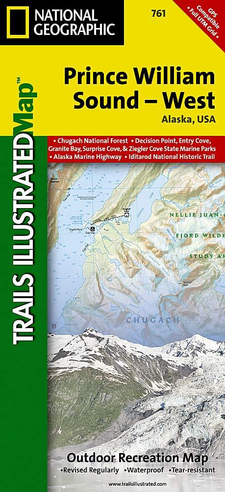
Wandelkaart 761 Prince William Sound West - Alaska - Nat Geo
De Prince William Sound is een deel van de Golf van Alaska
Korte omschrijving
TOPO Wandelkaart 761 - Prince William Sound, West - Alaska - National Geographic Productomschrijving: De Prince William Sound is een deel van de Golf van Alaska gelegen ten zuiden van de Ame...

Specificaties
- Uitgever: National Geographic
- ISBN-13: 9781566954204
- HOOFDCATEGORIEËN: Wandelkaart
- Regio: Alaska, USA
- Land: Verenigde Staten van Amerika (USA)
- Schaal: 1:110000
- Afmeting: 10x19
- Taal: Engels
Volledige omschrijving
TOPO Wandelkaart 761 - Prince William Sound, West - Alaska - National Geographic
Productomschrijving: De Prince William Sound is een deel van de Golf van Alaska gelegen ten zuiden van de Amerikaanse staat Alaska. De Prince William Sound heeft een kustlijn van een kleine 5000 kilometer en ligt ten oosten van het Kenai-schiereiland. In het oosten, noorden en westen wordt de Prince William Sound omgeven door de Chugach Mountains. De omgeving is bezaaid met wandelpaden die de schitterende natuur van dit deel van wereld in het licht brengen.
Engelse omschrijving: Prince William Sound is a dramatic marine landscape of endless coastline, rugged mountains, and tidewater glaciers known for calving enormous chunks of ice into the sea. Expertly researched and created in partnership with local land management agencies, National Geographic's Trails Illustrated map of Prince William Sound - West provides an unparalleled tool for exploring this breathtaking region. Key areas of interest include Whittier, Port Nellie Juan, Chugach National Forest, Nellie Juan-College Fiord Wilderness Study Area, and Harriman, Blue, and College fiords. Chenega, Knight, Latouche, Elrington, Evans, Bainbridge, Culross, Esther, and Perry islands are also shown.
Kayaking and boating are popular activities in Prince William Sound and state marine parks abound including South Esther Island, Granite Bay, Bettles Bay, Surprise Cove, Decision Point, Entry Cove, Ziegler Cove, Thumb Cove, Safety Cove, Sandspit Point, Sunny Cove, Driftwood Bay, and Horseshoe Bay. The map features detailed topography with shaded relief and contour lines; clearly defined, color-coded boundaries of state marine parks, wildlife areas, and native corporation lands; safety information; elevations for summits, passes, and some lakes; and depth soundings. Recreation features are clearly marked, including campgrounds, public use cabins, kayak landings, seaplane bases, selected anchorages, trailheads, and lighthouses. Every Trails Illustrated map is printed on "Backcountry Tough" waterproof, tear-resistant paper. A full UTM grid is printed on the map to aid with GPS navigation.
Other features found on this map include: Blying Sound, Cape Junken, Chugach National Forest, College Fiord, Day Harbor, Ellsworth Glacier, Inner Lake George, Kings Bay, Knight Island, Knight Island Passage, Knik Glacier, Montague Strait, Nellie Juan River, Perry Island, Port Bainbridge, Port Wells, Sargent Icefield, Unakwik Inlet, Upper Lake George.
Locatie op kaart
Overzichtskaarten

NAT GEO Alaska trails map
NAT GEO Alaska trails map

Producten op de overzichtskaart
Klik op een product om naar de detailpagina te gaan.
- Wandelkaart 231 Kenai Fjords NP- Alaska - Nat Geo
- Wandelkaart 248 Katmai NP- Alaska - Nat Geo
- Wandelkaart 254 Chilkoot Trail - Klondike Gold Rush - Nat Geo
- Wandelkaart 255 Glacier Bay NP- Alaska - Nat Geo
- Wandelkaart 257 Gates of the Arctic NP- Alaska - Nat Geo
- Wandelkaart 760 Kenai National Wildlife Refuge - Alaska - Nat Geo
- Wandelkaart 761 Prince William Sound West - Alaska - Nat Geo
- Wandelkaart 763 Kachemak Bay State Park - Alaska - Nat Geo
Artikelen uit dezelfde regio

Reisgids Alaska - Eyewitness • 9780241411520
Reisgids Alaska - Eyewitness Productomschrijving: Tour the mighty Mendenhall Glacier, ride the Alaska Marine Highway or brave the cold to catch a glimpse of the mesmerising Northern Lights (Aurora Borealis): everything you need to know is clearly laid out within colour-coded chapters. Discover the best of Alaska with this indispensable travel guide. Inside DK Eyewitness Travel Guide Al…

Wandelkaart 257 Gates of the Arctic NP- Alaska - Nat Geo • 9781566953764
TOPO Wandelkaart 257 - Gates of the Arctic NP - Alaska Productomschrijving: Het Gates of the Arctic National Park and Preserve is een nationaal park ten noorden van de noordpoolcirkel in de Amerikaanse staat Alaska. Het is het meest noordelijk gelegen en op een na grootste nationale park van de Verenigde Staten. Met een oppervlakte van 34.287 km² is het park iets kleiner dan Zwitserland. …

Wandelkaart 764 Chugach State Park- Anchorage - Natgeo • 9781566956789
TOPO Wandelkaart 764 - Chugach State Park- Anchorage - Natgeo Productomschrijving: Chugach State Park omvat een dikke 2004 M² KM, direct ten oosten van Anchorage Bowl in south-central Alaska. Engelse omschrijving: National Geographic's Trails Illustrated map of Chugach State Park and Anchorage combines unmatched detail with helpful information to offer an invaluable tool for making the…

Wandelkaart 254 Chilkoot Trail - Klondike Gold Rush - Nat Geo • 9781566954112
TOPO Wandelkaart 254 - Chilkoot Trail - Nat Geo Klondike Gold Rush - (1896–1899) Productomschrijving: Chilkoot Trail is een 53 km lange tocht door de Coast Mountains vertrekkende vanDyea, Alaska, in Amerika, tot Bennett, British Columbia, in Canada. Het omvatte al altijd een belangrijke route van de kust naar de Yukon goldfields in de late 1890s. De route werd overbodig in 1899 toen er…

Wandelkaart 255 Glacier Bay NP- Alaska - Nat Geo • 9781566953863
TOPO Wandelkaart 255 - Glacier Bay NP- Alaska - Nat Geo Productomschrijving: Glacier Bay National Park and Preserve is een nationaal park ter grootte van 13.287 km² in het zuiden van Alaska in de Verenigde Staten. Het park kan alleen over water of door de lucht worden bereikt omdat er geen wegen naartoe lopen. Desondanks bezoeken jaarlijks gemiddeld 380.000 bezoekers het park. Engelse…