
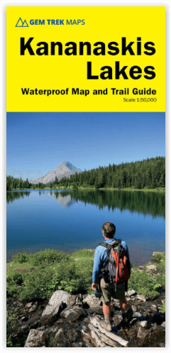
Wandelkaart D70 Kananaskis Country Alberta Canada - Gem Trek
Canmore- Bow Valley- Highwood River- Cataract Creek- Braggs Creek
Korte omschrijving
Wandelkaart Kananaskis Country Alberta Canada - Gem Trek Productomschrijving: Waterdichte en scheurbestendige kaart voor Kananaskis Country in de Canadese Rockies. Kaartdekking: De Kanan...

Specificaties
- Uitgever: Gem Trek Publishing
- ISBN-13: 9781990161001
- HOOFDCATEGORIEËN: Wandelkaart
- Activiteiten: Wandelen, Hiking & Trekking
- Regio: Alberta, Canada
- Land: Canada
- Schaal: 1:120000, 1:250000
- Afmeting: 12x25, 12x26
- Editie: 1
- Taal: Engels
Volledige omschrijving
Wandelkaart Kananaskis Country Alberta Canada - Gem Trek
Productomschrijving: Waterdichte en scheurbestendige kaart voor Kananaskis Country in de Canadese Rockies.
Kaartdekking: De Kananaskis Country Kaart bestrijkt heel Kananaskis Country in de Canadese Rockies. De kaart strekt zich uit van Canmore en de Bow Valley in het noorden tot de Highwood River en Cataract Creek in het zuiden. De Continental Divide en Elk Lakes Provincial Park worden in het westen bestreken, terwijl de oostelijke dekking zich uitstrekt tot Braggs Creek en de Elbow en Sheep River Valleys.
Engelse omschrijving: Waterproof and tear-resistant map for Kananaskis Country in the Canadian Rockies.
Map Coverage: The Kananaskis Country Map covers all of Kananaskis Country in the Canadian Rockies. Coverage extends from Canmore and the Bow Valley in the north to the Highwood River and Cataract Creek in the south. The Continental Divide and Elk Lakes Provincial Park are covered to the west while eastern coverage extends to Bragg Creek and the Elbow and Sheep River Valleys.
Whether you are a first-time visitor or a long-time local, you’ll find Gem Trek’s Kananaskis Country Map to be an invaluable tool. Researched and designed by locals, and printed in Canada, this map features accurate cartography and subtly coloured relief that puts the mountainous region in perspective. The map is printed on high-quality synthetic waterproof paper that can be folded and refolded hundreds of times.
The 1:250,000 scale is ideal for discovering the very best of Kananaskis Country. Highlights and our recommended hiking trails are marked by numbered stars, then cross-referenced on the reverse side with descriptions. Also included are all mountains and their elevations, along with natural features such as waterfalls, rivers, and lakes.
In addition to descriptions for the top highlights and most popular hiking trails, the reverse side has inset maps for Kananaskis Village and the Cataract Creek region. There are also descriptions of the park’s geology, history, wildlife, and eco-regions. Practical information on outdoor activities, weather, campgrounds, lodging, and visitor centres allows map users to plan their trip accordingly.
– Map scale: 1:250,000
– Sheet size: 27 x 39 inches
– Folded size: 4.5 x 9.5 inches
Map Features:
The Kananaskis Country Map features:
- waterproof and tear-resistant paper
- relief shading to better show the topography
- full colour on both sides
- hydrology rivers, rapids and waterfalls
- mountain names and all available mountain elevations
- all campgrounds with a handy chart showing campground details
- points of interest and attractions as well as day use areas and highway viewpoints
Locatie op kaart
Artikelen uit dezelfde regio

Wandelgids Toptrails - Nordamerika West - Rother • 9783763331857
Toptrails - Nordamerika West - Rother Productomschrijving: De uitgestrekte gebieden van het Amerikaanse Westen herbergen een grote verscheidenheid aan buitengewone natuurlandschappen. De bekendste werden al vroeg beschermd als de eerste nationale parken op aarde. Uitstekend ontwikkelde bezoekersfaciliteiten maken de spectaculaire bergen, kusten en woestijnen gemakkelijk toegankelijk voor i…


Wandelgids Kanadische Rocky Mountains - Canada - Rother • 9783763345274
Wandelgids Canadian Rocky Mountains - Rother Productomschrijving: De Rocky Mountains zijn een echt openluchtparadijs. De natuur is er nauwelijks door mensenhanden aangeraakt en betovert met haar wilde schoonheid. Dit ruige gebergte is het thuis van poema's, beren en wapiti's, en combineert de meest uiteenlopende ecosystemen in de kleinste ruimte, met enorme ijsvelden, winderige bergtoppen,…

Reisgids Canada - insight guide • 9789066554849
Reisgids - Canada - insight guide Productomschrijving: Canada is het op één na grootste land ter wereld en strekt zich uit over een afstand van 5500 km tussen de Atlantische Oceaan en de Grote Oceaan. De variatie van landschappen is dan ook ongekend groot en ondanks deze enorme afmetingen zijn de auteurs en fotografen op de bekende, onovertroffen en veelvuldig bekroonde Insight Guide-wijze…

Wandelkaart 13 Het beste van Lake Louise - Gemtrek • 9781895526752
Wandelkaart - Het beste van Lake Louise - Gemtrek Productomschrijving: Lake Louis, het befaamde meer, die althans de naam meedraagt. We spreken uiteraard over een volledig gebied. De Lake zelf is een prachtig helderblauw watergebied, met een immens uitzicht op de bijgelegen hoge met sneeuwbedekte bergen. In de winter kan tot een meter sneeuw op het water liggen, in de zomer vallen de blade…

Wandelkaart 900 Banff South & Banff and Kootenay NP - Nat Geo • 9781566956581
Wandelkaart 900 - Banff South & Banff and Kootenay NP - Natgeo Productomschrijving: Deze omvat een overzicht van alle recreatieve wandelpaden, wegen en vele andere informatie die u zou kunnen nodig hebben in deze 2 schitterende nationale parken, die letterlijk aan elkaar werden genaaid. De wildernis van Banff en Kootenay, zijn geen zondag wandelplaatsje, je bereidt uw tocht altijd goed voo…