
Reisgids Scottish Highlands & Islands - Rough guides
A fully updated The Rough Guide to Scottish Highlands
Korte omschrijving
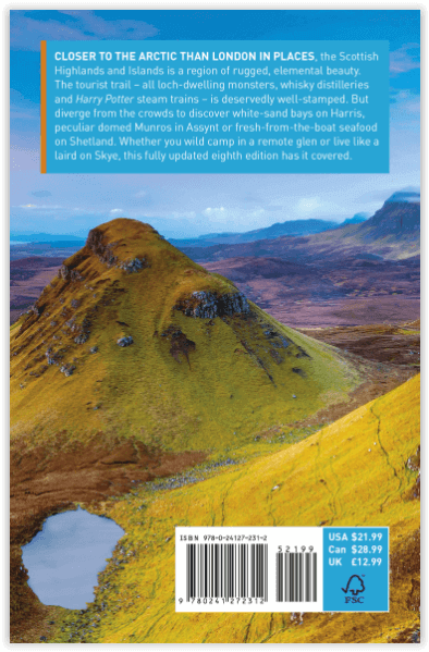
Scottish Highlands & Islands - Rough guides Product description: This fully updated The Rough Guide to Scottish Highlands and Islands is the ultimate guidebook to the captivating remote reac...

Specificaties
- Uitgever: Rough Guides
- ISBN-13: 9780241272312
- HOOFDCATEGORIEËN: Reisgids
- Activiteiten: Toerisme
- Regio: Highlands, Schotland, Inner hybrids (Binnen-Hebriden), Schotland, Outer Hibrids, Schetland Islands, Schotland
- Land: Schotland
- Blz.: 440
- Afmeting: 13x20
- Editie: 8
- Taal: Engels
Volledige omschrijving
Scottish Highlands & Islands - Rough guides
Product description: This fully updated The Rough Guide to Scottish Highlands and Islands is the ultimate guidebook to the captivating remote reaches of Scotland. From the divine seafood offerings at Loch Fyne to the whisky distilleries on Islay, this is a place for indulging. It’s also a hotspot for outdoor activities, whether you decide to bag a Munro or two, hop onto a mountain bike or stroll along deserted (if blustery) golden beaches.
The Rough Guide to Scottish Highlands and Islands contains more information than ever on where to go and what to see in this part of Scotland, with practical information on everything from events listings to transport logistics. There’s also coverage of the brand new North Coast 500 route, which loops around the northernmost reaches of the country.
From Skye’s breathtaking Cuillin ridge to abandoned castles, via riproaring unplanned ceilidhs, this stark and weather beaten part of the planet will not disappoint.
Locatie op kaart
Artikelen uit dezelfde regio

Wandelgids The Great Glen Way (Map Booklet) - Cicerone • 9781852848958
The Great Glen Way - Cicerone Productomschrijving: Klein boekje, en tevens gratis bij het grote boek van The Great Glen Way, van de 79 mijl (124 km) Great Glen Way (een van de Great Trails van Schotland), tussen Fort William en Inverness. Dit boekje hoort bij de Cicerone gids voor de route en toont de volledige route op Ordnance Survey 1:25.000 kaarten. De route duurt meestal een week en i…

Wandelgids West Highland Way - Trailblazer • 9781912716296
The West Highland Way - Trailblazer Productomschrijving: De West Highland Way, loopt door één van de meest spectaculaire landschappen van Groot-Brittannië. Vanaf de rand van Glasgow slingert de route zich over 95 mijl (152 km) langs de beboste oevers van Loch Lomond, over de wildernis van Rannoch Moor, over de bergen boven Glencoe naar een dramatische finish aan de voet van Ben Nevis - de …

Wandelkaart 437 Ben Wyvis & Strathpeffer Schotland - OSI • 9780319472897
Wandelkaart Ben Wyvis & Strathpeffer - Highland Schotland Omvat ook: Dingwall. Productbeschrijving: OS Explorer kaart 437 toont de stad van Dingwall naar het noorden via Easter Ross, en omvat een paar Lochs en pieken. De valleien hebben de neiging om zwaar bebost te zijn, hoewel er sporen en paden (trails) lopen die het grootste deel van de regio omvatten. De OS Explorer kaart voor Ben…

Wandelkaart 434 Gairloch & Loch Ewe Schotland - OSI • 9780319246665
Wandelkaart Gairloch & Loch Ewe - Highlands Schotland Productbeschrijving: 434 / Gairloch & Loch Ewe, Highlands, Schotland - Kaart nummer 434 in de OS Explorer kaart reeks is ideaal voor het ontdekken van de hooglanden van het noordwesten van Schotland rond Gairloch. Een populaire toeristische bestemming dankzij de talloze nabijgelegen lochs. Met deze kaart kunt u dit gebied verkennen …

Wandelkaart 413 Knoydart Loch Houm Schotland - OSI • 9780319472682
Wandelkaart Knoydart- Loch Houm - Highland's Schotland Omvat ook: Kyle of Lochalsh. Productbeschrijving: Explorer kaart 413 omvat de regio Kyle of Lochalsh tot Inverie, deze ruige kustlijn nodigt u uit voor ontdekking. Met 4 van de Munros en diverse andere belangrijke toppen, naast twee nationale natuurgebieden is het een populaire regio voor het ondekken van de schotse hooglanden. De …