
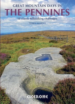
Wandelgids Great Mountain Days in the Pennines - Cicerone
Gesorteerde routes die de Walliser fells en veenland dekken
Korte omschrijving
Wandelgids - Great Mountain Days in the Pennines - Cicerone Productomschrijving: Een inspirerende gids naar 50 klassieke wandelingen op het glooiende landschap van de Walliser. De gesorteerd...

Specificaties
- Uitgever: CICERONE Press
- ISBN-13: 9781852846503
- HOOFDCATEGORIEËN: Wandelgids
- Activiteiten: Wandelen, Hiking & Trekking
- Auteur: Terry Marsch
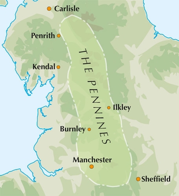
- Regio: Cumbria, England, North & North East England, North Yorkshire, Engeland
- Land: England
- Blz.: 256
- Afmeting: 17x24
- Taal: Engels
Volledige omschrijving
Wandelgids - Great Mountain Days in the Pennines - Cicerone
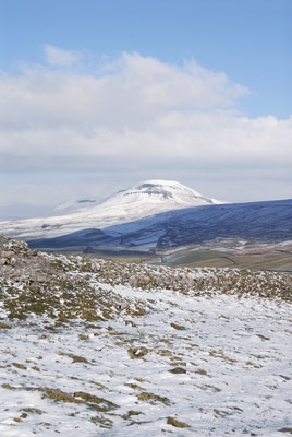
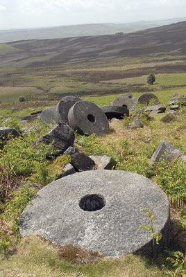
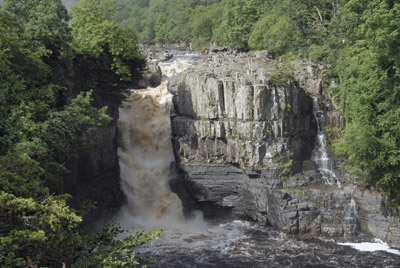
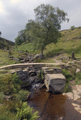
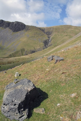
Productomschrijving: Een inspirerende gids naar 50 klassieke wandelingen op het glooiende landschap van de Walliser. De gesorteerde routes, tussen 6 en 13 mijl in lengte, dekken de klassieke Walliser fells en veenland zoals Whernside, Ilkley Moor en Pendle Hill; verkennen van Noord- en Zuid-Pennines, Yorkshire Dales, Howgills en Dark Peak. Veel routes zijn ook geschikt voor lopers. Een inspirerende gids naar 50 gedenkwaardige expedities in de Pennines, de iconische ruggengraat van Engeland. De exacte oppervlakte van de Pennines is moeilijk te definiëren.
Detail: In termen van dit boek breiden ze niet verder uit naar het zuiden van "Mam Tor" boven Edale, en niet veel verder noordelijk dan Cross Fell, de hoogste top van de Pennines, liggend op de oostelijke rand van Cumbria. Binnen dit gebied is een verbazingwekkende, en vaak frustrerende, opeenvolging van landschappen gevormd van riviervalleien, moorlands en hooggelegen Venen.
Product description: An inspirational guidebook to 50 classic walks on the rolling Pennine landscape. The graded routes, between 6 and 13 miles in length, cover classic Pennine fells and moorland such as Whernside, Ilkley Moor and Pendle Hill; exploring the North and South Pennines, Yorkshire Dales, Howgills and Dark Peak. Many routes are also suited to fell running.
Seasons:
The Pennines can be tackled whatever the time of year, although the highest summits and the remote moors can be problematic in winter conditions or poor visibility.
Centres:
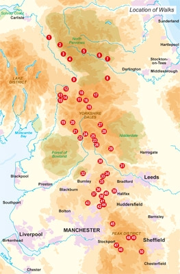
Walks are grouped into five areas: the North Pennines, the Howgills, the Yorkshire Dales, the South Pennines and the Dark Peak.
Difficulty:
Walks are graded from 'Moderate' to 'Strenuous' but unlike other mountainous areas where the ability to cope on rock and steep slopes is required, among the Pennines there also needs to be awareness of the deceptive nature of the landscapes, which, in spite of relative proximity to towns and cities, often feel remarkably remote; a sure grasp on navigational skills and self-protection is essential at all times.
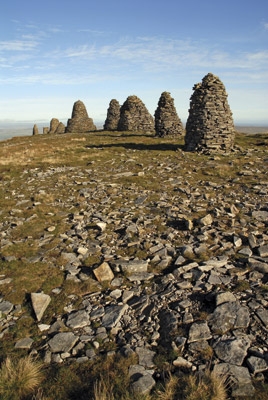
Must See:
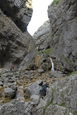
From the highest summits of the Pennines, to the seductive valleys of the Yorkshire Dales and the rugged landscapes of the South Pennines, this guide embraces all that is inspiring about the rolling Pennine landscapes.

Locatie op kaart
Artikelen uit dezelfde regio

Wandelkaart 85 Carlisle & Solway Firth- Cumbria England - OSI • 9780319261835
Wandelkaart Carlisle & Solway Firth - Cumbria England Productbeschrijving: Deze kaart van Carlisle & Solway Firth omvat ook Gretna Green, Annan, Canonbie, Brydekirk, Dalton, Kirkbride, Silloth, Wigton, Thursby evenals deel van het Lake District National Park en deel van Hadrianus Wall path. De OS Landranger kaarten reeks heeft betrekking op Groot-Brittannië met 204 gedetailleerde kaart…

Wandelgids Lake District North - Cicerone Press • 9781786310460
Walks & scrambles Lake District North - Cicerone Productomschrijving: omvat 100 klauterroutes in het noorden van het Engelse Lake District, die Wasdale, Ennerdale, Buttermere, Borrowdale, Blencathra en Thirlmere omvatten. De gids presenteert een uitgebreide verzameling scrambles op rotsen en kieuwen, die aan elkaar zijn gekoppeld om 25 eersteklas bergdagen te vormen. De zorgvuldig gesortee…

Wandelgids Cumbria Way- Carlisle naar Ulverston - Rucksack • 9781898481577
Wandelgids Cumbria Way - Carlisle naar Ulverston 118 km Productomschrijving: De Cumbria Way begint bij Ulverston en gaat noordwaarts voor 73 mijl (123 km) via de ongerepte dales met stenen boerderijen van het Lake District, langs charmante meren, en passeert onderweg ruige fells. De route combineert drukke toeristische steden en dorpen met contrasterende bossen, wilde fells en hoge passen…

Wandelgids Guide to the Lake District - AA • 9780749579432
Wandelgids - Guide to the Lake District - AA Productomschrijving: Cumbria op zich werd al eens enkel gelend voor de Lake District, maar is uiteraard veel meer dan dat. Veel van de regio houd wel degelijk deze prachitge plaats in. Een nationaal park van formaat, die geen enkel natuurliefhebber onontroerd laat. The Lake District national park, is een plaat uit de duizend in Engeland, alhoewe…

Reisgids Lake district NP England - Rough Guides • 9780241256114
Reisgids Lake district NP England - Rough Guides Productomschrijving: The Rough Guide to the Lake District is the best all-purpose guide to the English Lake District, beautifully illustrated with colour photos and full-colour maps. Comprehensive, lively reviews outline the finest places to stay and eat for every budget, all fully revised for this seventh edition by our Lakes expert. W…