
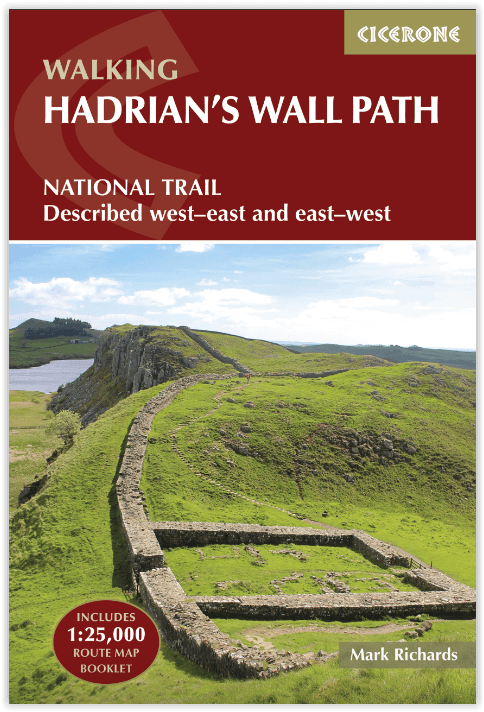
Wandelgids Hadrian's Wall Path National Trail - Cicerone
Bowness-on-Solway Newcastle naar Maryport en South Shields 135 km
Korte omschrijving
Hadrian's Wall Path National Trail - Cicerone Productomschrijving: Hadrians Wall Path gids om het 135 km lange National Trail te lopen. Beschreven in beide richtingen, is de hoofdbeschrijvin...

Specificaties
- Uitgever: CICERONE Press
- ISBN-13: 9781786311504
- Activiteiten: Wandelen, Hiking & Trekking
- Auteur: Mark Richards
- Regio: Newcastle, England, Schotse grenzen
- Land: England
- Nationale parken: Northumberland NP, England
- Blz.: 248
- Afmeting: 12x17
- Editie: 4
- Taal: Engels
Volledige omschrijving
Hadrian's Wall Path National Trail - Cicerone
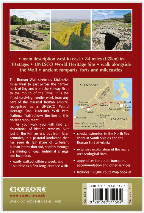
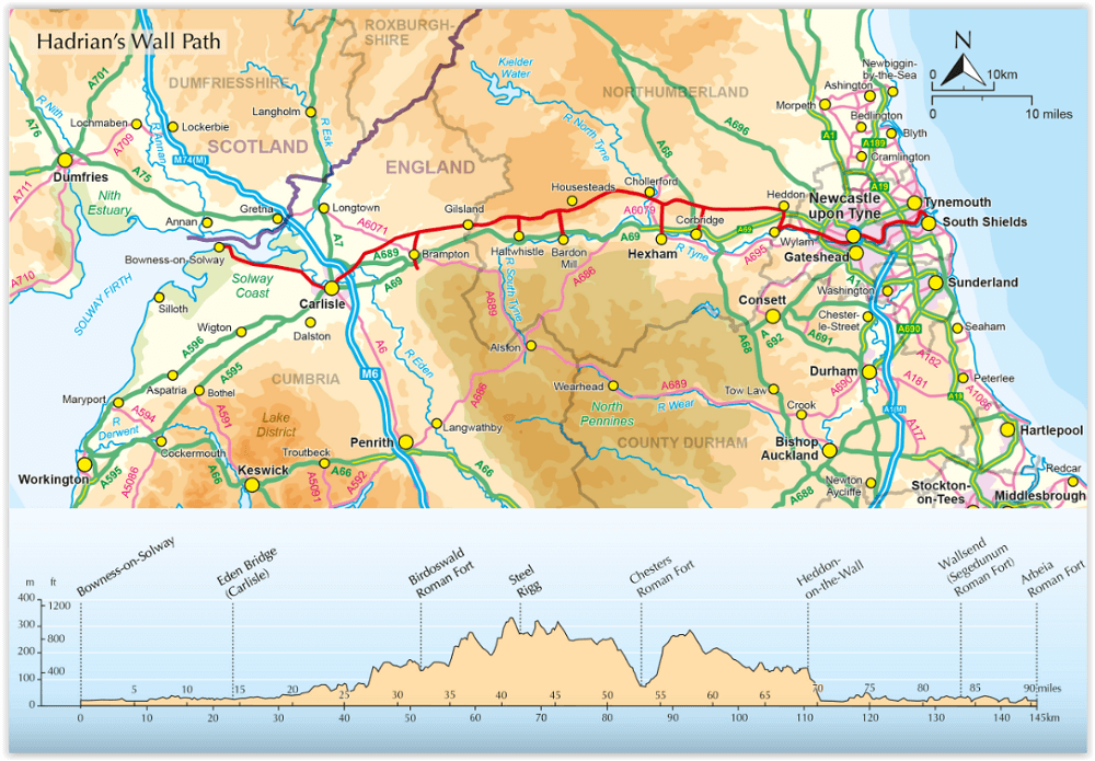
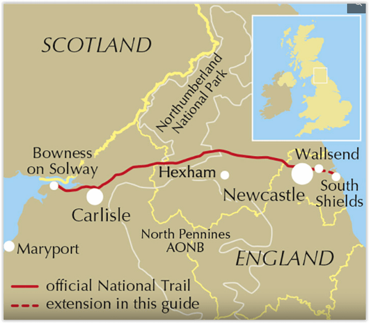
Productomschrijving: Hadrians Wall Path gids om het 135 km lange National Trail te lopen. Beschreven in beide richtingen, is de hoofdbeschrijving van west naar oost tussen Bowness-on-Solway en Wallsend, Newcastle, met uitbreidingen naar Maryport en South Shields. Met uitgebreide historische informatie over dit Werelderfgoed en een apart boekje met 1:25.000 OS-kaarten.
Engelse omschrijving: Hadrians Wall Path guidebook to walk the 84 mile National Trail. Described in both directions, the main description is west to east between Bowness-on-Solway and Wallsend, Newcastle, with extensions to Maryport and South Shields. With extensive historical information related to this World Heritage site and separate 1:25,000 OS map booklet included.
Seasons:
Year-round walking, although the useful bus service only operates during the summer months.
Centres:
Bowness-on-Solway, Carlisle, Haltwhistle, Chollerford, Corbridge and Newcastle all make good centres.
Difficulty:
Easy walking. But adequate fitness for a multi-day trek is required for the entire length.
Must See:
The central section of Housesteads and Vindolanda between Chollerford and Haltwistle.
Artikelen uit dezelfde regio

Wandelkaart 74 Kelso & Coldstream - Schotland - OSI • 9780319473979
Wandelkaart Kelso & Coldstream- Scotish borders - Schotland Productbeschrijving: De OS Landranger kaarten reeks heeft betrekking op Groot-Brittannië met 204 gedetailleerde kaarten, perfect voor dagtochten en korte pauzes. Elke kaart bevat alle informatie die u nodig heeft om dit lokaal gebied te leren kennen en omvat plaatsen van belang, toeristische informatie, picknickplaatsen en camping…

Wandelkaart 73 Peebles Galashiels & Selkirk Schotland - OSI • 9780319261712
Wandelkaart Eebles- Galashiels & Selkirk - Schotland Productbeschrijving: Net ten zuiden van de hoofdstad Edinburgh, toont OS Landranger kaart 73 Peebles, Galashiels, Selkirk en omvat ook Yarrow, Zeist, Stow, Eddleston, Swalmen, Langshaw, Melrose, doven Heights, Glenrath Heights, Gladhouse Reservoir en St. Mary's Loch. De Southern Upland Way (en een deel van het pad van de Long Distance E2…

Wandelgids The Borders Abbeys Way - Cicerone • 9781852849801
Wandelgids - The Borders Abbeys Way - Cicerone Productomschrijving: Deze gids brengt u langs een 109 km lange afstand pad op- en rond het Schotse grensgebied. Langs de route bevinden zich 4 van de beroemste oude Schotse Abbey's. De route start en eindigd in Tweedbank Schotland, en loopt voor zo'n dikke 109 km. De gids beschrijft een dikke 6 etappes en is zeer geschiedenisrijk. Goed voor me…

Wandelkaart 67 Duns Dunbar & Eyemouth Schotland - OSI • 9780319261651
Wandelkaart Duns- Dunbar & Eyemouth - Schotland Productbeschrijving: OS Landranger kaart 67 toont de oostkust in de buurt van Edinburgh, en omvat de steden Duns, Dunbar, East Linton, Eyemouth en Cosckburnspath. Het markeert het oostelijke uiteinde van de Southern Upland Way, en u kunt het ook verkennen van de Lammermuir Hills. De OS Landranger kaarten reeks heeft betrekking op Groot-Br…

Wandelkaart 339 Kelso Coldstream & Lower Tweed Valley - OSI • 9780319245910
Wandelkaart Kelso- Coldstream & Lower Tweed Valley - Schotland 339 / Kelso, Coldstream & Lower Tweed Valley, Schottish borders - Kaart nummer 339 dekt Kelso en Coldstream aan de schotse grens. Hoogtepunten zijn het nabijgelegen Northumberland National Park en de Borders Abbeys Way. Omvat ook de rivier Tweed, Newtown St. Boswells, Norham en Doddington. De OS Explorer kaart voor Kelso, Colds…