
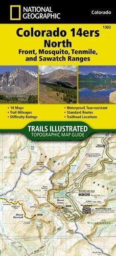
Wandelkaart 1302 Colorado 14'ers- Noord - Nat geo
14 Van de meest indrukwekkende bergmassieven in Colorado
Korte omschrijving
TOPO Wandelkaart 1302 - Colorado 14'ers- Noord - Natgeo Productomschrijving: De Colorado 14'ers bestaat uit 14 van de meest indrukwekkende bergmassieven in Colorado, verdeeld over drie versc...

Specificaties
- Uitgever: National Geographic
- ISBN-13: 9781566956994
- HOOFDCATEGORIEËN: Wandelkaart
- Regio: Colorado, USA
- Land: Verenigde Staten van Amerika (USA)
- Blz.: 48
- Schaal: 1:63360
- Afmeting: 10x19, 11x24
- Taal: Engels
Volledige omschrijving
TOPO Wandelkaart 1302 - Colorado 14'ers- Noord - Natgeo
Productomschrijving: De Colorado 14'ers bestaat uit 14 van de meest indrukwekkende bergmassieven in Colorado, verdeeld over drie verschillende regio's als Front Range, Momsquito Tenmile Ranges en de Sawatch Range. een indrukwekkende locatie om te gaan trekken uiteraard.
Front Range: Mount Bierstadt, Mount Evans, Grays Peak, Longs Peak, Pikes Peak, Torreys Peak
Mosquito, Tenmile Ranges: Tenmile Ranges: Mount Bross, Mount Cameron*, Mount Democrat, Mount Lincoln, Quandary Peak, Mount Sherman
Sawatch Range: Mount Antero, Mount Belford, Mount Columbia, Mount Elbert, Mount Harvard, Mt of the Holy Cross, Huron Peak, La Plata Peak, Mount Massive, Missouri Mountain, Mount Oxford, Mount Princeton, Mount Shavano, Tabeguache Peak, Mount Yale
Engelse omschrijving: Colorado has the highest mean elevation of any state in the United States. It's home to 58 mountain peaks higher than 14,000 feet—more than any other state in the U.S—making it a mountain sports mecca. "Bagging" these fourteeners is a goal for many Coloradans and visitors to the state—and for some, it's an obsession.
The Colorado 14ers North Topographic Map Guide provides the most accurate and convenient set of maps for the fourteeners of the Front, Mosquito, Tenmile, and Sawatch ranges of northern Colorado. Almost half of Colorado's fourteeners fall in these ranges, but their proximity to large population centers leave no shortage of hikers on their slopes. Moderate ridges, established trails, and accessible trailheads are the norm on the standard routes, making many of these peaks relatively easy to climb.
However, it's important to note that these seemingly gentle giants also have their rugged side—including the north face of Mount Evans, the amphitheater north of Mount Democrat, Ellingwood Ridge on La Plata Peak, and the sheer east face of Longs Peak—placing them among the most challenging alpine experiences in the United States. More convenient and easier to use than folded maps, but just as compact and lightweight, National Geographic's Topographic Map Guide booklets are printed on "Backcountry Tough" waterproof, tear-resistant paper with stainless steel staples.
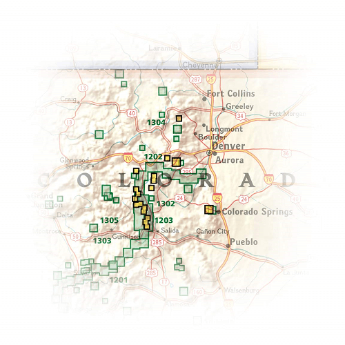
Locatie op kaart
Artikelen uit dezelfde regio

Wandelkaart 131 Crested Butte- Pearl Pass - Nat geo • 9781566952477
TOPO Wandelkaart 131 - Crested Butte- Pearl Pass Colorado, USA - National geographic Productomschrijving: Crested Butte is een rustige wandel- en MTB uitvalsbasis in Gunnison County, Colorado, United States. Omvat de oude kool industrie, en noemt nu "the last great Colorado ski town". Crested Butte is aeveneens een locatie voor skiërs & mountainbiking, als ook een verzameling van andere ou…

Wandelkaart 208 Colorado National Monument - Natgeo • 9781566954013
TOPO Wandelkaart 208 - Colorado National Monument - Natgeo Productomschrijving: recreatie regio's doorheen Colorado's 'Grand Valley' omvatten de steden: Grand Junction, Fruita, Palisade & Loma. Dit veel gebruikte gebied is gekend onder de de mensen die in Colorado wonen. Dit gebied is nationaal bekend voor zijn speciale mountainbiketrails en evengoed gekend voor de start van het Kokepelli …

Wandelkaart 103 Winter Park, Central City & Rollins Pass • 9781566952767
Wandelkaart Winter Park, Central City & Rollins Pass Productomschrijving: National Geographic's Trails Illustrated kaart van Winter Park, Central City en Rollins Pass biedt ongeëvenaarde details voor outdoor enthousiastelingen die het hele jaar door willen genieten van de recreatieve mogelijkheden in de zuidelijke delen van Roosevelt en Arapaho National Forest. Deskundig onderzocht en gema…

Wandelkaart 128 Maroon Bells- Redstond & Marble - Nat Geo • 9781566952484
TOPO Wandelkaart 128 - Maroon Bells- Redstond & Marble - National Geographic Productomschrijving: De Maroon Bells zijn 2 bergtoppen in de Elk Mountains, Maroon Peak & North Maroon Peak, met een dikke half kilometer gescheiden. De liggen liggen op de grens tussen Pitkin County & Gunnison County, Colorado, United States Engelse omschrijving: Colorado's Maroon Bells are the most photograp…

Wandelkaart 1304 Colorado Backpack Loops- Noord - Natgeo • 9781566957557
TOPO Wandelkaart 1304 - Colorado Backpack Loops- Noord - Natgeo Productomschrijving: Colorado is gelend voor zijn outdoor recreatrieve opportuniteiten. Eén van deze bezigheden is uiteraard backcountry & hiking. De Colorado Backpack Loops North Topographic Map Guide omavt de dozijn aan cirkelvormige wandelroutes geselecteerd door het personeel van National Geographic voor hun diversiteit, h…