
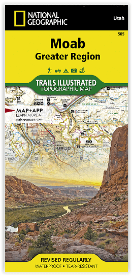
Wandelkaart 505 Moab Greater Region - Utah USA - Nat Geo
De perfecte uitvalsbasis voor de NP Arches en Canyonlands
Korte omschrijving
Wandelkaart Moab Utah USA - Nat Geo Productomschrijving: Moab is een zeer goed gekende locatie in het Amerikaanse Utah, tevens de hoofdplaats van Grand County. Op toeristisch vlak is Moab ge...

Specificaties
- Uitgever: National Geographic
- ISBN-13: 9781566959001
- HOOFDCATEGORIEËN: Wandelkaart
- Activiteiten: Wandelen, Hiking & Trekking
- Regio: Utah, USA
- Land: Verenigde Staten van Amerika (USA)
- Schaal: 1:90000
- Afmeting: 11x24
- Taal: Engels
Volledige omschrijving
Wandelkaart Moab Utah USA - Nat Geo
Productomschrijving: Moab is een zeer goed gekende locatie in het Amerikaanse Utah, tevens de hoofdplaats van Grand County. Op toeristisch vlak is Moab gekend voor zijn excursies naar de nabijgelegen natuurgebieden Arches en Canyonlands. Daarnaast is Moab de uitvalsbasis voor rafting op de Colorado river en tochten met de mountainbike, waarbij de Slickrock Trail waarschijnlijk de bekendste tocht is.
Deze kaart omvat het volledige gedeelte van het grote Moab recreatie gebied van het befamde National Geographic's Trails Illustrated. De kaart biedt een overzicht genummerd 505 op onderstaande kaart van het gebied. Het gebied omvat 3 kaarten met nummers, 505, 506 & 507. De 505 is de kaart die alles in één keer omvat, det 506 omvat het westelijke deel, en de 507 het Oostelijke gedeelte.
Omvat: Magnificent Seven, Rodeo, Navajo Rocks, Klondike Bluffs, Bar M (Moab Brands), Amasa Back, Klonzo, Sand Flats, Sovereign, and Whole Enchilada. The map includes all of Arches National Park and Dead Horse Point State Park, along with sections of Canyonlands National Park, Manti-La Sal National Forest, Bears Ears National Monument, Labyrinth Canyon Wilderness,
Omvat eveneens: Colorado River, Green River, Dolores River, Hatch Point, La Sal Mountains, Mineral Point, Mount Peale, Salt Valley.
Engelse omschrijving: A premier destination for mountain biking, hiking, whitewater rafting, four-wheeling, and more, Moab offers adventure and recreation in one of the most iconic landscapes in the United States. National Geographic's Trails Illustrated maps of Moab were created in partnership with local land management agencies and adventure experts to provide unmatched detail of the area, with useful up-to-date information to guide and enrich your visit.
The Moab Greater Region map shows all of the major trail systems, public lands, and recreation sites in and around Moab. Particularly useful for motorized off-road vehicle use, it features 29 highlighted 4x4 trails, with trail segments labeled with mileage between intersections. The region’s 10 major mountain bike trail areas are clearly mapped and labeled including: Magnificent Seven, Rodeo, Navajo Rocks, Klondike Bluffs, Bar M (Moab Brands), Amasa Back, Klonzo, Sand Flats, Sovereign, and Whole Enchilada. The map includes all of Arches National Park and Dead Horse Point State Park, along with sections of Canyonlands National Park, Manti-La Sal National Forest, Bears Ears National Monument, Labyrinth Canyon Wilderness, and dozens of BLM Special Recreation Management Areas.
Trails are symbolized by use types, with trail difficulty listed for mountain bike and 4x4 trails. Trail system comparison charts are included for 4x4 and mountain bike areas to help choose areas to explore given time, skill, and equipment constraints. Colorado River access points and mileages are mapped and labeled for river recreation. Visitor centers, campgrounds, interpretive trails, and scenic overlooks are prominently mapped and labeled with their amenities. OHV, biker, and desert safety tips, laws, and etiquette are also provided.
Every Trails Illustrated map is printed on "Backcountry Tough" waterproof, tear-resistant paper. A full UTM grid is printed on the map to aid with GPS navigation.
Other features found on this map include: Colorado River, Green River, Dolores River, Hatch Point, La Sal Mountains, Mineral Point, Mount Peale, Salt Valley.
Locatie op kaart
Gekoppelde artikelen

Wandelkaart 506 Moab West - Klondike Bluffs & Dead Horse Point • 9781566959018
standaard versieWandelkaart Moab West - Klondike Bluffs & Dead Horse Point Productomschrijving: Deze kaart omvat het westelijke gedeelte van het grote Moab recreatie gebied van het befamde National Geographic's Trails Illustrated. De kaart biedt een overzicht genummerd 506 op onderstaande kaart van het gebied. Het gebied omvat 3 kaarten met nummers, 505, 506 & 507. De 505 is de kaart die alles in één keer…

Wandelkaart 507 Moab Oost - Dewey Bridge & Sand Flats - Nat Geo • 9781566959025
standaard versieWandelkaart Moab Oost - Dewey Bridge & Sand Flats - Nat Geo Productomschrijving: Deze kaart omvat het Oostelijke gedeelte van het grote Moab recreatie gebied van het befamde National Geographic's Trails Illustrated. De kaart biedt een overzicht genummerd 507 op onderstaande kaart van het gebied. Het gebied omvat 3 kaarten met nummers, 505, 506 & 507. De 505 is de kaart die alles in één kee…
Artikelen uit dezelfde regio

Wandelkaart 710 Canyons of the Escalante NP - Nat Geo • 9781566953245
Wandelkaart Canyons of the Escalante NP - Nat Geo Productomschrijving: Dit National monument omvat drie belangrijke gebieden, de Grand Staircase, het Kaiparowits Plateau, en de Canyons van de Escalante. De regio omvat de steden van Big Water, Glendale en Kanab in Utah in het zuidwesten en de steden van Escalante en Boulder in het noordoosten Omvat: Box-Death Hollow Wilderness, Capitol …

Reisgids Californië- Arizona- Nevada & Utah - Gottmer • 9789025779139
Californië- Arizona- Nevada & Utah van Gottmer Productomschrijving: Of je nu nieuwsgierig bent naar cultuurbepalende wereldsteden als San Francisco en Los Angeles dan wel je juist graag terugtrekt in de natuur: de zuidwestelijke hoek van de VS is voor iedereen een gebied vol hoogtepunten. Californië trekt het grootste aantal bezoekers, gevolgd door de Grand Canyon in Arizona, de nationale …

Wandelkaart 707 Fish Lake - Manti- Utah Natgeo • 9781566953306
TOPO Wandelkaart 707 - Fish Lake - Manti- Utah - Nat Geo Productomschrijving: Fish Lake is een soort Alpine meer gelegen op 2,700 m in Fishlake op de zuidelijke Wasatch Plateau regio van zuid-centraal Utah, United States. Het ligt binnen het Fishlake National Forest. Fish Lake is 7.9 km lang en 1.3 km breedt, en ligt in een geologische structuur gekend als "graben valley". Engelse oms…

Wandelkaart 312 Canyonlands NP - Maze District - Natgeo • 9781566954624
Topografische Wandelkaart 312 - Canyonlands NP - Natgeo Productomschrijving: Canyonlands National Park is een Amerikaans nationaal park gelegen in het Zuidoosten van Utah, dichtbij de stad Moab. Het park omvat een kleurrijk landschap, geerodeerd in verschillende canyons door het water van de Colorado River. Het park is verdeeld in 4 districten: the Island in the Sky District, the Needles …

Reisgids Utah's national parks - Lonely planet • 9781838699857
Utah's national parks - Lonely planet Productomschrijving: Lonely Planet Zion & Bryce National Parks is jou paspoort voor het meest relevante, actuele advies over wat je moet zien en overslaan, en welke verborgen ontdekkingen er op je wachten. Wandel de Cable Mountain trail in Zion, rijd op een paard of muilezel door Bryce of ga zwemmen of tuben in Zion's Virgin River, allemaal met je vert…