
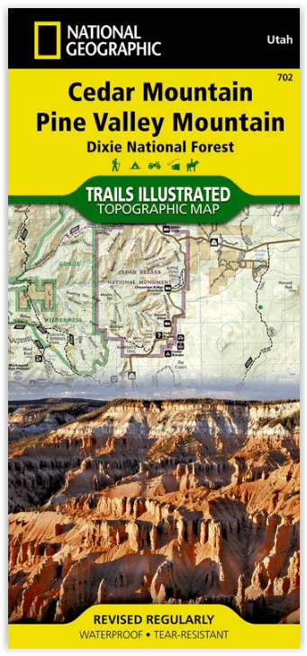
Wandelkaart 702 Cedar Mountain - Utah USA - Nat Geo
Pine Valley Mountain - Dixie National Forest
Korte omschrijving
Wandelkaart Cedar Mountain - Utah USA - Nat Geo Omvat: Ashdown Gorge Wilderness, Brian Head, Dixie National Forest, Kolob Terrace, Little Salt Lake, Markagunt Plateau, Panguitch Lake, Parowa...

Specificaties
- Uitgever: National Geographic
- ISBN-13: 9781566953061
- HOOFDCATEGORIEËN: Wandelkaart
- Activiteiten: Wandelen, Hiking & Trekking
- Regio: Utah, USA
- Land: Verenigde Staten van Amerika (USA)
- Waterafstotende kaart: Nat Geo waterproof series
- Schaal: 1:75000
- Afmeting: 10x19
- Taal: Engels
Volledige omschrijving
Wandelkaart Cedar Mountain - Utah USA - Nat Geo
Omvat: Ashdown Gorge Wilderness, Brian Head, Dixie National Forest, Kolob Terrace, Little Salt Lake, Markagunt Plateau, Panguitch Lake, Parowan Valley, Pine Valley Mountain Wilderness, Pine Valley Mountains, Signal Peak.
Engelse omschrijving: Cedar City is the headquarters of the Dixie National Forest which is a two-million-acre, 170-mile stretch of breathtaking wilderness across southern Utah. This map covers the Markagunt OHV Trail System from the stunning Pink Cliffs in the South to the Parowon Valley Northwest to the town of Panguitch in the East, and the spectacular Markagunt Plateau Scenic Drive—a 123-mile trail from Cedar City to Parowan.
Also featured are Cedar Breaks National Monument—with meadows at 10,000 feet and stunning nights for stargazing—as well as the shallow Navajo Lake, ideal for fishing, swimming, and boating, and the red limestone Hurricane Cliffs.
The area offers boundless outdoor recreation opportunities, from hiking, hunting, and horseback riding to skiing, swimming, and scenic driving—for all seasons, and a wide range of visitors. Recreation features are clearly marked, including trailheads, campgrounds, boat launches, mountain bike routes, ATV trails, downhill ski areas, scenic overlooks, and points of interest. The map includes contour lines, shaded relief, and elevations for summits and passes, as well as safety tips, visitor centers and ranger stations, and contact information for local agencies.
The printed map contains an inset showing greater detail of the popular Brian Head Ski Area and Cedar Breaks National Monument.
Every Trails Illustrated map is printed on "Backcountry Tough" waterproof, tear-resistant paper. A full UTM grid is printed on the map to aid with GPS navigation.
Other features found on this map include: Ashdown Gorge Wilderness, Brian Head, Dixie National Forest, Kolob Terrace, Little Salt Lake, Markagunt Plateau, Panguitch Lake, Parowan Valley, Pine Valley Mountain Wilderness, Pine Valley Mountains, Signal Peak.
Locatie op kaart
Overzichtskaarten

NAT GEO Utah trail maps
NAT GEO Utah trail maps

Producten op de overzichtskaart
Klik op een product om naar de detailpagina te gaan.
- Wandelkaart 210 Canyonlands NP - Utah - Natgeo
- Wandelkaart 211 Arches National Park- Utah - Natgeo
- Wandelkaart 214 Zion National Park - Natgeo
- Wandelkaart 219 Bryce Canyon NP Utah - Natgeo
- Wandelkaart 220 Dinosaur National Monument - Natgeo
- Wandelkaart 267 Capitol Reef NP Utah - Natgeo
- Wandelkaart 310 Canyonlands NP - Island in the Sky District
- Wandelkaart 311 Canyonlands NP - Needles District - Natgeo
- Wandelkaart 312 Canyonlands NP - Maze District - Natgeo
- Wandelkaart 702 Cedar Mountain - Utah USA - Nat Geo
- Wandelkaart 703 Manti-La Sal National forest - Natgeo
- Wandelkaart 704 Flaming Gorge- Recreational Area - Utah
- Wandelkaart 705 Mount Dutton & Aquarius Plateau - Nat Geo
- Wandelkaart 213 Glen Canyon & Capitol Reef NP - Nat Geo
Artikelen uit dezelfde regio

Wandelkaart 703 Manti-La Sal National forest - Natgeo • 9781566953771
TOPO Wandelkaart 703 - Manti-La Sal National forest - Nat Geo Productomschrijving: Het Manti–La Sal National Forest omvat meer dan 4,900 km, en is gelegen in centraal- en zuidoostelijke deel van Utah en het extreme westelijke deel van Colorado. Engelse omschrijving: Expertly researched and created in cooperation with the U.S. Forest Service, Bureau of Land Management and others, Natio…

Wandelkaart 506 Moab West - Klondike Bluffs & Dead Horse Point • 9781566959018
Wandelkaart Moab West - Klondike Bluffs & Dead Horse Point Productomschrijving: Deze kaart omvat het westelijke gedeelte van het grote Moab recreatie gebied van het befamde National Geographic's Trails Illustrated. De kaart biedt een overzicht genummerd 506 op onderstaande kaart van het gebied. Het gebied omvat 3 kaarten met nummers, 505, 506 & 507. De 505 is de kaart die alles in één keer…

Wandelkaart 213 Glen Canyon & Capitol Reef NP - Nat Geo • 9781566953436
Wandelkaart Glen Canyon & Capitol Reef NP - Nat Geo Omvat: Bullfrog Creek, Cataract Canyon, Dirty Devil River, Escalante River, Glen Canyon, Glen Canyon Dam, Glen Canyon National Recreation Area, Kaibito Creek, Lake Powell, Mount Hillers, Navajo Creek, Paria River, Rainbow Plateau, Red Canyon, San Juan River, Smoky Mountain, Wahweap Creek, Wilson Mesa. Engelse omschrijving: Let Nationa…

Wandelgids California & Southwest USA's NP's - Lonely Planet • 9781838696061
Wandelgids California & Southwest USA's National Parks Productomschrijving: Lonely Planet's California and Southwest USA's National Parks is uw paspoort voor het meest actuele advies over wat je moet zien en overslaan. Wandel door de Grand Canyon, bewonder Sequoia en jaag op watervallen in Yosemite; allemaal met je vertrouwde reisgenoot. Duik in het hart van de nationale parken van Califor…

Wandelkaart 707 Fish Lake - Manti- Utah Natgeo • 9781566953306
TOPO Wandelkaart 707 - Fish Lake - Manti- Utah - Nat Geo Productomschrijving: Fish Lake is een soort Alpine meer gelegen op 2,700 m in Fishlake op de zuidelijke Wasatch Plateau regio van zuid-centraal Utah, United States. Het ligt binnen het Fishlake National Forest. Fish Lake is 7.9 km lang en 1.3 km breedt, en ligt in een geologische structuur gekend als "graben valley". Engelse oms…