
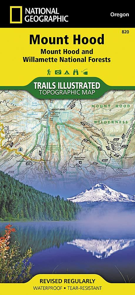
Wandelkaart 820 Mount Hood & Willamette National Forest
Met een dikke 6,790.75 km² grote
Korte omschrijving
TOPO Wandelkaart 820 - Mount Hood & Willamette National Forest - Oregon USA - National Geographic Productomschrijving: Het Willamette National Forest is een National bos gelegen in het centr...

Specificaties
- Uitgever: National Geographic
- ISBN-13: 9781566954723
- HOOFDCATEGORIEËN: Wandelkaart
- Regio: Oregon, USA
- Land: Verenigde Staten van Amerika (USA)
- Regionale parken: Willamette National Forest, Oregon USA
- Schaal: 1:75000
- Afmeting: 10x19
- Taal: Engels
Volledige omschrijving
TOPO Wandelkaart 820 - Mount Hood & Willamette National Forest - Oregon USA - National Geographic
Productomschrijving: Het Willamette National Forest is een National bos gelegen in het centrale deel van de Cascade Range in de U.S. satta van Oregon. Met een dikke 6,790.75 km². Een deel van 1,540 km² is echte wildernis waarin 7 grote pieken zijn vertegenwoordigd.
Engelse omschrijving: With its snow-covered peak, Mount Hood is an American icon and a premier destination for outdoor enthusiasts. The area's mountains, forests, wildernesses and rivers, provide an abundance of year-round recreation activities. National Geographic's Trails Illustrated map of Mount Hood is expertly researched and created in partnership with the U.S. Forest Service and others, to provide unparalleled detail for anyone wishing to explore this magnificent area. Included in the map are Mount Hood and Willamette National Forests, Mount Hood National Recreation Area, Olallie Lake Scenic Area, Sandy and Clackamas Rivers, Badger Creek and Timothy Lake. Descriptions of the region's eight wilderness areas are also provided, including Badger Creek, Bull of the Woods, Mount Hood and Salmon-Huckleberry Wilderness Areas.
With clearly marked trails including the Pacific Crest Trail and the Oregon National Historic Trail, and such scenic roadways as the West Cascades and Mount Hood Scenic Byways, this map will prove invaluable whether you're taking in the scenery on foot, by bike, on horseback or by car. Among the many recreation and adventure features noted on the map are campgrounds and primitive campsites, rock climbing areas, river access and boat launch points, ski areas and sno-parks, fishing areas and lookout towers. Also included are permit and background information and safety tips for climbing Mount Hood as well as essential contact information. Every Trails Illustrated map is printed on "Backcountry Tough" waterproof, tear-resistant paper. A full UTM grid is printed on the map to aid with GPS navigation.
Other features found on this map include: Badger Creek Wilderness, Barlow Pass, Battle Ax, Bull of the Woods Wilderness, Bull Run Reservoir Number One, Clackamas Wilderness, Detroit Lake, Fish Creek Mountain, Hunchback Mountain, Mount Hood, Mount Hood Wilderness, Mount Jefferson Wilderness, Mt. Hood National Forest, Olallie Butte, Opal Creek Wilderness, Roaring River Wilderness, Salmon-Huckleberry Wilderness, Shellrock Mountain, Timothy Lake, Wanderers Peak, Wapinitia Pass, Willamette National Forest, Zigzag Mountain.
Locatie op kaart
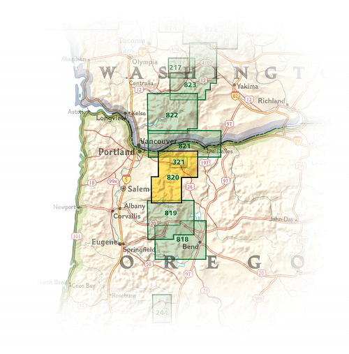
Overzichtskaarten

NAT GEO Oregon trails map
NAT GEO Oregon trails map

Producten op de overzichtskaart
Klik op een product om naar de detailpagina te gaan.
Artikelen uit dezelfde regio

Reisgids Oregon USA - Insight Guides ENG • 9781839053504
Reisgids Oregon USA - Insight Guides ENG Productomschrijving: Deze Insight Guide is een rijk geïllustreerde inspirerende reisgids voor Oregon en een prachtig souvenir van je reis. Perfect voor reizigers die op zoek zijn naar een diepere duik in de geschiedenis en cultuur van de bestemming en ideaal om inspiratie op te doen en je te helpen bij het plannen van je reis. Met zijn grote selecti…

Wandelgids Toptrails - Nordamerika West - Rother • 9783763331857
Toptrails - Nordamerika West - Rother Productomschrijving: De uitgestrekte gebieden van het Amerikaanse Westen herbergen een grote verscheidenheid aan buitengewone natuurlandschappen. De bekendste werden al vroeg beschermd als de eerste nationale parken op aarde. Uitstekend ontwikkelde bezoekersfaciliteiten maken de spectaculaire bergen, kusten en woestijnen gemakkelijk toegankelijk voor i…

Wandelkaart 818 Bend & Three Sisters Oregon USA - Nat Geo • 9781566956628
Wandelkaart Bend- Three Sisters Oregon USA - Nat Geo Productomschrijving: National Geographic's Trails Illustrated kaart van Bend en Three Sisters is ontworpen om te voldoen aan de behoeften van outdoor enthousiastelingen die de bergen en wildernissen in dit deel van centraal Oregon willen verkennen. Met drie van Oregon's hoogste toppen en een van de grootste wildernis gebieden, heeft het …

Reisgids Pacific Northwest USA - DK Eyewitness • 9780241411513
DK Eyewitness Pacific Northwest USA Omvat: Portland, Oregon, Seattle, Washington, Vancouver and British Columbia Productomschrijving: Tour de Wine Country van de North Willamette Valley, ga wandelen in het Mount Rainier National Park of verken het natuurschoon van Vancouver Island: alles wat u moet weten is overzichtelijk weergegeven in kleurgecodeerde hoofdstukken. Ontdek het beste v…

Portland & the Willamette Valley pocket guide - Lonely Planet • 9781788684583
Portland & the Willamette Valley van Lonely Planet Productomschrijving: Lonely Planet's Pocket Portland & the Willamette Valley is onze kleurrijke, gebruiksvriendelijke en handige gids die letterlijk in je broekzak past en boordevol staat met de beste bezienswaardigheden en ervaringen voor een korte trip of weekendje weg. Het is je paspoort voor het meest relevante, actuele advies over…