
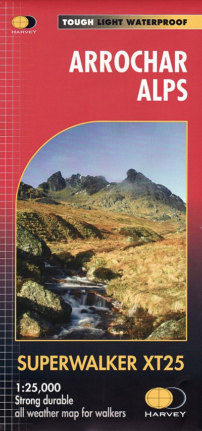
Wandelkaart XT25 Arrochar Alps - Harvey maps
Loch Long- Loch Fine & Loch Goil in de Argyl & Bute regio
Korte omschrijving
Wandelkaart - XT25 Arrochar Alps - Harvey maps Productomschrijving: De Arrochar Alps zijn een bergketen gelokalliseerd rond de "Loch Long", "Loch Fine" & "Loch Goil" in de Argyl & Bute regio...

Specificaties
- Uitgever: HARVEY MAPS
- ISBN-13: 9781851376063
- HOOFDCATEGORIEËN: Wandelkaart
- Activiteiten: Wandelen, Hiking & Trekking
- Regio: Argyll & Bute, Schotland
- Land: Schotland
- Nationale parken: Trossachs NP, Schotland
- Schaal: 1:25000
- Afmeting: 14x25
- Taal: Engels
- Reeks: Harvey, XT Superwalker maps
Volledige omschrijving
Wandelkaart - XT25 Arrochar Alps - Harvey maps
Productomschrijving: De Arrochar Alps zijn een bergketen gelokalliseerd rond de "Loch Long", "Loch Fine" & "Loch Goil" in de Argyl & Bute regio in de schotse Highlands, in het Trossachs nationale park. Gelegen dicht bij de dorpen van Arrochar en Lochgoilhead, op de Cowal Peninsula in de Argyll and Bute regio in Schotland. Deze bergketen is een belangrijk gegeven voor bergwandelaars, aangezien zijn gemakkelijke ligging voor wandelaars vanuit Glasgow. Ze liggen voornamelijk in het Loch Lomond and the Trossachs National Park, met een uitlopend stuk in het Argyll Forest park.
Engelse omschrijving: The Arrochar Alps are a group of mountains located around the head of Loch Long, Loch Fyne,and Loch Goil, near the villages of Arrochar and Lochgoilhead, on the Cowal Peninsula in Argyll and Bute, Scotland.[1] The mountains are especially popular with hillwalkers, due to their proximity and accessibility from Glasgow. They are largely within the Loch Lomond and the Trossachs National Park and in part also extend into the Argyll Forest Park. Glens which go into the heart of the range include: Glen Croe, Hell's Glen and Glen Kinglass.
Locatie op kaart
Overzichtskaarten

Harvey Maps - Mountain XT30 & XT25 Maps
Harvey Maps - Mountain XT30 & XT25 Maps

Producten op de overzichtskaart
Klik op een product om naar de detailpagina te gaan.
- Wandelkaart XT30 Macgillycuddy’s Range - Harvey Maps
- Wandelkaart XT25 Arran & Arran Coastal Way - Harvey maps
- Wandelkaart XT25 Arrochar Alps - Harvey maps
- Wandelkaart XT25 Ben Alder Highlands Schotland - Harvey Maps
- Wandelkaart XT25 Ben Nevis - Mamores - Harvey maps
- Wandelkaart XT25 Brecon Beacons NP - West - Harvey maps
- Wandelkaart XT25 Cairn Gorms & Ben Avon - Harvey maps
- Wandelkaart XT25 Cheviot Hills - Harvey Maps
- Wandelkaart XT25 Crieff & Comrie - Harvey Maps
- Wandelkaart XT25 Noord Dartmoor NP Devon - Harvey Maps
- Wandelkaart XT25 Dartmoor Zuid Devon England - Harvey Maps
- Wandelkaart XT25 Fannichs Seana Bhraigh - Harvey Maps
- Wandelkaart XT25 Galloway Hills Schotland - Harvey Maps
- Wandelkaart XT25 Glen Coe- Glen Etive & Black Mount
- Wandelkaart XT30 Isle of Man Channel Islands - Harvey Maps
- Wandelkaart XT25 Jura - Inner Hybrids - Harvey Maps
- Wandelkaart XT25 Lake District Noord - Harvey map
- Wandelkaart XT25 Lake District West - Harvey maps
- Wandelkaart XT25 Lake District Zuid Oost - Harvey maps
- Wandelkaart XT25 Loch Lomond & The Trossachs - Harvey maps
- Wandelkaart XT Malvern Hills AONB England - Harvey map
- Wandelkaart XT Mull- Iona & Ulva - Harvey Maps
- Wandelkaart XT Suilven Highlands Schotlands - Harvey
- Wandelkaart XT25 Mourne Mountains N. Ireland - Harvey maps
- Wandelkaart XT25 Ochil Hills Schotland - Harvey maps
- Wandelkaart XT25 Peak District Central - Harvey Maps
- Wandelkaart XT25 Peak District Noord - Harvey maps
- Wandelkaart XT25 Peak District Zuid - Harvey maps
- Wandelkaart en MTB kaart XT25 Pentland Hills - Harvey maps
- Wandelkaart XT25 Pentland Hills Schotland - Harvey Maps
- Wandelkaart XT25 Rum- Eigg- Canna & Muck - Harvey maps
- Wandelkaart XT25 Skye The Cuillin - Harvey maps
- Wandelkaart XT25 Skye Trotternish - South-West Storr - Harvey maps
- Wandelkaart XT25 Snowdonia Central - Harvey Maps
- Wandelkaart XT25 Snowdonia North - Harvey maps
- Wandelkaart XT25 Snowdonia South - Harvey Maps
- Wandelkaart XT25 Torridon Schotland - Harvey maps
- Wandelkaart XT25 Trossachs NP North - Harvey Maps
- Wandelkaart XT30 Wicklow Mountains - Harvey Maps
- Wandelkaart XT25 Yorkshire Dales NP Noord-Oost - Harvey maps
- Wandelkaart XT25 Yorkshire Dales Noord-West - Harvey maps
- Wandelkaart XT25 Yorkshire Dales Zuid-Oost - Harvey maps
- Wandelkaart XT25 Yorkshire Dales Zuid-West - Harvey Maps
- Wandelkaart XT30 Dingle Peninsula - Dingle Way - Harvey Maps
- Wandelkaart XT25 Foinaven- Ben Hope & Ben Klibreck - Harvey maps
- Wandelkaart XT25 An Teallach- Fisherfield & Letterewe - Harvey Maps
Artikelen uit dezelfde regio

Wandelkaart 362 Cowal West & Isle of Bute- Argyl & Bure • 9780319472330
Wandelkaart Cowal West & Isle of Bute - Argyl & Bute Schotland Omvat ook: Rothesay. Productbeschrijving: Kaart nummer 362 omvat Cowal West, Rothesay en the Isle of Bute. Hoogtepunten zijn Kyles of Bute, Loch Riddon en Loch Lomond en de Trossarchs National Park. Omvat ook Loch Fyne, Garbhallt en Kingarth. De OS Explorer kaart voor Cowal West & Isle of Bute is beschikbaar in zowel de sta…

Wandelkaart 352 Islay South Argyl & Bute- Schotland - OSI • 9780319246030
Wandelkaart Islay South - Argyl & Bute Schotland Omvat ook: Port Ellen, Bowmore & Bridgend Productomschrijving: Hier word de zuidelijke helft van Islay getoont op de Binnen-Hebriden, in de Schotse regio Argyl & Bute, en omvat OS Explorer kaart blad 352 ook het eiland 'kapitaal', Bowmore. U kunt er Port Ellen en het schiereiland van Oa verkennen. De OS Explorer kaart voor zuid Islay is …

Wandelkaart Arrochar Alps - Argyl & Bute Schotland - Harvey Maps • 9781851376476
Wandelkaart Arrochar Alps - XT40 Ultra - Harvey Maps Productomschrijving: Omvat een groot gebied en is praktisch en compact in zakformaat. Gedetailleerde kaart bergwandelaars van het westelijke deel van Loch Lomond en Trossachs National Park. De Arrochar Alps zijn een gebergte aan de kop van Loch Long, Loch Fyne en Loch Goil, in de buurt van de dorpen Arrochar en Lochgoilhead, op het schi…

Wandelkaart 372 Coll & Tiree- Inner-Hybrids - OSI • 9780319472392
Wandelkaart Coll & Tiree - Inner-Hybrids Schotland Productbeschrijving: Kaart nummer 372 omvat Coll en Tiree. Hoogtepunten zijn Calgary point, Gunna, Gott Bay, Crossapol Bay en Hynish Bay. De kaart omvat ook Loch Fada en Loch Cilad. De OS Explorer kaart voor Coll & Tiree is beschikbaar in zowel de standaard papieren versie als de weerbestendige 'Actief' versie. Productdiscription: Map …

Wandelkaart 376 Oban & North Lorn Argyl & Bute - OSI • 9780319246238
Wandelkaart Oban & North Lorn - Argyl & Bute Schotland Omvat ook: Benderloch, Lismore & Loch Creran Productomschrijving: Kaart nummer 376 omvat Oban en Noord Lorn. Hoogtepunten zijn Loch Creran, Lynn of Lorn & Shuna eiland. Omvat ook Lismore, Port Appin, North Shian en Loch Etive. De OS Explorer kaart voor Oban & Noord Lorn is beschikbaar in zowel de standaard papieren versie als de we…