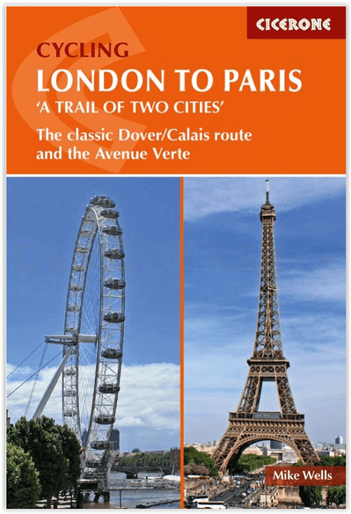
Fietsgids Cycling London to Paris - Cicerone
Gloednieuwe fietsgids over de London to Paris Bike Ride
Korte omschrijving
Cycling London to Paris - Cicerone Press Productomschrijving: Gloednieuwe fietsgids over de London to Paris Bike Ride, inclusief de 500 km traditionele route, die gebruik maakt van fietspade...

Specificaties
- Uitgever: CICERONE Press
- ISBN-13: 9781852849146
- HOOFDCATEGORIEËN: Fietsgids
- Activiteiten: Fietsen / VTT / MTB
- Auteur: Mike Wells
- Regio: Haute-Normandie, Frankrijk, South & South East England, Île-de-France
- Land: England, Frankrijk
- Departement: Eure (27), Oise (60), Pas-de-Calais (62), Seine-Maritime 76, Somme (80)
- Blz.: 272
- Afmeting: 12x17
- Editie: 1
- Taal: Engels
Volledige omschrijving
Cycling London to Paris - Cicerone Press
Productomschrijving: Gloednieuwe fietsgids over de London to Paris Bike Ride, inclusief de 500 km traditionele route, die gebruik maakt van fietspaden en rustige wegen plus een ferry overtocht vanuit Dover, en de 400 km Avenue Verte, een bewegwijzerde route via Newhaven/Dieppe die meer gebruik maakt van speciale fietspaden. Elke route duurt 5-7 dagen en ze kunnen gecombineerd worden voor een rondreis.
Engelse omschrijving: Guidebook to the London to Paris Bike Ride, including both the 500km traditional route, which makes use of cycle tracks and quiet roads plus a ferry crossing from Dover, and the 400km Avenue Verte, a waymarked route via Newhaven/Dieppe which makes greater use of dedicated cycle paths. Each takes 5-7 days and they can be combined for a round trip.
Seasons:
Both routes can be cycled at any time of year, though April-October is the best period. Off-road sections of Stages 2 (Pilgrims' Way) and 8 (Coulée Verte) of the classic route are best done after a period of dry weather.
Centres:
The classic route passes through London, Rochester, Ashford, Folkestone, Dover, Calais, Desvres, Hesdin, Abbeville, Amiens, Beauvais, Chantilly and Paris. The Avenue Verte passes through London, Crawley, East Grinstead, Newhaven, Dieppe, Gournay-en-Bray, Gisors, Cergy and Paris.
Difficulty:
Both routes are straightforward, with gently rolling hills and a few short ascents (the maximum altitude reached is only 204m). City street riding in London and Paris can be avoided by using trains to reach the edge of town. Much of the route follows dedicated off-road cycle tracks along old railway track-beds and canal/river towpaths. Where roads are used, these are mostly quiet country lanes or suburban streets. Mainly asphalt or compacted gravel surfaces in good condition, suitable for hybrid or touring cycles. Off-road options in Stages 2 and 8 of the classic route are suitable for mountain bikes at all times and hybrids or tourers in dry weather.
Must See:
The two cities of London and Paris, with their many tourist sights, cultural offerings and gastronomic opportunities, the maritime centre of Greenwich, the North Downs with the Pilgrims' Way and White Cliffs of Dover, the Wealden landscape of Sussex and Kent (England) and the Bray (France), the medieval French towns of Calais, Hesdin, Montreuil, Abbeville and Gisors, the Somme and Oise valleys, the cathedral cities of Rochester, Amiens and Beauvais, the chateau of Chantilly & the limestone plateau of the Vexin.

Artikelen uit dezelfde regio

Wandelgids The Pilgrim's Way - Cicerone • 9781852847777
Wandelgids - The Pilgrim's Way - Cicerone Productomschrijving: Een samenstelling van alle route gegevens van deze uitermate gekende St-jacobs/bedevaart wandelroute in hartje Engeland. Product description: This guidebook details the Pilgrims' Way, an historic pilgrimage route to Canterbury Cathedral in Kent, home of the shrine of the martyred archbishop, St Thomas Becket. The route is…

Wandelkaart 1911 OT Forêts Brotonne et du Trait-Maulévrier - IGN • 9782758555391
Forêts Brotonne et du Trait-Maulévrier - IGN Productomschrijving: De kaart omvat het prachtige park van de PNR de Forêts Brotonne et du Trait-Maulévrier, gelegen op rijafstand van de stad Rouen, in de Haut Normandië. Bestreken gemeenten: Rives-en-Seine, Routot, Rougemontiers, Berville-sur-Seine, Aizier, Tocqueville, La Trinité-de-Thouberville, Saint-Paër, Notre-Dame-de-Bliquetuit, Car…

Wandelkaart North Downs Way - Harvey maps • 9781851375295
Wandelkaart North Downs Way - Harvey maps Productomschrijving: Meer dan een kaart, een essentieel nieuw stuk met indeling, deze HARVEY routekaart toont het geheel van de North Downs Way op één vel. Het is een duidelijk gedetailleerde route. Het bevat ook informatie over accommodatie en diensten, handige telefoonnummers om te helpen met de planning en de volledige tour. Gedrukt op 100% wate…

Wandelkaart 2313 OT Forêts de Montmorency Paris - IGN • 9782758543411
Wandelkaart Forêts de Montmorency - IGN Productomschrijving: Het bos van Montmorency is een staatsbos, gelegen in het Franse Val -d'Oise, in de regio Île-de-France . Samen met de bossen van L'Isle-Adam en Carnelle vormt het één van de 3 belangrijkste staatsbossen van de Val-d'Oise. Omvat: Épinay-sur-Seine, Argenteuil, Villetaneuse, Pierrefitte-sur-Seine, Stains, Achères, Franconville, …

Wandelkaart 2215 OT Forêt de Rambouillet - IGN • 9782758544845
Wandelkaart Forêt de Rambouillet - IGN Productomschrijving: Deze kaart omvat grotendeels het bos van Rambouillet en het Parc naturèl régionale du Haute-Vallée de Chevreuse. Beide locaties liggen naast elkander, en de omliggende, hieronder vermelde locaties kunnen stuk voor stuk dienen als uitvalsbasis voor wandelaars. Omvat: Rambouillet, La Verrière, Montigny-le-Bretonneux, Milon-la-Ch…


