
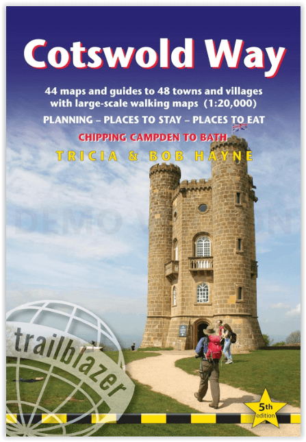
Wandelgids Cotswold Way - Trailblazer Publications
Chipping Campden to Bath - 164 km
Korte omschrijving
The Cotswold Way - Trailblazer Publications Productomschrijving: Chipping Campden tot Bath met 49 maps en 30 kleurfoto's. The Cotswolds Way loopt door het befaamd Cotswold AONB (Area of Outs...

Specificaties
- Uitgever: Trailblazer Publications
- ISBN-13: 9781912716418
- HOOFDCATEGORIEËN: Wandelgids
- Activiteiten: Wandelen, Hiking & Trekking
- Auteur: Bob Hayne, Tricia Hayne
- Regio: Gloucestershire, Egland
- Land: England
- Lange afstand wandelroutes: Cotswold Way, England (164km)
- AONB - Area of Outstanding Beauty: Cotswolds AONB
- Blz.: 204
- Afmeting: 12x18
- Editie: 5
- Taal: Engels
Volledige omschrijving
The Cotswold Way - Trailblazer Publications
Productomschrijving: Chipping Campden tot Bath met 49 maps en 30 kleurfoto's. The Cotswolds Way loopt door het befaamd Cotswold AONB (Area of Outstanding Natural Beauty, of regio van uitmunend natuurschoon. The Cotswold Way, is een zeer goed gekende route van een dikke 164 km lang en biedt alles voor de natuurliefhebber.
Engelse omschrijving: The Cotswold Way is a 102-mile (163km) National Trail that runs from Chipping Campden to Bath, following the beautiful Cotswold escarpment for much of its course. The trail leads through quintessentially English countryside with little villages of honey-coloured stone, from open farmland to the historic city of Bath. Includes accommodation, pubs and restaurants in detailed guides to 48 towns and villages along or near the route.
This new 5th edition has been completely rewalked and all the information checked and updated.
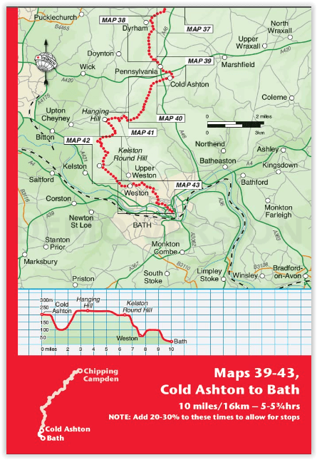
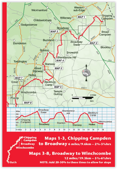
- Includes 44 detailed walking maps: The largest-scale maps available
- Unique mapping features, walking times, directions, tricky junctions, places to stay, places to eat, points of interest.
- Itineraries for all walkers, whether hiking the entire route or sampling highlights on day walks or short breaks.
- Practical information for all budgets – what to see; where to eat (cafés, pubs and restaurants); where to stay (B&Bs, hotels, hostels and campsites).
- All places that offer baths (as well as/instead of showers) are mentioned, as are those that accept dogs – both being important features for many walkers.
- Detailed public transport information for all access points for day walkers
- Full city guide to Bath
- Overview map and trail profiles
- Waypoints now include what3ways references.
Artikelen uit dezelfde regio

Wandelkaart 169 Cirencester & Swindon - England - OSI • 9780319243626
Wandelkaart Cirencester & Swindon - England - OSI Omvat : Fairford & Cricklade. Productbeschrijving: 169 / Cirencester & Swindon, Glousctershire, England - Kaart nummer 169 in de OS Explorer reeks heeft betrekking op een gebied van Cirencester en Fairford met een gedeelte van de Cotswolds AONB in het noorden, tot de North Wessex Downs AONB in het zuiden. Nationale routes van Thames…

Fietskaart & Mtb kaart The Cotswolds - Goldeneye • 9781859652589
Fietskaart en Mtb kaart - The Cotswolds - Goldeneye Productomschrijving: De Cotswolds is een AONB streek, (Area of Outstanding Natural Beauty) in centraal Engeland. Het gebied omvat de graafschappen Somerset, Warwickshire, Wiltshire, Oxfordshire & Worcestershire, maar het grootste deel ligt in Gloucestershire. Er wordt sinds eeuwen kalksteen uit de steengroeven gewonnen in deze regio, en d…

Wandelgids Walking in the Wye Valley - Cicerone • 9781852847241
Wandelgids - Walking in the Wye Valley - Cicerone Productomschrijving: Een gids met 30 gevarieerde wandelingen van 3 tot 10 mijl, in de vallei van de Wye, en de mooiste rivier in Engeland en Wales, tussen Chepstow in het zuiden en Plynlimon. Het landschap varieert van open heidevelden naar beboste kloven en is bezaaid met de sites van de IJzertijd met heuvelforten en kastelen. Centra omvat…

Wandelkaart Offa's Dyke Path- Route Map Booklet - Cicerone • 9781852848941
Wandelkaart boekje - Offa's Dyke Path - Cicerone Productomschrijving: Kaartboekje van het 177 mijl (283 km) lange Offa's Dyke Path National Trail, tussen Sedbury (bij Chepstow) en Prestatyn. Het pad is in 2 weken te lopen en is geschikt voor wandelaars van alle ervaringsniveaus. Dit compacte boekje met OS 1:25,000 kaarten toont de volledige route en biedt alle kaarten die u nodig heeft, e…

Reisgids Cotswolds AONB - Rough Guides • 9781839059728
The Cotswolds AONB - Rough Guides Productomschrijving: Deze omvat het Cotswolds gebied in zuid-oost Engeland. Een gebied van uitmuntend natuurschoon, of in andere meer lokalere woorden, een AONB area, of Area of Outstanding Natural Beauty. Bij ons is dat bijvoorbeeld de westhoek, het Zwin, enz... Deze reisgids biedt u deze regio inclusief de locaties van Stratford-Uppon-Avon & Oxford die a…