
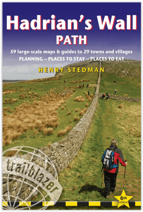
Wandelgids Hadrian's Wall Path - Trailblazer
Wallsend op de East coast van Engeland tot Bowness-on-Solway
Korte omschrijving
Hadrian's Wall Path 135 km - Trailblazer Productomschrijving: Hadrian's Wall Path is een lange-afstandwandelroute in het noorden van Engeland. De route loopt voor 135 km van Wallsend op de E...

Specificaties
- Uitgever: Trailblazer Publications
- ISBN-13: 9781912716371
- HOOFDCATEGORIEËN: Wandelgids
- Activiteiten: Wandelen, Hiking & Trekking
- Auteur: Henry Stedman
- Regio: Cumbria & Lake District, England, Northumberland, Engeland
- Land: England
- Historische wandelroutes: Hadrian's Wall path (135 km)
- Lange afstand wandelroutes: Hadrian's Wall path (135 km)
- UNESCO werelderfgoed: Hadrian's Wall Path (135 km)
- Blz.: 256
- Afmeting: 12x18
- Editie: 7
- Taal: Engels
Volledige omschrijving
Hadrian's Wall Path 135 km - Trailblazer
Productomschrijving: Hadrian's Wall Path is een lange-afstandwandelroute in het noorden van Engeland. De route loopt voor 135 km van Wallsend op de East coast van Engeland tot Bowness-on-Solway op de West kust. Voor het meeste van de route loopt het pad dicht bij Hadrian's Wall, die de defensieve muur omvat die gebouwd werd door de Romeinen op de noordelijke grens van hun rijk. Deze route wordt nu herkent als "Frontiers of the Roman Empire" en een World Heritage Site van Het Unesco gebueren?
New two-way edition with routes rewalked from Bowness-on-Solway to Wallsend (Newcastle) and Wallsend (Newcastle) to Bowness-on-Solway
(British Walking Guide)
244 pages,
59 trail maps + 8 town plans
40 colour photos + 4pp colour flower guide
Features:
1. Unique mapping features – In many walking guides the reader has to read a route description then try to relate it to the map. Our guides are easier to use because walking directions, tricky junctions, places to stay and eat, points of interest and walking times are all written onto the maps themselves in the places to which they apply. With their uncluttered clarity, these are not general-purpose maps but fullyedited maps drawn by walkers for walkers. Downloadable GPS waypoints also included.
2. The largest scale walking maps available – At just under 1:20,000 (8cm or 31/8 inches to 1 mile) our maps are bigger than even the most detailed walking maps currently available in the shops.
3. An all-in-one guide – Trailblazer guides include practical information not usually found in walking guides to the UK: reviews of places to stay, places to eat, attractions along the way and detailed public transport information showing all access points on the path, for weekend and day walkers.
4. Re-researched and rewritten two-way 6th edition – with routes rewalked from Bowness-on-Solway to Wallsend (Newcastle) and Wallsend (Newcastle) to Bowness-on-Solway. As with the new edition of Offa’s Dyke Path, we’ve given this book the full two-way treatment to make it easier to use in either direction.
Overzichtskaarten

Hystorische wandel- en fietsroutes
Hystorische wandel- en fietsroutes

Producten op de overzichtskaart
Klik op een product om naar de detailpagina te gaan.
- Wandelkaart - South Downs Way - Harvey maps
- Wandelgids - North Yorkshire historic walks - Cicerone
- Wandelkaart OL13 - Brecon Beacons NP - Eastern area - OSI
- Wandelgids - Pilgrim Pathways walking guide - Trailblazer
- Wandelgids - The Great Glen Way - Trailblazer
- Wandelgids - Hadrian's wall Path - Knife Edge
- Wandelgids - Hadrian's Wall Path - Trailblazer
- Wandelkaart XT40 - Offa's Dyke Path - Harvey Maps
- Wandelkaart OL43 - Hadrian's Wall - OSI
- Wandelgids - Cleveland Way - Trailblazer
- Wandelkaart 351 - Dunbar & North Berwick- Schotland - OSI
- Wandelgids - Walking in the Forest of Dean - Cicerone
- Wandelkaart 130 - Salisburry & Stonehenge- Wiltshire - OSI
- Wandelkaart 256 - Wrexham- Wrecsam & Llangollen - OSI
- Wandelkaart 130 - Salisbury & Stonehenge- Wiltshire - OSI
- Wandelgids - John Muir Trail - Cicerone
- Wandelkaart - Rob Roy Way National trail - Harvey maps
- Wandelkaart - Hadrian's Wall Path - Harvey maps
- Wandelkaart - Offa's Dyke Path- Route Map Booklet - Cicerone
Artikelen uit dezelfde regio

Wandelgids Coast to Coast path - Trailblazer • 9781912716258
Coast to Coast path 370 km - Trailblazer Productomschrijving: 109 kaarten, 14 etappe kaarten en 60 kleurfoto's van één van Engeland's mooiste wandelroutes, en tevens meest gekend. Het Coast to Coast Pad is een pad van 307 km dat loopt van St Bees aan de Ierse Zee over de breedte van Noord-Engeland naar de Noordzee bij Robin Hood's Bay. Deze spectaculaire wandeling van twee weken doorkruist…

Wandelgids The Big Rounds - Cicerone • 9781852847722
Wandelgids - The Big Rounds - Cicerone Productomschrijving: Deze inspirerende gids kijkt naar elk van de 19 nationale routes in het Verenigd Koninkrijk, met informatie die vergelijkings- en contrastgemak mogelijk maakt, waardoor u wordt geïnspireerd om meer te weten te komen en een uitdaging op lange afstand aan te gaan. Sommige paden zijn kort en gemakkelijk, anderen veel langer, en veel …

Wandelgids 15 Simple Routes in the Lake District NP - Cicerone • 9781786311528
15 Simple Routes in the Lake District NP - Cicerone Productomschrijving: Onze auteurs hebben 15 van de beste korte wandelingen rond Windermere, Ambleside en Grasmere uitgekozen. Elke wandeling is voorzien van goed leesbare Ordnance Survey-kaarten, een duidelijke routebeschrijving en veel afbeeldingen, plus informatie over lokale schoonheidsplekjes en smakelijke versnaperingen. Geen moeilij…

Wandelgids Lakes- Meres and Waters of the Lake District • 9781786310873
Lakes- Meres and Waters of the Lake District - CIcerone Productomschrijving: Koning van de Fells. Iron man. Lake District bergloop legende. Joss Naylor is al deze dingen en meer. Zijn prestaties zijn verbluffend, zijn records blijven de tand des tijds doorstaan. In 1983 voltooide hij de Lakes, Meres and Waters (LMW) route van 105 mijl in maar liefst 19 uur en 14 minuten en tot op de dag va…

Reisgids Lake District National park - Goldeneye • 9781859652046
Lake District National park - Goldeneye Productomschrijving: Dit boek is iets compleet anders. Het gaat hier om een onafhankelijke stem, omdat alle inhoud werd gekozen op basis van verdienste en verdienste alleen. In een digitaal tijdperk waar (reis)informatie wordt geleverd door reclamebudgetten. Hierbij een verfrissende en verhelderende kijk op wat het Lake District de bezoeker en bewone…