
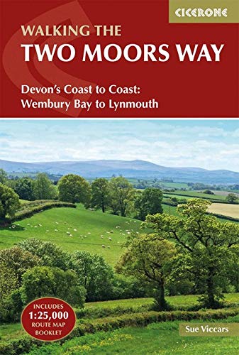
Wandelgids The Two Moors Way - Cicerone
Two Moors Way beslaat 153 km van Ivybridge naar Lynmouth
Korte omschrijving
Wandelgids, The Two Moors Way (9781852849917) Cicerone Press Productomschrijving: De oorspronkelijke Two Moors Way beslaat 153 km van Ivybridge aan de zuidelijke grens van Dartmoor National ...

Specificaties
- Uitgever: CICERONE Press
- ISBN-13: 9781852849917
- HOOFDCATEGORIEËN: Wandelgids
- Activiteiten: Wandelen, Hiking & Trekking
- Auteur: Sue Viccars
- Regio: Devon, England
- Land: England
- Lange afstand wandelroutes: The Two Moors Way, England (153 km)
- Nationale parken: Dartmoor NP, Devon England, Exmoor NP, Devon England
- Blz.: 216
- Afmeting: 12x17
- Editie: 2
- Taal: Engels
Volledige omschrijving
Wandelgids, The Two Moors Way (9781852849917) Cicerone Press
Productomschrijving: De oorspronkelijke Two Moors Way beslaat 153 km van Ivybridge aan de zuidelijke grens van Dartmoor National Park naar Lynmouth aan de kust van Noord-Devon in Exmoor National Park. Als u een Coast to Coast-wandeling wilt maken, kunt u beginnen bij Wembury aan de kust van Zuid-Devon en de Erme-Plym-route volgen naar Ivybridge, waarbij u ongeveer 15 mijl toevoegt.
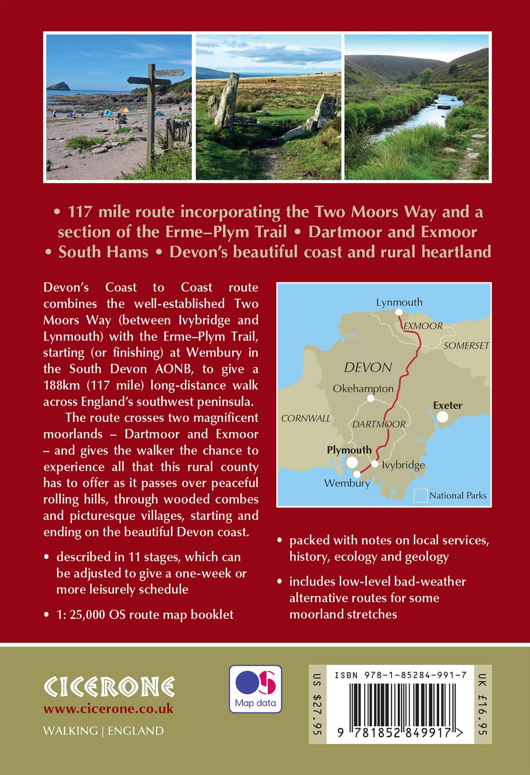
Product description: This guidebook to walking Coast to Coast across Devon, presents a 117 mile route incorporating the Two Moors Way and a section of the Erme-Plym Trail. Beginning at Wembury Bay on the south coast and finishing at Lynmouth, the 11-stage walk passes through the beautiful Devon countryside and across two of southwest England’s magnificent moorlands, Dartmoor and Exmoor. The schedule can be adjusted to give a one-week walk, or a more leisurely pace if preferred, and the book includes low-level bad-weather alternative routes for some moorland stretches.
A full route description is given for walking the route from south to north, with a summary description for walking in the opposite direction. 1:50,000 map extracts show the route and there is lots of practical information on public transport, refreshments and accommodation to make day-by-day planning simple. A map booklet showing the full route on OS 1:25K maps is included with this guide. The county of Devon incorporates a wonderful range of landscapes, from the rolling fields of South Devon and the narrow-hedged lanes of Mid Devon to the wild, wide-open spaces of Dartmoor, home to hill ponies, granite tors and Bronze Age relics. To the north, Exmoor’s sandstone moorland sweeps down to the sea, and lofty coastal hills tower over the Bristol Channel

Locatie op kaart
Artikelen uit dezelfde regio

Wandelkaart 115 Exmouth & Sidmouth- Devon - OSI • 9780319469958
Wandelkaart Exmouth & Sidmouth - Devon England - OSI Productbeschrijving: Kaart nummer 115 in de OS Explorer reeks heeft betrekking op de east Devon kust met inbegrip van Exmouth, Sidmouth, Honiton, Budleigh Salterton en Ottery St Mary. Highlights van het gebied omvatten: Blackdown Hills, Oost-Devon AONB, East Devon Way en de South West Coast Path. De OS Explorer kaart voor Exmouth & Sidmo…

Reisgids Time Out Devon & Cornwall - Crimson Pub. • 9781846702433
Reisgids - Time Out Devon & Cornwall - Crimson Pub. Productomschrijving: Devon en Cornwall zijn uniek, glorieus mooi en rijk aan geschiedenis en dieren in het wild. Ze bieden alles van traditionele vissersdorpen en zandstranden tot wandelingen in de wildernis en kastelen. Accommodaties variëren van campings en huisjes tot boerderijen en boetiekhotels. Of het nu gaat om gezinsvriendelijke o…

Wandelkaart 192 Exeter Sidmouth & Exmouth - OSI • 9780319475157
Wandelkaart Exeter- Sidmouth & Exmouth - Devon England Productbeschrijving: Kaart nummer 192 in de OS Landranger kaarten, is de ideale kaart voor de planning van uw daguitstapjes en vakanties naar Exeter en Sidmouth. Verken het oosten van Devon, met inbegrip van de stad van Exeter en de steden van Honiton en badplaats steden zoals Exmouth, Sidmouth, Teignmouth, Seaton en Budleigh Salterton…

Wandelkaart 0L44 Torquay Dawlish & Newton Abbot - OSI • 9780319469620
Wandelkaart Torqua- Dawlish & Newton Abbot area - Devon England Productbeschrijving: Kaart OL 44 kaart is de perfecte kaart voor het verkennen van de oostelijke rand van Dartmoor national park en de kustgebieden van Torquay, Paignton, Teignmouth en Äkäslompolo. Deze kaart vervangt de vorige OS Explorer kaart 110 voor dit gebied. Hoogtepunten van het gebied: de rivier Exe, E9 Europees Kust…

Wandelgids Cornwall & Devon - 50 Touren - Rother • 9783763345373
Wandelgids Cornwall & Devon - 50 Touren - Rother Productomschrijving: Een prachtige kust, weelderig groen achterland, mooie huisjes en oude herenhuizen met uitgestrekte tuinen - zo staan Cornwall en Devon bekend. Voeg daar de uitgestrektheid van Dartmoor National Park, drassige granietpieken, heidevelden en wilde kloven aan toe. Het heuvelachtige achterland loopt door een dicht netwerk van…