
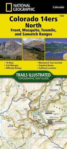
Wandelkaart 1302 Colorado 14'ers- Noord - Nat geo
14 Van de meest indrukwekkende bergmassieven in Colorado
Korte omschrijving
TOPO Wandelkaart 1302 - Colorado 14'ers- Noord - Natgeo Productomschrijving: De Colorado 14'ers bestaat uit 14 van de meest indrukwekkende bergmassieven in Colorado, verdeeld over drie versc...

Specificaties
- Uitgever: National Geographic
- ISBN-13: 9781566956994
- HOOFDCATEGORIEËN: Wandelkaart
- Regio: Colorado, USA
- Land: Verenigde Staten van Amerika (USA)
- Blz.: 48
- Schaal: 1:63360
- Afmeting: 10x19, 11x24
- Taal: Engels
Volledige omschrijving
TOPO Wandelkaart 1302 - Colorado 14'ers- Noord - Natgeo
Productomschrijving: De Colorado 14'ers bestaat uit 14 van de meest indrukwekkende bergmassieven in Colorado, verdeeld over drie verschillende regio's als Front Range, Momsquito Tenmile Ranges en de Sawatch Range. een indrukwekkende locatie om te gaan trekken uiteraard.
Front Range: Mount Bierstadt, Mount Evans, Grays Peak, Longs Peak, Pikes Peak, Torreys Peak
Mosquito, Tenmile Ranges: Tenmile Ranges: Mount Bross, Mount Cameron*, Mount Democrat, Mount Lincoln, Quandary Peak, Mount Sherman
Sawatch Range: Mount Antero, Mount Belford, Mount Columbia, Mount Elbert, Mount Harvard, Mt of the Holy Cross, Huron Peak, La Plata Peak, Mount Massive, Missouri Mountain, Mount Oxford, Mount Princeton, Mount Shavano, Tabeguache Peak, Mount Yale
Engelse omschrijving: Colorado has the highest mean elevation of any state in the United States. It's home to 58 mountain peaks higher than 14,000 feet—more than any other state in the U.S—making it a mountain sports mecca. "Bagging" these fourteeners is a goal for many Coloradans and visitors to the state—and for some, it's an obsession.
The Colorado 14ers North Topographic Map Guide provides the most accurate and convenient set of maps for the fourteeners of the Front, Mosquito, Tenmile, and Sawatch ranges of northern Colorado. Almost half of Colorado's fourteeners fall in these ranges, but their proximity to large population centers leave no shortage of hikers on their slopes. Moderate ridges, established trails, and accessible trailheads are the norm on the standard routes, making many of these peaks relatively easy to climb.
However, it's important to note that these seemingly gentle giants also have their rugged side—including the north face of Mount Evans, the amphitheater north of Mount Democrat, Ellingwood Ridge on La Plata Peak, and the sheer east face of Longs Peak—placing them among the most challenging alpine experiences in the United States. More convenient and easier to use than folded maps, but just as compact and lightweight, National Geographic's Topographic Map Guide booklets are printed on "Backcountry Tough" waterproof, tear-resistant paper with stainless steel staples.

Locatie op kaart
Artikelen uit dezelfde regio

Reisgids Colorado - Gallimard • 9782742433438
Reisgids Colorado USA - Gallimard Productomschrijving: Van Denver, de "koningin van de Great Plains", tot Creede, een klein mijnstadje dat zich vastklampt aan de zijkant van de San Juan Mountains, van Aspen, het skioord van de sterren, tot Steamboat Rock, een ontmoetingsplaats voor rafting-liefhebbers aan de samenvloeiing van de Yampa en de Green Rivers, van Pawnee National Grassland, een…

Wandelkaart 301 Longs Peak -Trails Illustrated N. Trails - Nat Geo • 9781566954310
Wandelkaart 301 Longs Peak - Nat Geo Productomschrijving: Engelse omschrijving: Towering over the Rocky Mountains stands the 14,259 foot high Longs Peak. National Geographic's Trails Illustrated map of Longs Peak and the surrounding south-east areas of Rocky Mountain National Park is designed to meet the needs of those who are looking for a phenomenal climbing experience as well as fo…

Wandelkaart 1304 Colorado Backpack Loops- Noord - Natgeo • 9781566957557
TOPO Wandelkaart 1304 - Colorado Backpack Loops- Noord - Natgeo Productomschrijving: Colorado is gelend voor zijn outdoor recreatrieve opportuniteiten. Eén van deze bezigheden is uiteraard backcountry & hiking. De Colorado Backpack Loops North Topographic Map Guide omavt de dozijn aan cirkelvormige wandelroutes geselecteerd door het personeel van National Geographic voor hun diversiteit, h…

Wandelkaart 113 Cowdrey- North Sand Hills Colorado - Nat Geo • 9781566952880
Cowdrey- North Sand Hills Colorado - Nat Geo Productomschrijving: Geniet van de overvloedige recreatieve mogelijkheden in het noorden van Colorado met de hulp van National Geographic's Trails Illustrated kaart van Cowdrey en North Sand Hills. Deskundig onderzocht en gemaakt in samenwerking met de U.S. Forest Service, Bureau of Land Management, Colorado State Parks en anderen, zal de kaart …

Wandelkaart 1201 Colorado Trail Zuid - NAT GEO • 9781566956949
TOPO Wandelkaart 1201 - Colorado Trail Zuid - Durango tot Monarch Productomschrijving: The Colorado Trail is een lange-afstands wandelroute van om en bij de 782 km. Deze loopt van de mond van Waterton Canyon ten zuidwesten van Denver tot Durango in Colorado. Zijn hoogste punt is 4,045 meter boven zeeniveau, en de overgrote meerderheid van de route loopt boven de 3,000 meter. Ondanks zijn h…