
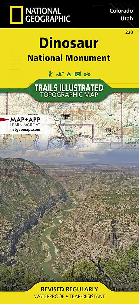
Wandelkaart 220 Dinosaur National Monument - Natgeo
Gelegen op de zuidoostelijke kant van de Uinta Mountains.
Korte omschrijving
TOPO Wandelkaart 220 - Dinosaur National Monument - Nat Geo Productomschrijving: Dinosaur National Monument in de United States, gelegen op de zuidoostelijke kant van de Uinta Mountains op d...

Specificaties
- Uitgever: National Geographic
- ISBN-13: 9781566954037
- HOOFDCATEGORIEËN: Wandelkaart
- Activiteiten: Wandelen, Hiking & Trekking
- Regio: Colorado, USA
- Land: Verenigde Staten van Amerika (USA)
- Schaal: 1:75000
- Afmeting: 10x19, 11x24
- Taal: Engels
Volledige omschrijving
TOPO Wandelkaart 220 - Dinosaur National Monument - Nat Geo
Productomschrijving: Dinosaur National Monument in de United States, gelegen op de zuidoostelijke kant van de Uinta Mountains op de grens tussen Colorado en Utah met invloeden van de Green & Yampa Rivieren. Ondanks dat het grootste deel ervan gelegen is in Moffat County, Colorado, is Dinosaur gelegen in Utah net ten noorden van de stad Jensen, Utah.
Engelse omschrijving: National Geographic's Trails Illustrated map of Dinosaur National Monument, which straddles the state lines of northwest Colorado and northeast Utah, is the perfect recreational map for this stunning monument. Within its craggy hills, you can discover pieces of a long ago world where the largest land creatures of all time once roamed and died. Expertly researched and created in partnership with local land management agencies, this map features key points of interest including Dinosaur Quarry, Red Fleet State Park, Canyon of Lodore, Harpers Corner, and the town of Dinosaur. The map also highlights many popular routes for scenic driving including Dinosaur Diamond, Harpers Corner, Tour of the Tilted Rocks, Browns Park, and Jones Hole.
This map features detailed topography with shaded relief, elevations, easy-to-read trails, and clearly defined, color-coded boundaries for parks, wildlife study areas, public lands, and areas of critical environmental concern. Information about the region, its history and culture, geology, and natural history are provided as well. Those exploring by boat will appreciate the inclusion of river campsites, river mileage and access points along the Yampa and Green rivers. Other recreation features noted include campgrounds, boat launches, interpretive trails, fishing access, scenic viewpoints, and visitor centers. Every Trails Illustrated map is printed on "Backcountry Tough" waterproof, tear-resistant paper. A full UTM grid is printed on the map to aid with GPS navigation.
Other features found on this map include: Canyon of Lodore, Diamond Gulch, Dinosaur, Douglas Mountain, Split Mountain, Yampa River.
.jpg)
Locatie op kaart
Overzichtskaarten

NAT GEO Utah trail maps
NAT GEO Utah trail maps

Producten op de overzichtskaart
Klik op een product om naar de detailpagina te gaan.
- Wandelkaart 210 Canyonlands NP - Utah - Natgeo
- Wandelkaart 211 Arches National Park- Utah - Natgeo
- Wandelkaart 214 Zion National Park - Natgeo
- Wandelkaart 219 Bryce Canyon NP Utah - Natgeo
- Wandelkaart 220 Dinosaur National Monument - Natgeo
- Wandelkaart 267 Capitol Reef NP Utah - Natgeo
- Wandelkaart 310 Canyonlands NP - Island in the Sky District
- Wandelkaart 311 Canyonlands NP - Needles District - Natgeo
- Wandelkaart 312 Canyonlands NP - Maze District - Natgeo
- Wandelkaart 702 Cedar Mountain - Utah USA - Nat Geo
- Wandelkaart 703 Manti-La Sal National forest - Natgeo
- Wandelkaart 704 Flaming Gorge- Recreational Area - Utah
- Wandelkaart 705 Mount Dutton & Aquarius Plateau - Nat Geo
- Wandelkaart 213 Glen Canyon & Capitol Reef NP - Nat Geo
NAT GEO Utah trail maps
NAT GEO Utah trail maps
Producten op de overzichtskaart
Klik op een product om naar de detailpagina te gaan.
- Wandelkaart 210 Canyonlands NP - Utah - Natgeo
- Wandelkaart 211 Arches National Park- Utah - Natgeo
- Wandelkaart 214 Zion National Park - Natgeo
- Wandelkaart 219 Bryce Canyon NP Utah - Natgeo
- Wandelkaart 220 Dinosaur National Monument - Natgeo
- Wandelkaart 267 Capitol Reef NP Utah - Natgeo
- Wandelkaart 310 Canyonlands NP - Island in the Sky District
- Wandelkaart 311 Canyonlands NP - Needles District - Natgeo
- Wandelkaart 312 Canyonlands NP - Maze District - Natgeo
- Wandelkaart 703 Manti-La Sal National forest - Natgeo
- Wandelkaart 704 Flaming Gorge- Recreational Area - Utah
- Wandelkaart 709 Wasatch Front North Utah - Nat Geo
- Wandelkaart 710 Canyons of the Escalante NP - Nat Geo
- Wandelkaart 213 Glen Canyon & Capitol Reef NP - Nat Geo
Artikelen uit dezelfde regio

Reisgids Colorado USA - Lonely Planet • 9781787016811
Reisgids Colorado - Lonely Planet Productomschrijving: Spectaculaire vergezichten, eindeloze poedersneeuwafdalingen en bergstadjes met echo's van het Oude Westen - Colorado is een plek die al heel lang mensen tot avontuur uitnodigt. Lonely Planet brengt je naar het hart van Colorado, met geweldige reiservaringen en het beste planningsadvies. Ga de pistes op in Aspen, ontdek het Oude Westen…

Wandelkaart 140 Weminuche Wilderness Colorado USA - Nat Geo • 9781566952910
Wandelkaart Weminuche Wilderness Colorado USA - Nat Geo Productomschrijving: De Weminuche Wilderness overspant de Continental Divide en is met bijna een half miljoen hectare het grootste wildernisgebied in Colorado. Deskundig onderzocht en gemaakt in samenwerking met lokale landbeheerders, biedt National Geographic's Trails Illustrated kaart van de Weminuche Wilderness een ongeëvenaard hul…

Wandelkaart 104 Idaho Springs & Loveland Pass - Nat Geo • 9781566952491
Wandelkaart Idaho Springs & Loveland Pass Colorado Productomschrijving: Deskundig onderzocht en gemaakt in samenwerking met lokale landbeheerders, biedt National Geographic's Trails Illustrated kaart van Idaho Springs, Loveland Pass een ongeëvenaard hulpmiddel voor het verkennen van deze schilderachtige regio. Ongeacht het seizoen, zult u deze kaart handig vinden voor het uitoefenen van e…

Wandelkaart 601 Aspen Local Trails - Nat Geo • 9781566957526
Wandelkaart Aspen Local Trails - Nat Geo Productomschrijving: Met meer dan 320 km aan wandelpaden op korte afstand van de stad hebben bezoekers van Aspen een benijdenswaardig probleem: met al deze paden om uit te kiezen, waar moeten ze beginnen? De Aspen Local Trails-kaart helpt bij het beantwoorden van deze vraag - waar gaan de plaatselijke bewoners heen als ze een korte wandeling met het…

Wandelkaart 134 Black Mesa - Curecanti Pass Colorado - Nat Geo • 9781566954303
Wandelkaart Black Mesa - Curecanti Pass Colorado - Nat Geo Productomschrijving: Outdoor enthousiastelingen die de afgelegen en ongetemde bergen van westelijk Colorado willen verkennen zullen zich verbazen over National Geographic's Trails Illustrated kaart van Black Mesa en Curecanti Pass. Gemaakt in samenwerking met de U.S. Forest Service, dekt deze deskundig onderzochte kaart, het recrea…