
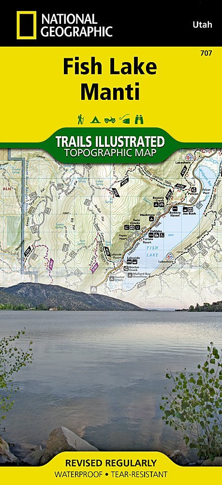
Wandelkaart 707 Fish Lake - Manti- Utah Natgeo
Fish Lake is een soort Alpine meer gelegen op 2,700 m
Korte omschrijving
TOPO Wandelkaart 707 - Fish Lake - Manti- Utah - Nat Geo Productomschrijving: Fish Lake is een soort Alpine meer gelegen op 2,700 m in Fishlake op de zuidelijke Wasatch Plateau regio van zui...

Specificaties
- Uitgever: National Geographic
- ISBN-13: 9781566953306
- HOOFDCATEGORIEËN: Wandelkaart
- Regio: Utah, USA
- Land: Verenigde Staten van Amerika (USA)
- Schaal: 1:75000
- Afmeting: 10x19, 11x24
- Taal: Engels
Volledige omschrijving
TOPO Wandelkaart 707 - Fish Lake - Manti- Utah - Nat Geo
Productomschrijving: Fish Lake is een soort Alpine meer gelegen op 2,700 m in Fishlake op de zuidelijke Wasatch Plateau regio van zuid-centraal Utah, United States. Het ligt binnen het Fishlake National Forest. Fish Lake is 7.9 km lang en 1.3 km breedt, en ligt in een geologische structuur gekend als "graben valley".
Engelse omschrijving: Fish Lake is a high alpine lake nestled in a deep valley at the southern edge of the Wasatch Front. Manti is a small town that serves as a convient staging ground for access to the Manti-La Sal National Forest. This map contains many hundreds of miles of OHV trails with both the Arapeen and Goosberry ATV Trail Systems. The Paiute ATV Trail is shown from Koosharem in the south to Salina in the north.
Each trail is clearly marked with its use such as hiking trail or OHV. There are many OHV Staging Areas on the map that are used as launching pads for access to the extensive trail networks. Road and Trail mileages are shown between each intersection which help with trip planning and knowing just how far it is to get back to camp. The Great Western Trail cuts through the middle of the map as it runs north-south on its way from Canada to Mexico. It is marked with a distinct highlight and badge. The Skyline Drive Scenic Backway is also marked for people who want to experience this beautiful landscape from the comfort of their car. Every Trails Illustrated map is printed on "Backcountry Tough" waterproof, tear-resistant paper. A full UTM grid is printed on the map to aid with GPS navigation.
Other features found on this map include: Capitol Reef National Park, Castle Valley, Coal Cliffs, Fish Lake, Fishlake National Forest, Manti-La Sal National Forest, Mount Baldy, Mount Marvine.
.png)
Locatie op kaart
Artikelen uit dezelfde regio

Wandelkaart 702 Cedar Mountain - Utah USA - Nat Geo • 9781566953061
Wandelkaart Cedar Mountain - Utah USA - Nat Geo Omvat: Ashdown Gorge Wilderness, Brian Head, Dixie National Forest, Kolob Terrace, Little Salt Lake, Markagunt Plateau, Panguitch Lake, Parowan Valley, Pine Valley Mountain Wilderness, Pine Valley Mountains, Signal Peak. Engelse omschrijving: Cedar City is the headquarters of the Dixie National Forest which is a two-million-acre, 170-mile…

Reisgids Utah's national parks - Lonely planet • 9781838699857
Utah's national parks - Lonely planet Productomschrijving: Lonely Planet Zion & Bryce National Parks is jou paspoort voor het meest relevante, actuele advies over wat je moet zien en overslaan, en welke verborgen ontdekkingen er op je wachten. Wandel de Cable Mountain trail in Zion, rijd op een paard of muilezel door Bryce of ga zwemmen of tuben in Zion's Virgin River, allemaal met je vert…

Reisgids USA Southwest & National Parks - DK Eyewitness • 9780241365519
USA Southwest & National Parks Omvat: Arizona, Las Vegas, Southern Utah, the Four Corners & New Mexico. Productomschrijving: Staar naar de diepten van de Grand Canyon, ervaar de glitter en glamour van de Las Vegas strip, beklim de rotsachtige overspanningen van Arches National Park of wandel door het historische Santa Fe: alles wat u moet weten is overzichtelijk weergegeven in kleurgec…

Reisgids Zuidwest Amerika - Insight Guides • 9789066554801
Zuidwest Amerika - Insight Guides Productomschrijving: Zuidwest-Amerika is een fenomenaal mooi gebied dat zich uitstrekt over verschillende staten. Dit boek voert u mee door Arizona, New Mexico, Zuid-Utah en delen van Colorade, Texas en Nevada, inclusief Las Vegas. De auteurs en fotografen laten u op de bekende, onovertroffen en veelvuldig bekroonde Insight Guide -wijze in woord en bee…

Wandelkaart 219 Bryce Canyon NP Utah - Natgeo • 9781566953207
TOPO Wandelkaart 219 - Bryce Canyon NP Utah - Natgeo Productomschrijving: Bryce Canyon Nationaal Park is een Amerikaans nationaal park gelegen in het zuidwesten van Utah. De hoofd atractie in het park is Bryce Canyon, die ondanks zijn naam, geen echte canyon is, maar een collectie van lange natuurlijke amphitheaters langs de oostelijke zijde van het Paunsaugunt Plateau. Engelse omschri…