
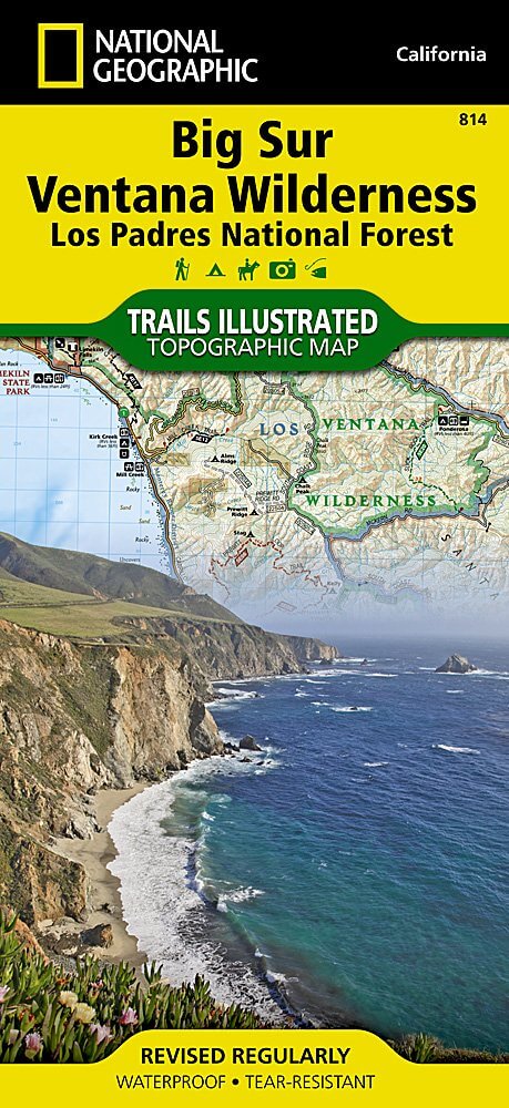
Wandelkaart 814 Big Sur & Ventana Wilderness - Natgeo
Het Los Padres National Forest in New York State
Korte omschrijving
TOPO Wandelkaart 814 - Big Sur & Ventana Wilderness - Natgeo Productomschrijving: Big Sur & Ventana Wilderness California- Natgeo zijn in andere woorden, het Los Padres National Forest in he...

Specificaties
- Uitgever: National Geographic
- ISBN-13: 9781566955782
- HOOFDCATEGORIEËN: Wandelkaart
- Regio: Californië, USA
- Land: Verenigde Staten van Amerika (USA)
- Regionale parken: Los Padres National Forest, California USA
- Schaal: 1:80000
- Afmeting: 10x19
- Taal: Engels
Volledige omschrijving
TOPO Wandelkaart 814 - Big Sur & Ventana Wilderness - Natgeo
Productomschrijving: Big Sur & Ventana Wilderness California- Natgeo zijn in andere woorden, het Los Padres National Forest in het United States national forest in southern en central California.
National Geographic's Trails Illustrated map of Big Sur, Ventana Wilderness combines unmatched detail with helpful information to offer an invaluable tool for making the most of your visit to this remarkable section of California coastline. Expertly researched and created in partnership with local land management agencies, this map features key points of interest including Los Padres National Forest, Silver Peak Wilderness, Pinnacles National Park, Fort Ord National Monument, Big Sur National Wild and Scenic River, and Julia Pfeiffer Burns State Park.
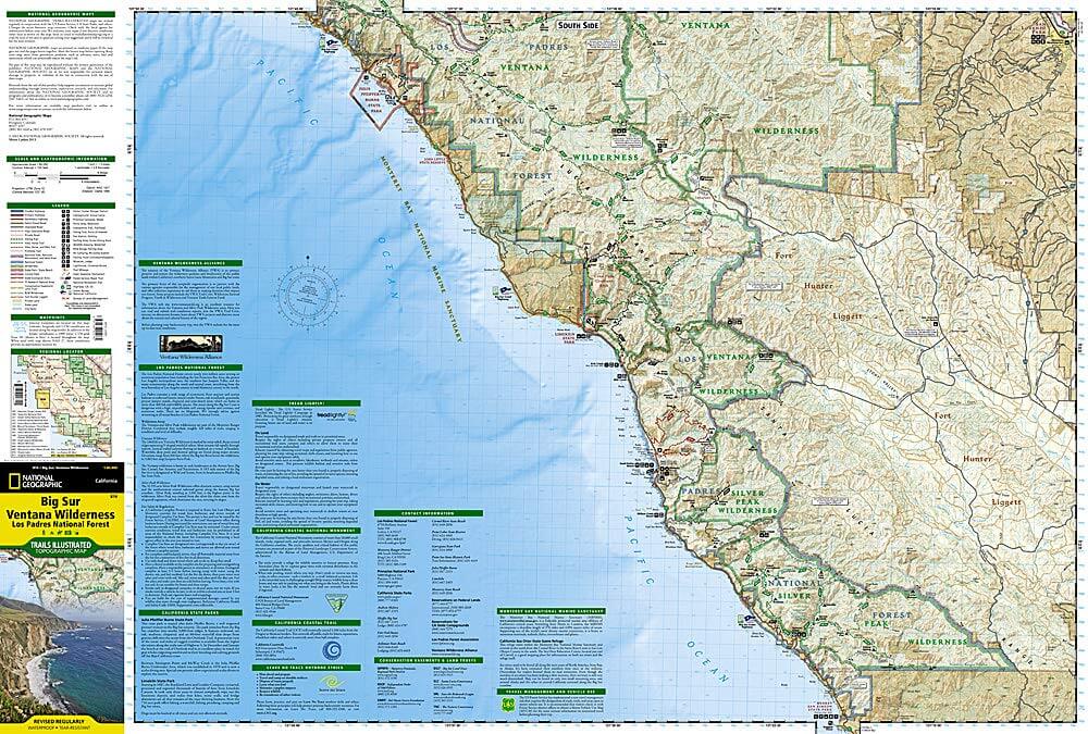
With miles of mapped trails, this map can guide you off the beaten path and back again in some of the most breathtaking scenery in the region. The trails are clearly marked according to use and include mileages between intersections. The Big Sur Coast Highway is noted for those wishing to take in the scenery by car. The map base includes contour lines and elevations for summits and coastal waters. Some of the many recreation features include surfing and scuba diving areas, interpretive trails, fishing areas, trailheads, and campgrounds. A variety of information about California state parks, Monterrey Bay National Marine Sanctuary, California Coastal National Monument, and Los Padres National Forest is included as well. Every Trails Illustrated map is printed on "Backcountry Tough" waterproof, tear-resistant paper. A full UTM grid is printed on the map to aid with GPS navigation.
Other features found on this map include: Cape San Martin, Carmel Point, Carmel River, Gabilan Range, Greenfield, Junipero Serra Peak, Lopez Point, Los Padres National Forest, Monterey, Pacific Grove, Pinnacles National Park, Point Lobos, Point Pinos, Point Sur, Santa Lucia Range, Seaside, Sierra de Salinas, Silver Peak Wilderness, Soledad, Ventana Wilderness.

Locatie op kaart
Artikelen uit dezelfde regio

Reisgids USA Southwest & National Parks - DK Eyewitness • 9780241365519
USA Southwest & National Parks Omvat: Arizona, Las Vegas, Southern Utah, the Four Corners & New Mexico. Productomschrijving: Staar naar de diepten van de Grand Canyon, ervaar de glitter en glamour van de Las Vegas strip, beklim de rotsachtige overspanningen van Arches National Park of wandel door het historische Santa Fe: alles wat u moet weten is overzichtelijk weergegeven in kleurgec…

Wandelkaart 812 Los Padres Nat. Forest East - Natgeo • 9781566955805
TOPO Wandelkaart 812 - Los Padres Nat. Forest East - Natgeo Productomschrijving: Los Padres National Forest is een bosgebied in Amerika, meerbepaald in oost- en centraal California. Het bos is uitermate gekend voor mountainbikers en hikers. Engelse omschrijving: One of the most diverse National Forests in the United States, Los Padres National Forest provides recreation opportunities f…

Reisgids Geoguide Californie - Gallimard • 9782742464708
Reisgids Californie - Gallimard Productomschrijving: De meest bezocht staat van America, de meest zonnige als je de Amerikanen mag geloven. Ze noemen hun eigen staat, de Sunshine state. Dat is durven. Van De bruisende stad van Los Angeles, tot San Francisco & San Diego, de daarbuiten liggen nationale parken, en zelfs Las Vegas die in Amerikaanse termen niet ver afligt? Franse omschrijv…

Wandelkaart 268 Lassen Volcanic NP - California - Nat Geo • 9781566956796
TOPO Wandelkaart 268 - Lassen Volcanic NP - Nat Geo Productomschrijving: Het Lassen Volcanic National Park is een Amerikaans nationaal park in het noordoosten van de staat Californië. Het meest in het oog springende kenmerk in het park is de Lassen Peak, een 3181 meter hoge kegelvulkaan en de meest zuidelijke vulkaan in het Cascadegebergte. Engelse omschrijving: Lassen Volcanic Nation…

Wandelkaart 804 Tahoe National Forest West - Nat Geo • 9781566954259
Tahoe National Forest West - Nat Geo Omvat: Donner Pass, Eldorado National Forest, Granite Chief Wilderness, Mosquito Ridge, Plumas National Forest, Sawtooth Ridge, Tahoe National Forest, Truckee. Engelse omschrijving: Expertly researched and created in partnership with the U.S. Forest Service and others, National Geographic's Trails Illustrated map of Yuba and American Rivers region o…