
Mountainbikegids Southern & Central Schotland - Cicerone
Beschrijft 21 mountainbike fietsroutes in Midden- en Z. Schotland
Korte omschrijving
Mountainbikegids - Southern & Central Schotland - Cicerone Productomschrijving: Deze gids beschrijft 21 mountainbike fietsroutes in Midden- en Zuid-Schotland, met inbegrip van de 7 stanes in...

Specificaties
- Uitgever: CICERONE Press
- ISBN-13: 9781852847470
- HOOFDCATEGORIEËN: Fietsgids
- Activiteiten: Fietsen / VTT / MTB
- Regio: Highlands, Schotland
- Land: Schotland
- Blz.: 208
- Afmeting: 12x17
- Editie: 1
- Taal: Engels
Volledige omschrijving
Mountainbikegids - Southern & Central Schotland - Cicerone
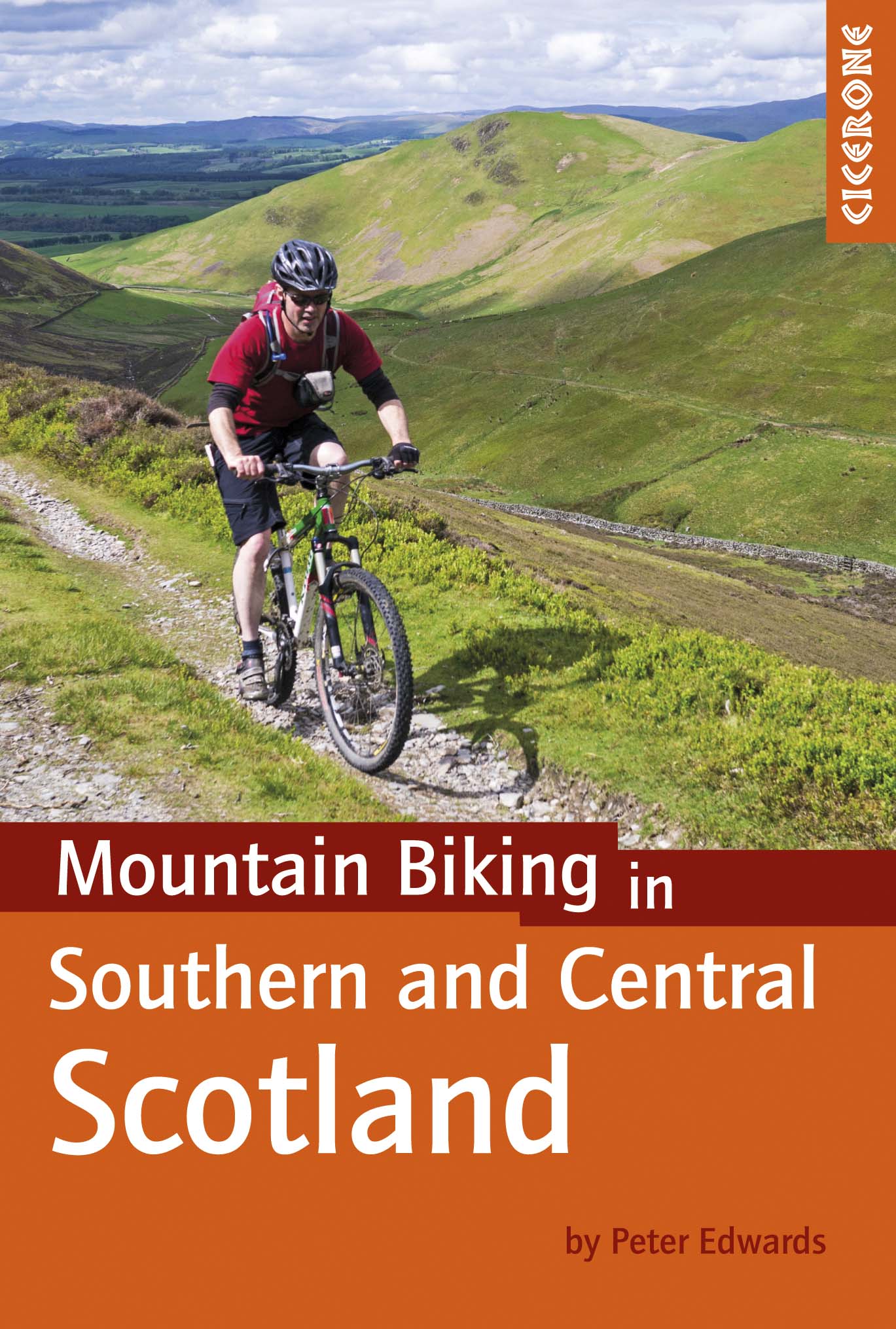
Productomschrijving: Deze gids beschrijft 21 mountainbike fietsroutes in Midden- en Zuid-Schotland, met inbegrip van de 7 stanes in Dumfries and Galloway, en crosscountry-routes in de Campsie Fells, Pentland Hills en Lammermuirs, de Galloway Forest, Tweed Vallei, Cheviots en Lowther Hills. De routes variëren van 16,5 tot 66km ingedeeld van matig tot zeer zwaar.
Productdescription: This guidebook describes 21 mountain biking routes in central and southern Scotland, including the 7stanes in Dumfries and Galloway, and cross country routes in the Campsie Fells, Pentland Hills and Lammermuirs, the Galloway Forest, Tweed Valley, Cheviots and Lowther Hills. The routes range from 16.5 to 66km graded from moderate to very hard.
Seasons:
Dry weather is hard to guarantee in Southern and Central Scotland though summer is the likeliest time for dry trails. However, every season has its charms - so long as rain and mud doesn't scare you - and winter really can be a wonderland.
Centres:
Glasgow, Milngavie, Greenock, Lochwinnoch, Glentrool, New Cumnock, Moniaive, Durisdeer, Wanlockhead, Sanquhar, Hownam, Kirk Yetholm, Peebles, Traquair, Innerleithen, Longformacus, Gifford, Balerno.
Difficulty:
The routes are intended for mountain bikers with at least some experience and a reasonable degree of fitness. There are no 'easy' routes in this guidebook, hence routes are graded 'moderate', 'hard' and 'very hard' Any 'difficult' or 'technical' sections are indicated. The general lack of signposts and other waymarkers endemic to Scotland makes navigation more of a challenge than in other parts of the UK.
Must See:
The Campsie Fells, the Pentland Hills and the Lammermuirs, the Galloway Forest, the Tweed Valley, the Cheviots and the Lowther Hills of Dumfriesshire.
Locatie op kaart
Artikelen uit dezelfde regio

Wandelkaart 19 Gairloch & Ullapool Highland's Schotland - OSI • 9780319473429
Wandelkaart Gairloch Ullapool - Highland's Schotland Productomschrijving: Gairloch is een plaats aan de noordwestkust van Schotland. De locatie aan de oever van Loch Gairloch is een populaire zomer toeristische badplaats. Het biedt wandelen, een golfbaan en een klein museum. Talloze kleine meren in het gebied zijn populaire bestemmingen van forel -Fischern. Voordat Gairlochs kust van het e…

Wandelkaart XT25 Cairn Gorms & Ben Avon - Harvey maps • 9781851374939
Wandelkaart Cairn Gorms & Ben Avon Schotland - Harvey maps Productomschrijving: HARVEY XT25 Superwalker kaart op schaal 1: 25.000, is een gedetailleerde wandel- en klimkaart van de Cairn Gorm & Ben Avon. Deze kaart heeft betrekking op de Cairngorms van Coylumbridge via de Lairig Ghru Glen Dee en Braemar. De 18 Munros op het blad omvatten 5 meer dan 4000' (Cairn Gorm, Ben Macdui, Cairn Toul…

Wandelkaart 449 Strath Halladale & Strathy Point - OSI • 9780319473016
Wandelkaart Strath Halladale & Strathy Point - Schotland Omvat ook: Melvich & Forsinard. Productbeschrijving: Aan de Noord kust van Schotland, volgt OS Explorer kaart 449 de Strath Halladale en de Halladale-rivier, en omvat Strathy Point, Melvich en Forsinard. Er zijn talrijke kleine lochs aanwezig, evenals de pieken van Beinn Ratha (242 m) en Channian Hil (302 m). De OS Explorer kaart…

Wandelkaart 61 Grantown-on-Spey & Hills Cromdale - OSI • 9780319469798
Wandelkaart Grantown-on-Spey & Hills Cromdale - Highlands Omvat ook: Upper Knockando & Tomnavoulin Productbeschrijving: OS Explorer kaart OL 61 toont het noordelijk deel van het Cairngorms National Park, evenals de streek rond Grantown-on-Spey & Bridge of Avon. U kunt de Dava way & de Speyside way verkennen, of streven naar de externe Carn Kitty (521m). Deze kaart vervangt de vorige OS…

Wandelkaart Ben Lawers & Schiehallion - Harvey maps • 9781851375417
Wandelkaart Ben Lawers & Schiehallion - Harvey maps Productomschrijving: Deze serie toont de heuvels van Loch Tay naar Glen Lyon. Deze gedetailleerde wandelkaart omvat Ben Berjaya Eden Park en de Tarmachan bergkam. Nieuwe generatie HARVEY Superwalker, XT25 waterproof, werden ontworpen om de meest praktische tools te zijn voor GPS-navigatie. Het formaat geeft meer toewijzingen op het bl…