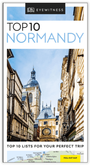
Reisgids Normandy - Top 10 - DK Eyewitness
Rouen cathedral - Etretat - Mont-St-Michel - D-Day beaches
Korte omschrijving
DK Eyewitness Normandy Omvat: Northwestern Normandy, Central Normandy, Southwestern Normandy, Southern Normandy. Productomschrijving: Verken de kathedraal van Rouen, breng tijd door in ...

Specificaties
- Uitgever: Dorling Kindersley Limited
- ISBN-13: 9780241355954
- HOOFDCATEGORIEËN: Reisgids
- Activiteiten: Toerisme
- Regio: Normandië, Frankrijk
- Land: Frankrijk
- Blz.: 144
- Afmeting: 11x19
- Taal: Engels
- Reeks: Eyewitness, Dorling Kingsley, TOP 10 - Eyewitness
Volledige omschrijving
DK Eyewitness Normandy
Omvat: Northwestern Normandy, Central Normandy, Southwestern Normandy, Southern Normandy.
Productomschrijving: Verken de kathedraal van Rouen, breng tijd door in de badplaats Etretat, bezoek de eilandgemeente Mont-St-Michel, bekijk de D-Day stranden of ga terug naar de natuur in de heuvels van Suisse Normande. Van Top 10 restaurants tot de Top 10 natuurgebieden - deze gebruiksvriendelijke reisgids staat boordevol informatie om u het allerbeste van Normandië te laten ontdekken.
Engelse omschrijving: Explore Rouen cathedral, spend time at the seaside resort of Etretat, visit the island commune of Mont-St-Michel, see the D-Day beaches or get back to nature in the hills of Suisse Normande. From Top 10 restaurants to the Top 10 areas of natural beauty - this easy-to-use travel guide is packed with information to help you discover the very best of Normandy.
Inside Top 10 Normandy:
- Seven easy-to-follow itineraries, perfect for a day trip, a weekend or a week
- Top 10 lists showcase Normandy's best attractions, covering Mont-St-Michel, Pays d'Auge, Rouen, Etretat and many more
- Free laminated pull-out map of Normandy, plus five colour neighbourhood maps
- In-depth neighbourhood guides explore Normandy's most interesting areas, with the best places for shopping, going out and sightseeing
- Colour-coded chapters divided by area make it easy to find information quickly and plan your day
- Essential travel tips including our expert choices of where to stay, eat, shop and sightsee, plus useful transport, visa and health information
- Colour maps help you navigate with ease.

Locatie op kaart
Artikelen uit dezelfde regio

Wandelkaart 1616 SB La Ferté-Macé & Pré-en-Pail - IGN • 9782758533788
Wandelkaart 1616 SB - La Ferté-Macé & Pré-en-Pail Productomschrijving: Deze topografische kaarten hebben een zeer nauwkeurige gronddetail, niet te vergeten de topografische hoogteprofielen, die het wandelen een stuk gemakkelijker maken. La Ferté-Macé is een gemeente in het Franse departement Orne regio Laag-Normandië. De plaats maakt deel uit van het arrondissement Alençon. Desciptive…

Wandelkaart 1414 SB Vire & St-Sever-Calvados - IGN • 9782758542643
Wandelkaart 1414 SB - Vire & St-Sever-Calvados Productomschrijving: Vire & St-Sever-Calvados zijn gemeentes in het Franse departement Calvados in de regio Normandië. Een gloed nieuwe reeks IGN kaarten: de oude versies met de Est en Ouest (E en O aanduiding achter het nummer van de kaart) verdwijnen en worden vervangen door SB na het kaart nummer. In de meeste gevalen is het een samenvo…

Wandelkaart 1211 OT Les Pieux & Barneville-Carteret - IGN • 9782758544579
TOPO Wandelkaart Les Pieux & Barneville-Carteret Productomschrijving: Les Pieux & Barneville-Carteret zijn gemeentes in het Franse departement Manche in de regio Normandië. De plaats maakt deel uit van het arrondissement Cherbourg-Octeville. Een gloed nieuwe reeks IGN kaarten: de oude versies met de Est en Ouest (E en O aanduiding achter het nummer van de kaart) verdwijnen en worden ve…

Wandelgids Les chemins du Mont-Saint-Michel - Ed. Ouest-france • 9782737387142
Les chemins du Mont-Saint-Michel - Ouest-france Productomschrijving: In de 15e eeuw werd een eerste netwerk van paden aangelegd, die naar de Mont-Saint-Michel leiden, vergelijkbaar met de verschillende routes naar Santiago de Compostela. Franse omschrijving: Au XVe siècle, un premier réseau de chemins, convergeant vers le Mont-Saint-Michel, s'est créé, à l'image de ce que furent …

Wandelkaart 1515 SB Flers & Briouze - IGN • 9782758538967
Wandelkaart 1515 SB - Flers & Briouze - Nieuwe versie Productomschrijving: Flers & Briouze zijn gemeentes in het Franse departement Orne in de regio Normandië. De plaatsen maken deel uit van het arrondissement Argentan Desciptive produits: Une nouvelle cartographie pour une lisibilité optimale, avec une meilleure précision géométrique et des informations touristiques enrichies. Un nouv…


