
Reisgids Scottish Highlands & Islands - Rough guides
A fully updated The Rough Guide to Scottish Highlands
Korte omschrijving
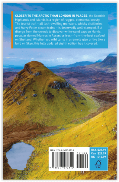
Scottish Highlands & Islands - Rough guides Product description: This fully updated The Rough Guide to Scottish Highlands and Islands is the ultimate guidebook to the captivating remote reac...

Specificaties
- Uitgever: Rough Guides
- ISBN-13: 9780241272312
- HOOFDCATEGORIEËN: Reisgids
- Activiteiten: Toerisme
- Regio: Highlands, Schotland, Inner hybrids (Binnen-Hebriden), Schotland, Outer Hibrids, Schetland Islands, Schotland
- Land: Schotland
- Blz.: 440
- Afmeting: 13x20
- Editie: 8
- Taal: Engels
Volledige omschrijving
Scottish Highlands & Islands - Rough guides
Product description: This fully updated The Rough Guide to Scottish Highlands and Islands is the ultimate guidebook to the captivating remote reaches of Scotland. From the divine seafood offerings at Loch Fyne to the whisky distilleries on Islay, this is a place for indulging. It’s also a hotspot for outdoor activities, whether you decide to bag a Munro or two, hop onto a mountain bike or stroll along deserted (if blustery) golden beaches.
The Rough Guide to Scottish Highlands and Islands contains more information than ever on where to go and what to see in this part of Scotland, with practical information on everything from events listings to transport logistics. There’s also coverage of the brand new North Coast 500 route, which loops around the northernmost reaches of the country.
From Skye’s breathtaking Cuillin ridge to abandoned castles, via riproaring unplanned ceilidhs, this stark and weather beaten part of the planet will not disappoint.
Locatie op kaart
Artikelen uit dezelfde regio

Wandelkaart 437 Ben Wyvis & Strathpeffer Schotland - OSI • 9780319472897
Wandelkaart Ben Wyvis & Strathpeffer - Highland Schotland Omvat ook: Dingwall. Productbeschrijving: OS Explorer kaart 437 toont de stad van Dingwall naar het noorden via Easter Ross, en omvat een paar Lochs en pieken. De valleien hebben de neiging om zwaar bebost te zijn, hoewel er sporen en paden (trails) lopen die het grootste deel van de regio omvatten. De OS Explorer kaart voor Ben…

Wandelkaart 440 Glen Cassley & Glen Oykel Schotland - OSI • 9780319246832
Wandelkaart Glen Cassley & Glen Oykel - Highland Schotland Productbeschrijving: 440 / Glen Cassley & Glen Oykel, Highland, Schotland - Omvat de centrale hooglanden, de OS Explorer kaart 440 omvat de streek rond Oykel Bridge en Loch Shin. De OS Explorer kaart voor Glen Cassley & Glen Oykel is beschikbaar in zowel de standaard papieren versie als de weerbestendige 'Actief' versie. 44…

Wandelkaart 455 South Harris Outer Hybrids Schotland - OSI • 9780319246986
Wandelkaart South Harris - Outer Hybrids Schotland Omvat ook: Taransay Outer Hybrids- Schotland Productbeschrijving: OS Explorer kaart 455 toont het zuidelijke deel van Harris op de Buiten-Hebriden in Schotland, die is aangewezen als een National Scenic Area. Met een paar nederzettingen en officiële paden is dit een gebied dat zich leent tot uitermate geschikt ondekkings omgeving. De a…

Reisgids Handbook Schotland Highlands & Islands - Footprint • 9781911082576
Reisgids Handbook Schotland/Scotland Highlands & Islands - Footprint Productomschrijving: Als de regen ophoudt met vallen en de mist opklaart, is er geen mooiere plek op aarde dan de Schotse Hooglanden en Eilanden. Footprint's Schotland Highlands & Islands geeft je alles wat je nodig hebt om het meeste uit Europa's laatste grote wildernis te halen: de mooiste glens en lochs, de spookachtig…

Wandelkaart Schiehallion - Ben Lawers & Glen Lyon - Harvey maps • 9781851375110
Wandelkaart Schiehallion - Ben Lawers & Glen Lyon - Harvey maps Productomschrijving: Schiehallion BMC berg kaart - Over 42 uitdagende Perthshire hills op één plan, omvat 27 Munros en 15 Corbetts. Nieuwe generatie HARVEY Superwalker, XT25 waterproof, werden ontworpen om de meest praktische tools te zijn voor GPS-navigatie. Het formaat geeft meer toewijzingen op het blad zonder de kaart …