
Wandelgids Ceredigion & Snowdonia coastal paths - Cicerone
Volg de Ceredigion Coast Path en Snowdonia Coast Path voor 233km
Korte omschrijving
Wandelgids - Ceredigion & Snowdonia coastal paths - Cicerone Productomschrijving: Als onderdeel van het Wales Coast Path, traceren de Ceredigion Coast Path en het Snowdonia Coast Path een cu...

Specificaties
- Uitgever: CICERONE Press
- ISBN-13: 9781852847388
- HOOFDCATEGORIEËN: Wandelgids
- Activiteiten: Wandelen, Hiking & Trekking
- Auteur: John B Jones
- Regio: North Wales
- Land: Wales
- Nationale parken: Snowdonia NP, Wales UK
- Blz.: 176
- Afmeting: 12x17
- Editie: 1
- Taal: Engels
Volledige omschrijving
Wandelgids - Ceredigion & Snowdonia coastal paths - Cicerone
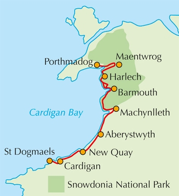
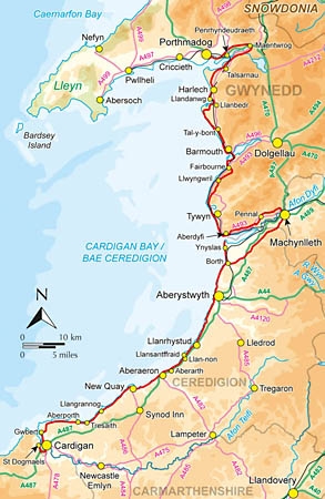
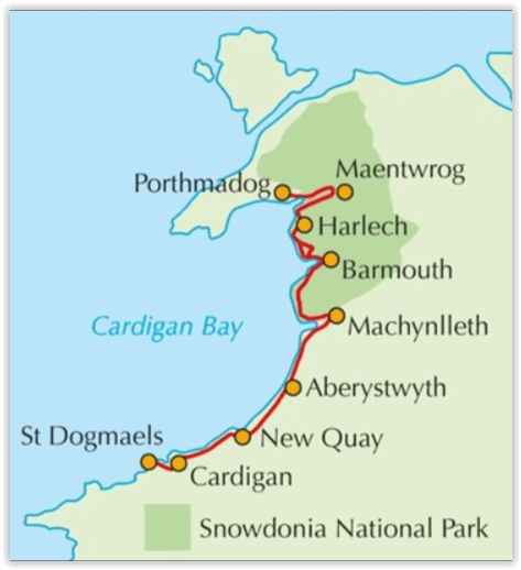
Productomschrijving: Als onderdeel van het Wales Coast Path, traceren de Ceredigion Coast Path en het Snowdonia Coast Path een curve van 233km (145 mijl) van kust- en binnenwaterwegen langs Cardigan Bay. Deze gids beschrijft een 16-fasige gids over de wandeling van Porthmadog aan St. Dogmaels die betrekking hebben op de trail tussen het Llyn-schiereiland en het Pembrokeshire Coast Path. In 16 dagstadia van Porthmadog St. Dogmaels, biedt deze gids alle wandelaars de nodige informatie.
Product description: As part of the Wales Coast Path, the Ceredigion Coast Path and Snowdonia Coast Path trace a curve of 233km (145 miles) of coastal and inland walking down Cardigan Bay. This guidebook describes a 16-stage guide to the walk from Porthmadog to St Dogmaels covering the trail between the Llyn Peninsula and the Pembrokeshire Coast Path. In 16 day stages from Porthmadog to St Dogmaels, this guidebook offers all the information walkers need to complete the 233km (145 miles) section of the Wales Coast Path that curve down Cardigan Bay, passing through a range of contrasting landscapes.
Seasons:
Technically, it is possible to trek this route at any time of the year. However, spring into summer tends to be the most favourable season for weather and also for the wild flowers. Early autumn can also be rewarding, especially for the quality of the light and autumnal colours.
Centres:
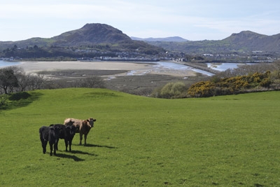
The walk passes through a number of attractive settlements, from towns such as Aberystwyth to villages such as Llangrannog.
Difficulty:
While many stretches of the Snowdonia Coast Path enable a fast walking pace, there are also some big climbs. The Ceredigian Coast Path is surprisingly challenging and a good level of fitness is required.
Must See:
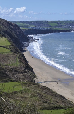
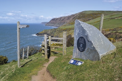
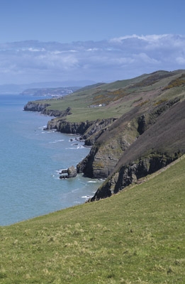
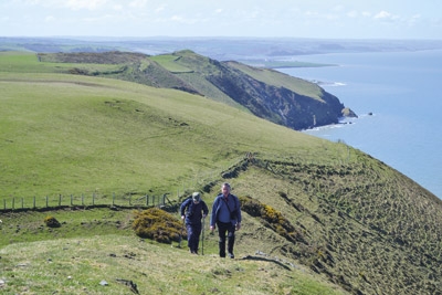
The Snowdonia and Ceredigian Coast Paths, part of the Welsh Coast Path, run some 230kms down Cardigan Bay. The walk crosses fine sandy beaches, rugged cliffs, salt marshes and hill country. There are great coastal and inland views, fascinating geology and history, and wide varieties of plants and wildlife.
Locatie op kaart
Artikelen uit dezelfde regio

Wandelkaart Snowdonia NP North - Harvey maps • 9781851374724
Wandelkaart Snowdonia North - Harvey maps Productomschrijving: Deze kaarten bieden duidelijke, gedetailleerde informatie. Sir Chris Bonington. Van belangrijke bergen op één enkele kaart van Snowdonia, afgedrukt op polyethyleen - duurzaam, scheurbestendige en 100% waterdicht. Gemaakt in samenwerking met de British Council van het alpinisme. Minder dan de helft van het gewicht van een geplas…

Wandelkaart 265 Clwydian Range- Prestatyn- Mold - OSI • 9780319471371
Wandelkaart Clwydian Range - Prestatyn, Mold & Ruthin Omvat ook: Prestatyn, Mold & Ruthin. Productbeschrijving: Kaart nummer 265 in de OS Explorer reeks beslaat een gebied in Noord-Wales langs het Clwydian range. Dit gebied van uitzonderlijke natuurlijke schoonheid AONB hosts het nationale spoor van Offa's Dyke Path en de steden van Prestatyn, Mold en Ruthin. Andere hoogtepunten van he…
Wandelkaart XT25 Brecon Beacons NP - West - Harvey maps • 9781851375721
Wandelkaart XT25 - Brecon Beacons NP - West - Harvey maps Productomschrijving: De westelijke range vormt het centrale deel van het Brecon Beacons National Park, een benaming die ook de ranges zowel naar het oosten en het westen van "het centrale Beacons" bevat. Dit veel groter gebied wordt ook vaak aangeduid als "de Brecon Beacons", en het omvat de Black Mountains Nieuwe generatie HARV…

Wandelkaart 116 Denbigh & Colwyn Bay - North Wales - OSI • 9780319474396
Wandelkaart Denbigh & Colwyn Bay - North Wales - OSI Productbeschrijving: OS Landranger kaart 116 beschikt over de kust van Noord-Wales. De oude stad van Denbigh, die datteert bijna duizend jaar terug met de kasteel ruïnes die er nog steeds staan vandaag. Colwyn Bay is een badplaats gelegen aan de noordelijke kustlijn sportieve 3 mijl van de zandstranden. De OS Landranger kaart voor Denbig…

Wandelkaart XT40 Anglesey Coastal Path N. Wales - Harvey Maps • 9781851375851
Wandelkaart XT40 - Anglesey Coastal Path N. Wales - Harvey Maps Productomschrijving: Anglesey, is een eiland en bestuurlijk graafschap aan de noordwestkust van Wales. Het vormt een onderdeel van het ceremoniële behouden graafschap Gwynedd en is tevens een historisch graafschap. Deze kaart brengt u per wandelpad langs de kust van dit uitermate geschikt wandeleiland Nieuwe generatie HARV…