
Wandelgids Walking the Provence - Cicerone
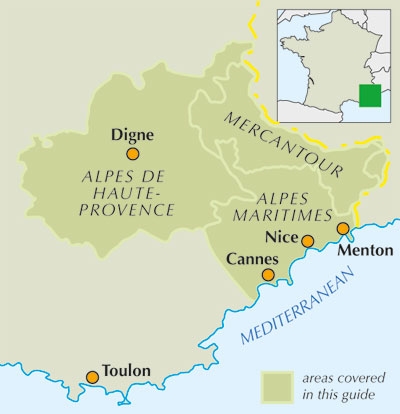
Alpes Maritimes- Alpes de Haute-Provence & Mercantour NP

Korte omschrijving
Wandelgids - Walking the Provence - Cicerone Productomschrijving: Een gids over 30 afwisselende dagwandelingen in het oosten van de Provence in de Alpes Maritimes, Alpes de Haute-Provence en...

Specificaties
- Uitgever: CICERONE Press
- ISBN-13: 9781852846176
- HOOFDCATEGORIEËN: Wandelgids
- Activiteiten: Wandelen, Hiking & Trekking
- Auteur: Janette Norton
- Regio: Provence-Alpes-Côte d’Azur
- Land: Frankrijk
- Departement: Alpes-Maritimes (06)
- Blz.: 240
- Afmeting: 12x17
- Editie: 1
- Taal: Engels
Volledige omschrijving
Wandelgids - Walking the Provence - Cicerone
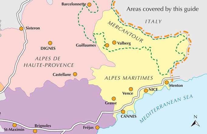
Productomschrijving: Een gids over 30 afwisselende dagwandelingen in het oosten van de Provence in de Alpes Maritimes, Alpes de Haute-Provence en de Mercantour, met praktische informatie voor de wandelaar. Wandelingen starten van de Esterel aan de kust van de Mercantour, en omvatten de Gorges du Verdon en de Geologische Reserve van de Haute Provence, van basissen zoals Vence, Grasse en Digne-les-Bains.
Product description: Guidebook to 30 varied day walks in the east of Provence in the Alpes Maritimes, Alpes de Haute-Provence and Mercantour, with practical information for the walker. Walks span from the Esterel on the coast to the Mercantour, and include the Verdon Gorge and Geological Reserve of Haute Provence, from bases such as Vence, Grasse and Digne-les-Bains.
Seasons:
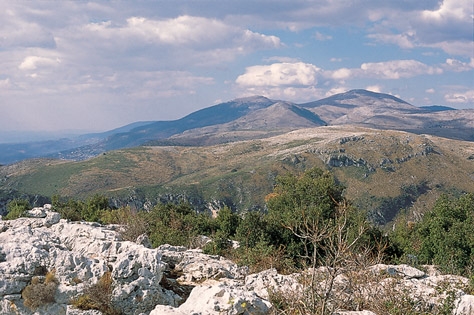
Walks near the coast can be made at any time of the year, but the high trails in the Mercantour are restricted to snow-free months in summer and autumn.
Centres:
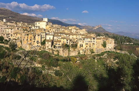
Vence and Grasse (Alpes Maritimes); Digne-les-Bains and Castellane (Alpes de Haute-Provence); Guillaumes and the Val d'Entraunes (Mercantour).
Difficulty:
Circular day walks, suitable for averagely fit people and graded Easy, Medium or Difficult, depending on length, total ascent and terrain; easy walks are short, while difficult ones take up to eight hours and may include sections which are precipitous or difficult to navigate; no special equipment is needed.
Must See:
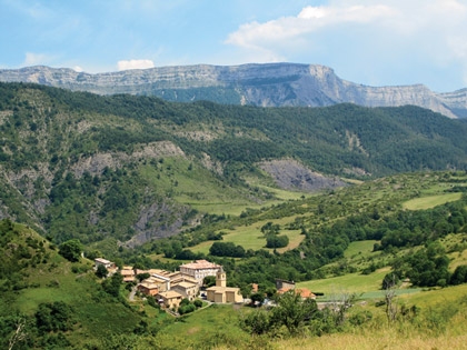
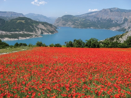
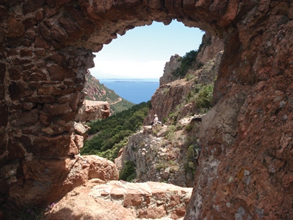
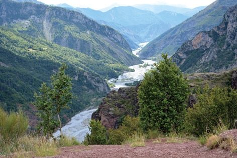
Dramatic mountain ridges, alpine lakes and deep river gorges; perched medieval villages, ruined castles and churches; the red rocks in the Estérel on the Mediterranean coast to high mountains in the Mercantour.

Locatie op kaart
Artikelen uit dezelfde regio

Wandelgids Provence - Rother • 9783763348015
Wandelgids Provence - 50 walks in Ardèche & de Verdon Gorge Productomschrijving: De Provence, het land van licht en lavendel, is niet alleen een reisbestemming voor liefhebbers van cultuur of zonaanbidders, maar is ook een prachtige bestemming voor wandelaars. Deze wandelgids, is één van de eerste voor de regio's Ardèche en Verdon, Mont Ventoux en Calanques, en schenkt een kleurrijke scala…

Reisgids Marseille - Le Routard • 9782017100676
Guide de voyager Marseille - Le Routard Déscription de produits: Marseille reste, d’un millénaire à l’autre, une immense scène de théâtre où les représentations se succèdent. Pas de saison, pas de relâche, drames et comédies en alternance. Ville étonnante dont les habitants ont des talents innés de comédiens. Vous êtes là ? Tant mieux. Vous aimez ? C'est encore mieux. Vous trouverez dans l…

Wandelgids Circuits de randonnées dans les Ecrins - Glénat • 9782723433174
Wandelgids - Circuits de randonnées dans les Ecrins - Glénat Productomschrijving: Het massief van Ecrin, als Nationaal park geclassificeerd, presenteert een reliëf specifiek voor de wandelaar of lange meerdaagse trekking. Jaarlijks trekken duizenden wandelaars door deze soms zware routes tussen de periodes van half mei, tot zelfs het vroege oktober. De GR54 onderdeel van deze gids, is 254 …

Wandelgids Walking in the Briançonnais - Cicerone • 9781852848880
Wandelgids Walking in the Briançonnais - Cicerone Press Productomschrijving: Gids van 40 wandelingen rond Briançon in Frankrijk. Wandelingen voor alle niveaus, variërend van 1½ tot 7 uur. Het boek concentreert zich op de prachtige valleien van Clarée, Cerveyrette, Ayes, Durance en Guisane, en omvat de prachtige Alpenlandschappen rond Vallouise en Montgenèvre. Engelse omschrijving: Guid…

Wandelkaart 3544 ET Fréjus - St-Raphaël - IGN • 9782758538745
TOPO Wandelkaart Fréjus - St-Raphaël - IGN Productpomschrijving: Fréjus, St-Raphaël & Corniche de l'Esterel zijn Franse gemeentes gelegen in het departement van de Var, in de regio Provence-Alpes-Côte d'Azur. Tussen 2014 en 2018, worden alle SERIE BLUE kaarten in de collectie vernieuwd. Een nieuwe kaart voor optimale leesbaarheid, met de precieze meetkundige en rijke toeristische informati…