
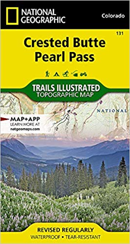
Wandelkaart 131 Crested Butte- Pearl Pass - Nat geo
Een rustige wandel- en MTB uitvalsbasis in Gunnison County
Korte omschrijving
TOPO Wandelkaart 131 - Crested Butte- Pearl Pass Colorado, USA - National geographic Productomschrijving: Crested Butte is een rustige wandel- en MTB uitvalsbasis in Gunnison County, Colorad...

Specificaties
- Uitgever: National Geographic
- ISBN-13: 9781566952477
- HOOFDCATEGORIEËN: Wandelkaart
- Regio: Colorado, USA
- Land: Verenigde Staten van Amerika (USA)
- Schaal: 1:40000
- Afmeting: 10x19
- Taal: Engels
Volledige omschrijving
TOPO Wandelkaart 131 - Crested Butte- Pearl Pass Colorado, USA - National geographic
Productomschrijving: Crested Butte is een rustige wandel- en MTB uitvalsbasis in Gunnison County, Colorado, United States. Omvat de oude kool industrie, en noemt nu "the last great Colorado ski town". Crested Butte is aeveneens een locatie voor skiërs & mountainbiking, als ook een verzameling van andere outdoor activiteiten. De 'Colorado General Assembly' noemt deze regio 'Crested Butte the Wildflower Capital of Colorado'.
Engelse omschrijving: National Geographic's Trails Illustrated map of Crested Butte and Pearl Pass offers unparalleled detail for outdoor enthusiasts seeking to enjoy the year-round recreational opportunities available in this mountainous area on the west side of the Continental Divide. Created in partnership with the U.S. Forest Service, Bureau of Land Management and others, this expertly researched map covers key areas of interest including Gunnison National Forest, Maroon Bells-Snowmass and Collegiate Peaks Wilderness areas, Crested Butte Ski Area, Elk Mountains, Taylor River, Taylor Park Reservoir, West Elk Loop Scenic Byway and the Continental Divide.
Trailheads will lead you to precisely mapped trails with clear mileage indicators, labeled according to their designated usage, whether your adventure involves hiking, cross-country skiing, biking, snowmobiling or using some other motorized vehicle. The map features shaded relief; contour lines with elevations; labeled passes, peaks and summits; and reservoirs, rivers and other water features. Some of the many recreation features include campgrounds, boat launch and river access points, and fishing areas. Every Trails Illustrated map is printed on "Backcountry Tough" waterproof, tear-resistant paper. A full UTM grid is printed on the map to aid with GPS navigation.
Other features found on this map include: Collegiate Peaks Wilderness, Gunnison National Forest, Maroon Bells-Snowmass Wilderness, Taylor Park Reservoir.
Locatie op kaart
Artikelen uit dezelfde regio

Wandelkaart 138 Sangre de Cristo Mountains - Nat Geo • 9781566953511
Sangre de Cristo Mountains - Great Sand Dunes NP & Preserve Productomschrijving: Verken de kroon van de zuidelijke Rockies en het wonder van de Great Sand Dunes met National Geographic's Trails Illustrated kaart van Sangre de Cristo Mountains. Gemaakt in samenwerking met lokale land management agentschappen, deze deskundig onderzochte kaart levert ongeëvenaarde details en nuttige informati…

Reisgids Colorado - Insight Guides ENG • 9781789198393
Reisgids Colorado USA - Insight Guides ENG Productomschrijving: Van het beslissen wanneer je gaat, tot het kiezen van wat te zien als je aankomt, deze gids voor Colorado is alles wat je nodig hebt om je perfecte reis te plannen, met insider informatie over must-see, top attracties zoals Denver Art Museum, Pikes Peak en het Old Fort National Historic Site, en culturele juweeltjes zoals de g…

Wandelkaart 119 Yampa & Gore Pass Colorado USA - Nat Geo • 9781566953931
Yampa & Gore Pass Colorado USA - Nat Geo Productomschrijving: Outdoor enthousiastelingen die het hele jaar door willen genieten van de recreatieve mogelijkheden in en rond het zuiden van Routt National Forest zullen zich verbazen over National Geographic's Trails Illustrated kaart van Yampa en Gore Pass. Gemaakt in samenwerking met de U.S. Forest Service, Bureau of Land Management en ander…

Wandelkaart 101 Cache La Poudre- Big Thompson Colorado - Nat Geo • 9781566953900
Cache La Poudre, Big Thompson Colorado - Nat Geo Productomschrijving: Canyon Lakes Ranger District, dat is het bezienswaardige bosgebied, of zeg maar wildernis gebied dat naast Fort Collins Colorado ligt. Outdoor enthousiastelingen die willen genieten van de recreatieve mogelijkheden net ten oosten van Rocky Mountain National Park zullen National Geographic's Trails Illustrated kaart van C…

Wandelkaart 103 Winter Park, Central City & Rollins Pass • 9781566952767
Wandelkaart Winter Park, Central City & Rollins Pass Productomschrijving: National Geographic's Trails Illustrated kaart van Winter Park, Central City en Rollins Pass biedt ongeëvenaarde details voor outdoor enthousiastelingen die het hele jaar door willen genieten van de recreatieve mogelijkheden in de zuidelijke delen van Roosevelt en Arapaho National Forest. Deskundig onderzocht en gema…