
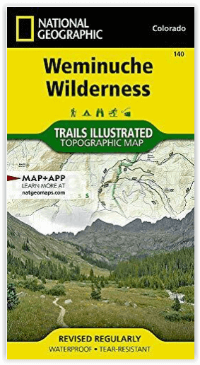
Wandelkaart 140 Weminuche Wilderness Colorado USA - Nat Geo
Big Meadows - Williams Creek - Rio Grande reservoirs
Korte omschrijving
Wandelkaart Weminuche Wilderness Colorado USA - Nat Geo Productomschrijving: De Weminuche Wilderness overspant de Continental Divide en is met bijna een half miljoen hectare het grootste wil...

Specificaties
- Uitgever: National Geographic
- ISBN-13: 9781566952910
- HOOFDCATEGORIEËN: Wandelkaart
- Activiteiten: Wandelen, Hiking & Trekking
- Regio: Colorado, USA
- Land: Verenigde Staten van Amerika (USA)
- Waterafstotende kaart: Nat Geo waterproof series
- Schaal: 1:63360
- Afmeting: 10x19
- Taal: Engels
Volledige omschrijving
Wandelkaart Weminuche Wilderness Colorado USA - Nat Geo
Productomschrijving: De Weminuche Wilderness overspant de Continental Divide en is met bijna een half miljoen hectare het grootste wildernisgebied in Colorado. Deskundig onderzocht en gemaakt in samenwerking met lokale landbeheerders, biedt National Geographic's Trails Illustrated kaart van de Weminuche Wilderness een ongeëvenaard hulpmiddel voor het verkennen van dit ruige land en zijn fragiele ecosystemen. Deze kaart biedt ongeëvenaarde details van het hele park, met inbegrip van belangrijke gebieden zoals Big Meadows, Williams Creek, en Rio Grande reservoirs, de Rio Grande en Animas rivieren, Wolf Creek, en drie veertieners, Mount Eolus, Sunlight Peak, en Windom Peak, gelegen in de San Juan Mountains. De kaart omvat ook de nationale bossen van San Juan en Rio Grande.
Andere kenmerken op deze kaart zijn: Mount Eolus, Needle Mountains, Rio Grande National Forest, San Juan Mountains, San Juan National Forest, Sunlight Peak, Weminuche Wilderness, Windom Peak, Wolf Creek Pass.
Engelse omschrijving: The Weminuche Wilderness spans the Continental Divide and at nearly a half million acres is the largest wilderness area in Colorado. Expertly researched and created in partnership with local land management agencies, National Geographic's Trails Illustrated map of Weminuche Wilderness provides an unparalleled tool for exploring this rugged country and its fragile ecosystems. This map offers unmatched detail of the entire park including such key areas of interest as Big Meadows, Williams Creek, and Rio Grande reservoirs, the Rio Grande and Animas rivers, Wolf Creek, and three fourteeners, Mount Eolus, Sunlight Peak, and Windom Peak, located in the San Juan Mountains. The map also includes the San Juan and Rio Grande national forests.
Other features found on this map include: Mount Eolus, Needle Mountains, Rio Grande National Forest, San Juan Mountains, San Juan National Forest, Sunlight Peak, Weminuche Wilderness, Windom Peak, Wolf Creek Pass.
With miles of clearly marked trails including portions of the Colorado and Continental Divide trails, and the scenic roadways Silver Thread and San Juan Skyway, this map will prove invaluable whether you're taking in the scenery on foot or by car. Whatever the season, you'll find this map a useful tool in pursuing a host of recreational activities. Alpine ski areas, hard surface and mountain bike routes, campgrounds, trailheads, boat ramps, fishing access, and ATV trails are all noted, as are historic townsites and mining camps. The map base includes contour lines and elevations for summits, passes and many lakes.
Every Trails Illustrated map is printed on "Backcountry Tough" waterproof, tear-resistant paper. A full UTM grid is printed on the map to aid with GPS navigation.
Locatie op kaart
Overzichtskaarten

NAT GEO Colorado trail maps
NAT GEO Colorado trail maps

Producten op de overzichtskaart
Klik op een product om naar de detailpagina te gaan.
- Wandelkaart 110 Leadville & Fairplay - Colorado - Nat Geo
- Wandelkaart 127 Aspen - Independence Pass - Colorado USA
- Wandelkaart 137 Pikes Peak & Cañon City - Nat Geo
- Wandelkaart 138 Sangre de Cristo Mountains - Nat Geo
- Wandelkaart 139 La Garita Caldera - Cochetopa - Nat Geo
- Wandelkaart 140 Weminuche Wilderness Colorado USA - Nat Geo
- Wandelkaart 141 Telluride- Silverton- Ouray & Lake City - Nat Geo
- Wandelkaart 144 Durango & Cortez- Colorado - Natgeo
- Wandelkaart 200 Rocky Mountain NP- Colorado - Nat Geo
- Wandelkaart 208 Colorado National Monument - Natgeo
- Wandelkaart 245 Black Canyon of the Gunnison NP - Natgeo
- Wandelkaart 301 Longs Peak -Trails Illustrated N. Trails - Nat Geo
- Wandelkaart 601 Aspen Local Trails - Nat Geo
Artikelen uit dezelfde regio

Wandelkaart 103 Winter Park, Central City & Rollins Pass • 9781566952767
Wandelkaart Winter Park, Central City & Rollins Pass Productomschrijving: National Geographic's Trails Illustrated kaart van Winter Park, Central City en Rollins Pass biedt ongeëvenaarde details voor outdoor enthousiastelingen die het hele jaar door willen genieten van de recreatieve mogelijkheden in de zuidelijke delen van Roosevelt en Arapaho National Forest. Deskundig onderzocht en gema…

Wandelkaart 245 Black Canyon of the Gunnison NP - Natgeo • 9781566953689
TOPO Wandelkaart 245 - Black Canyon of the Gunnison NP - Nat Geo Productomschrijving: Het Black Canyon of the Gunnison National Park is een nationaal park in het westen van de Amerikaanse staat Colorado. Het beschermt 19 km van de 77 km lange kloof van de Gunnison River, een zijrivier van de Colorado River. Engelse omschrijving: The Black Canyon, 48 miles of awe-inspiring, steep-walle…

Wandelkaart 141 Telluride- Silverton- Ouray & Lake City - Nat Geo • 9781566953405
Wandelkaart Telluride- Silverton- Ouray & Lake City - Nat Geo Productomschrijving: De National Geographic Trails Illustrated kaart van Telluride, Silverton, Ouray, en Lake City is deskundig onderzocht en gemaakt in samenwerking met lokale landbeheerders. Het is een ongeëvenaard hulpmiddel voor het verkennen van deze adembenemende regio van Colorado. Ongeacht het seizoen is deze kaart een h…

Wandelkaart 113 Cowdrey- North Sand Hills Colorado - Nat Geo • 9781566952880
Cowdrey- North Sand Hills Colorado - Nat Geo Productomschrijving: Geniet van de overvloedige recreatieve mogelijkheden in het noorden van Colorado met de hulp van National Geographic's Trails Illustrated kaart van Cowdrey en North Sand Hills. Deskundig onderzocht en gemaakt in samenwerking met de U.S. Forest Service, Bureau of Land Management, Colorado State Parks en anderen, zal de kaart …

Wandelkaart 1304 Colorado Backpack Loops- Noord - Natgeo • 9781566957557
TOPO Wandelkaart 1304 - Colorado Backpack Loops- Noord - Natgeo Productomschrijving: Colorado is gelend voor zijn outdoor recreatrieve opportuniteiten. Eén van deze bezigheden is uiteraard backcountry & hiking. De Colorado Backpack Loops North Topographic Map Guide omavt de dozijn aan cirkelvormige wandelroutes geselecteerd door het personeel van National Geographic voor hun diversiteit, h…