
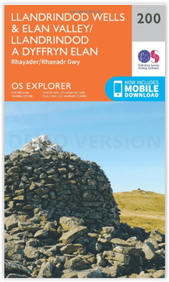
Wandelkaart 200 Llandrindod Wells & Elan Valley - OSI
Omvat Llandrindod Wells tot de Claerwen Reservoir
Korte omschrijving
Wandelkaart Llandrindod Wells & Elan Valley - Wales Omvat ook: Rhayader. Productbeschrijving: Deze dubbelzijdige kaart toont Llandrindod Wells tot de Claerwen Reservoir, met inbegrip van...

Specificaties
- Uitgever: Ordnance Survey
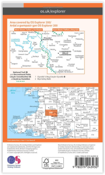
- ISBN-13: 9780319243930
- HOOFDCATEGORIEËN: Wandelkaart
- Activiteiten: Wandelen, Hiking & Trekking
- Regio: South Wales
- Land: Wales
- Schaal: 1:25000
- Afmeting: 13x23
- Taal: Engels
- Reeks: Explorer Series
Volledige omschrijving
Wandelkaart Llandrindod Wells & Elan Valley - Wales
Omvat ook: Rhayader.
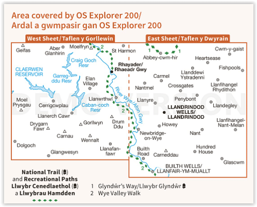
Productbeschrijving: Deze dubbelzijdige kaart toont Llandrindod Wells tot de Claerwen Reservoir, met inbegrip van de steile heuvels rond de Rivey Wye (Afon Gwy). De Wye Valley Walk recreatieve pad is één van de belangrijkste wandelpaden in het gebied, maar er zijn wel nog vele andere opties om te gaan verkennen, met inbegrip van een reeks van fotogeniek dammen. De OS Explorer kaart voor Llandrindod Wells & Elan Valley is beschikbaar in zowel de standaard papieren versie als de weerbestendige 'Actief' versie.
Productdiscription: This double sided map shows Llandrindod Wells to Claerwen Reservoir, including the steep hills around the Rivey Wye (Afon Gwy). The Wye Valley Walk Recreational Path is one of the main footpaths in the area, but there are many other options to explore, including a series of photogenic dams. The OS Explorer map for Llandrindod Wells & Elan Valley is available in both the standard paper version and weatherproof 'Active' version.
Locatie op kaart
Gekoppelde artikelen

Wandelkaart 200 Llandrindod Wells & Elan Valley - OSI • 9780319243930
standaard versieWandelkaart Llandrindod Wells & Elan Valley - Wales Omvat ook: Rhayader. Productbeschrijving: Deze dubbelzijdige kaart toont Llandrindod Wells tot de Claerwen Reservoir, met inbegrip van de steile heuvels rond de Rivey Wye (Afon Gwy). De Wye Valley Walk recreatieve pad is één van de belangrijkste wandelpaden in het gebied, maar er zijn wel nog vele andere opties om te gaan verkennen, m…

Wandelkaart 200 Llandrindod Wells & Elan Valley Wales - OSI • 9780319470725
weatherproof versieWandelkaart Llandrindod Wells & Elan Valley - Wales Productbeschrijving: Deze dubbelzijdige kaart toont de regio van Llandrindod Wells tot Claerwen Reservoir, met inbegrip van de steile heuvels rond de Rivey Wye (Afon Gwy). Het Wye Valley Walk recreatieve pad, is één van de belangrijkste wandelpaden in het gebied, maar er zijn vele andere opties om te verkennen, met inbegrip van een reeks …
Overzichtskaarten

OSI Explorer & Explorer Active - Wales
OSI Explorer & Explorer Active - Wales

Producten op de overzichtskaart
Klik op een product om naar de detailpagina te gaan.
- Wandelkaart 151 Cardiff & Bridgend- Wales - OSI
- Wandelkaart 152 Newport & Pontypool- South Wales - OSI
- Wandelkaart 164 Gower AONB & Gwyr- South Wales - OSI
- Wandelkaart 165 Swansea & Abertawe- South Wales - OSI
- Wandelkaart 166 Rhondda & Merthyr Tydfil - OSI
- Wandelkaart 177 Carmarthen & Kidwelly- Wales - OSI
- Wandelkaart 178 Llanelli- Ammanford & Rhydaman - OSI
- Wandelkaart 185 Newcastle & Emly- Northumberland - OSI
- Wandelkaart 186 Llandeilo- Brechfa Forest- Wales - OSI
- Wandelkaart 187 Llandovery- South Wales - OSI
- Wandelkaart 188 Builth Wells & Llanfair-ym-Muallt - OSI
- Wandelkaart 189 Hereford & Ross-on-Wye- England - OSI
- Wandelkaart 198 Cardigan & New Quay- Wales - OSI
- Wandelkaart 199 Lampeter- Wales - OSI
- Wandelkaart 200 Llandrindod Wells & Elan Valley - OSI
- Wandelkaart 201 Knighton & Presteigne- Wales - OSI
- Wandelkaart 202 Leominster & Bromyard Hererfordshire - OSI
- Wandelkaart 203 Ludlow & Shropshire Hills AONB - OSI
- Wandelkaart 213 Aberystwyth & Cwm Rheidol - Wales - OSI
- Wandelkaart 214 Llanidloes- Newtown & Y Drenewydd - OSI
- Wandelkaart 215 Newtown & Machynlleth- Powys Wales - OSI
- Wandelkaart 216 Welshpool & Montgomery- Powys - OSI
- Wandelkaart 217 Long Mynd & Wenlock Edge - OSI
- Wandelkaart 239 Lake Vyrnwy & Efyrnwy- North Wales - OSI
- Wandelkaart 240 Oswestry & Croesoswallt- Shropshir - OSI
- Wandelkaart 241 Shrewsbury- shropshire England - OSI
- Wandelkaart 253 Lleyn Peninsula West Wales - OSI
- Wandelkaart 254 Lleyn Peninsula East- Wales - OSI
- Wandelkaart 255 Llangollen & Berwyn- West Wales - OSI
- Wandelkaart 256 Wrexham- Wrecsam & Llangollen - OSI
- Wandelkaart 257 Crewe & Nantwich & Cheshire East - OSI
- Wandelkaart 262 Anglesey West- Wales AONB - OSI
- Wandelkaart 263 Anglesey East AONB- Wales - OSI
- Wandelkaart 264 Vale of Clwyd & Dyffryn Clwyd - OSI
- Wandelkaart 265 Clwydian Range & Bryniau Clwyd - OSI
- Wandelkaart 266 Wirral- Chester & Caer- Merseyside - OSI
- Wandelkaart 267 Northwich & Delamere Forest - OSI
- Wandelkaart 275 Liverpool- South West England - OSI
- Wandelkaart OL12 Brecon Beacons NP- West & Central - OSI
- Wandelkaart OL13 Brecon Beacons NP - Eastern area - OSI
- Wandelkaart OL17 Snowdon & Conwy Valley area - OSI
- Wandelkaart OL35 North Pembrokeshire Wales - OSI
- Wandelkaart OL36 South Pembrokeshire- Wales - OSI
Artikelen uit dezelfde regio

Wandelkaart 171 Cardiff & Newport South Wales - OSI • 9780319262696
Wandelkaart Cardiff & Newport - South Wales Productbeschrijving: Als een compacte en levendige stad is Cardiff een spannende plek om te vertroeven. OS Landranger kaart 171 dekt Cardiff, Newport en Pontypool en de monding van de Severn. Het heeft een schat aan sport, culturele, en entertainment attracties variërend van de studio's van BBC Wales naar de kathedraal van Llandaff. De OS Lan…
Wandelkaart XT40 Brecon Beacons Oost Wales - Harvey Maps • 9781851376001
Wandelkaart -XT40 Brecon Beacons Oost Wales - Harvey Maps Productomschrijving: Omvat een grote oppervlakte, maar is heel handig & compact. Gedetailleerde kaart voor hardlopers en wandelaars van het oostelijke deel van het Brecon Beacons National Park en de Black Mountains op de magische schaal van 1:40, 000. Omvat: Pen y Fan en de Black Mountains. Welsh-Engelse tekst.

Wandelkaart 178 Llanelli- Ammanford & Rhydaman - OSI • 9780319243718
Wandelkaart Llanelli- Ammanford & Rhydaman - South Wales Productbeschrijving: Kaart nummer 178 dekt Llanelli, Ammanford en Kidwelly. Hoogtepunten zijn Brecon Beacons National Park. Omvat ook Lliedi Resr, Gorseinon, Burry Port, Llanddarog en Llangain. De OS Explorer kaart voor Llanelli & Ammanford is beschikbaar in zowel de standaard papieren versie als de weerbestendige 'Actief' versie. …

Wandelgids Walking in Carmarthenshire South Wales - Cicerone • 9781852847371
Wandelgids - Walking in Carmarthenshire South Wales - Cicerone Productomschrijving: Deze gids beschrijft 30 wandelroutes van (2 to 10 mijl) in Carmarthenshire, Zuid-Wales, met inbegrip van delen van het "Carmarthenshire Coast Path". Wandelingen voor alle niveaus, met inbegrip van de kust, rivier, bos- en heuvelwandelingen in de Cambrian Mountains, Tywi Valley, Y Mynydd Du (Zwarte Bergen) e…

Wandelkaart 165 Swansea & Abertawe- South Wales - OSI • 9780319243589
Wandelkaart Swansea & Abertawe - South Wales Omvat ook: Neath & Port Talbot. Productbeschrijving: Kaart nummer 165 in de OS Explorer kaarten reeks is ideaal voor het verkennen van het zuiden van Wales rond Swansea en Port Talbot. Wandel tot aan Mumbles Head en kijk uit over de geweldige Swansea Bay, of neem een kijkje in en rond de stad van Swansea zelf. Andere hoogtepunten van het geb…