
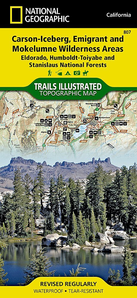
Wandelkaart 807 Carson-Iceberg- Nat.Geo
Omvat eveneens het Mokelumne Wilderness Areas
Korte omschrijving
TOPO Wandelkaart 807 - Carson-Iceberg- Nat.Geo Productomschrijving: Een verzameling aan nationale bosgebieden op één kaart en gelegen in Calofornia. Engelse omschrijving: Expertly resear...

Specificaties
- Uitgever: National Geographic
- ISBN-13: 9781566952651
- HOOFDCATEGORIEËN: Wandelkaart
- Activiteiten: Wandelen, Hiking & Trekking
- Regio: Californië, USA
- Land: Verenigde Staten van Amerika (USA)
- Regionale parken: Eldorado National forest, Humboldt-Toiyabe National forest, Mokelumne Wilderness Area, Stanislaus National Forests
- Schaal: 1:63360
- Afmeting: 10x19
- Taal: Engels
Volledige omschrijving
TOPO Wandelkaart 807 - Carson-Iceberg- Nat.Geo
Productomschrijving: Een verzameling aan nationale bosgebieden op één kaart en gelegen in Calofornia.
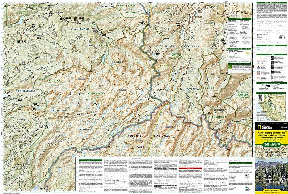
Engelse omschrijving: Expertly researched and created in partnership with the U.S. Forest Service and others, National Geographic's Trails Illustrated map of Yuba and American Rivers region of Tahoe National Forest provides an unparalleled tool for exploring this historically significant region of the Sierras. Whatever the season, you'll find this map a useful tool in pursuing a host of recreational activities from skiing and snowmobiling to camping and boating. The map features many key points of interest, including French Meadows and New Bullards Bar Reservoirs, Granite Chief Wilderness, South Yuba River Recreation Area, Malakoff Diggins State Historic Park, Donner Memorial State Park and the western rim of the Lake Tahoe Basin Management Unit.
The Tahoe National Forest West map can guide you off the beaten path and back again with miles of clearly marked trails including portions of the Pacific Crest, Pioneer, and Tahoe Rim trails. To help you choose the path that's right for you, trails are color coded according to the designated usage and mileage between intersections is indicated. The Yuba Donner scenic byways is noted for those wishing to take in the scenery by car. Many recreation features are noted as well, including ski areas, campgrounds, trailheads, wildlife viewing areas, boat launches, and swimming and fishing areas. The map base includes contour lines and elevations for summits, passes and many lakes. Every Trails Illustrated map is printed on "Backcountry Tough" waterproof, tear-resistant paper. A full UTM grid is printed on the map to aid with GPS navigation.
Other features found on this map include: Donner Pass, Eldorado National Forest, Granite Chief Wilderness, Mosquito Ridge, Plumas National Forest, Sawtooth Ridge, Tahoe National Forest, Truckee.

Locatie op kaart
Artikelen uit dezelfde regio

Reisgids California - Lonely Planet • 9781838691813
Reisgids California - Lonely Planet Productomschrijving: Van mistige Noord-Californische sequoiawouden tot zonovergoten Zuid-Californische stranden, in de betoverende Golden State lijkt Disneyland heel gewoon. Lonely Planet brengt je naar het hart van Californië, met geweldige reiservaringen en het beste planningsadvies. Lonely Planet California is je paspoort voor het meest relevante,…

Wandelkaart 810 Shaver Lake - Sierra National Forest - Nat Geo • 9781566952422
Shaver Lake - Sierra National Forest - Nat Geo Omvat: Ansel Adams Wilderness, Bass Lake, Chowchilla Mountains, Courtright Reservoir, Dinkey Lakes Wilderness, John Muir Wilderness, Kaiser Wilderness, Mammoth Pool Reservoir, Nelson Mountain, Sequoia National Forest, Shaver Lake, Sierra National Forest, Wishon Reservoir, Yosemite National Park. Engelse omschrijving: National Geographic's …

Wandelkaart 308 Yosemite NE- Tuolumne Meadows - Nat Geo • 9781566953696
Yosemite North East - Tuolumne Meadows - Nat Geo Productomschrijving: National Geographic's Trails Illustrated kaart van Yosemite NE: Tuolumne Meadows and Hoover Wilderness is ontworpen om te voldoen aan de behoeften van outdoor enthousiastelingen door het combineren van waardevolle informatie met ongeëvenaarde details van deze prachtige regio van het park. Deskundig onderzocht en gemaakt …

Wandelgids Hiking the Pacific Crest Trail - Cicerone • 9781852849207
Hiking the Pacific Crest Trail - PCT - Cicerone Productomschrijving: Een wandelgids over de Pacific Crest Trail (PCT), een epische wandeling van 3300 km van de Mexicaanse grens naar het Canadese British Columbia. Een van 's werelds beste wandelingen, de route loopt door Californië, Oregon en de staat Washington, langs de Mojave-woestijn, High Sierras, Cascades en talloze meer wilde bergen …

Wandelkaart 205 Sequoia & Kings Canyon NP - California • 9781566952989
TOPO Wandelkaart 205 - Sequoia & Kings Canyon NP Productomschrijving: Sequoia National Park is een nationaal park in het zuidelijke deel van de Sierra Nevada in Californië. Het park grenst aan de noordzijde aan Kings Canyon National Park, en wordt door de National Park Service als geheel beheerd. Engelse omschrijving: In Sequioa and Kings Canyon National Parks you can walk among the w…