
Wandelkaart OL27 North York Moors- Eastern area - OSI
Omvat het North York Moors National Park
Korte omschrijving
Wandelkaart North York Moors - Yorkshire England Omvat de: "Eastern area" Productbeschrijving: OS Explorer kaart OL27 omvat het North York Moors National Park, met inbegrip van de Clevel...

Specificaties
- Uitgever: Ordnance Survey
- ISBN-13: 9780319469453
- HOOFDCATEGORIEËN: Wandelkaart
- Activiteiten: Wandelen, Hiking & Trekking
- Regio: Yorkshire, England
- Land: England
- Waterafstotende kaart: Ordnance Survey ACTIVE Explorer Weatherproof Maps
- Nationale parken: Yorkshire Moors NP, England
- Schaal: 1:25000
- Afmeting: 13x24
- Taal: Engels
- Reeks: Explorer ACTIVE Series OSI
Volledige omschrijving
Wandelkaart North York Moors - Yorkshire England
Omvat de: "Eastern area"
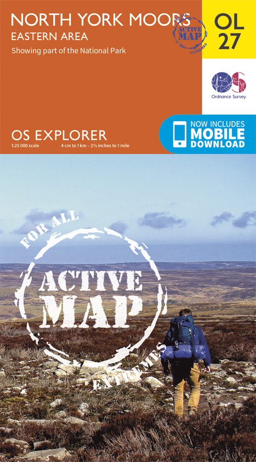
Productbeschrijving: OS Explorer kaart OL27 omvat het North York Moors National Park, met inbegrip van de Cleveland Hills en The Hambleton Hills. Ook zijn op deze kaart de Celeveland way National Trail & de Tabular Hills way, Cleveland Street, Esk Valley Walk en het noordelijke uiteinde van Ebor way beschreven. De OS Explorer kaart voor het North York Moors is beschikbaar in zowel de standaard papieren versie als de weerbestendige 'Actief' versie.
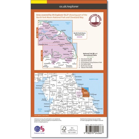
Kaart nummer OL27 is een all purpose kaart vol gepakt met informatie om u het gebied te helpen leren kennen. De kaarten bestrijken het land. Elke kaart heeft een oppervlakte van 40 km door 40 km (25 mijl door 25 mijl) en zoals andere kaarten van Ordnance Survey, National Grid-vierkanten worden verstrekt zodat elke functie een unieke referentienummer kan worden gegeven.
Productdiscription: OS Explorer sheet OL27 covers the North York Moors National Park, including the Cleveland Hills and The Hambleton Hills. Also on this map sheet are the Celeveland Way National Trail, Tabular Hills Walk, Cleveland Street, Esk Valley Walk and the northern end of Ebor Way. The OS Explorer map for North York Moors is available in both the standard paper version and weatherproof 'Active' version.
De samenstellende 9 kaarten set voor de Wainright's Coast-to-Coast Walk kunt bestellen met 10% korting op de combinatie van volgende ISBN nrs.
Omvat de kaarten: OL4, OL5, OL19, OL26, OL27, OL30, 302, 303 and 304
Graag doorgeven op service@bibliotrek.be met uw bestelling van de set, uw krijgt vervolgens de info om het bedrag over te schrijven. waarna u dan de facuur digitaal krijgt doorgemaild, en de kennisgeving van verzending die erop volgt.

Locatie op kaart
Gekoppelde artikelen

Wandelkaart OL27 North York Moors- Eastern area - OSI • 9780319469453
weatherproof versieWandelkaart North York Moors - Yorkshire England Omvat de: "Eastern area" Productbeschrijving: OS Explorer kaart OL27 omvat het North York Moors National Park, met inbegrip van de Cleveland Hills en The Hambleton Hills. Ook zijn op deze kaart de Celeveland way National Trail & de Tabular Hills way, Cleveland Street, Esk Valley Walk en het noordelijke uiteinde van Ebor way beschreven. D…
Overzichtskaarten

OSI Explorer & Explorer Active - Noord Engeland - Lake District
OSI Explorer & Explorer Active - Noord Engeland - Lake District

Producten op de overzichtskaart
Klik op een product om naar de detailpagina te gaan.
- Wandelkaart 275 Liverpool- South West England - OSI
- Wandelkaart 276 Bolton- Wigan & Warrington- Machester - OSI
- Wandelkaart 277 Manchester & Salford - OSI
- Wandelkaart 278 Sheffield & Barnsley- South Yorkshire - OSI
- Wandelkaart 279 Doncaster- South Yorkshire - OSI
- Wandelkaart 280 Isle of Axholme- Lincolnshire - OSI
- Wandelkaart 281 Ancholme Valley- Lincolnshire - OSI
- Wandelkaart 283 Louth & Mablethorpe- Lincolnshire - OSI
- Wandelkaart 284 Grimsby- Cleethorpes & Immingham - OSI
- Wandelkaart 285 Southport & Chorley- Merseyside - OSI
- Wandelkaart 286 Blackpool & Preston- Lancashire - OSI
- Wandelkaart 287 West Pennine Moors- Lankashire - OSI
- Wandelkaart 288 Bradford & Huddersfield- West Yorkshire - OSI
- Wandelkaart 289 Leeds- Harrogate- Wetherby & Pontefract - OSI
- Wandelkaart 290 York- Selby & Tadcaster- North Yorkshire - OSI
- Wandelkaart 291 Goole & Gilberdyke- Yorkshire - OSI
- Wandelkaart 292 Withernsea & Spurn Head- East Riding - OSI
- Wandelkaart 293 Kingston upon Hull & Beverley - OSI
- Wandelkaart 294 Market Weighton & central Yorkshire Wolds - OSI
- Wandelkaart 295 Bridlington- Driffield & Hornsea - OSI
- Wandelkaart 296 Lancaster- Morecambe & Fleetwood - OSI
- Wandelkaart 297 Lower Wharfedale & Washburn Valley - OSI
- Wandelkaart 298 Nidderdale AONB- Yorkshire - OSI
- Wandelkaart 299 Ripon & Boroughbridge- North Yorkshire - OSI
- Wandelkaart 300 Howardian Hills AONB & Malton - OSI
- Wandelkaart 301 Scarborough- Bridlington & Flamborough
- Wandelkaart 302 Northallerton & Thirsk- North Yorkshire
- Wandelkaart 303 Whitehaven & Workington - OSI
- Wandelkaart 304 Darlington & Richmond- North Cleveland
- Wandelkaart 305 Bishop Auckland & Durham - OSI
- Wandelkaart 306 Middlesbrough & Hartlepool - OSI
- Wandelkaart 307 Consett & Derwent reservoir - OSI
- Wandelkaart 308 Durham & Sunderland- England - OSI
- Wandelkaart 314 Solway Firth- Wigton & Silloth - OSI
- Wandelkaart 315 Carlisle- Brampton- Longtown - OSI
- Wandelkaart 316 Newcastle upon Tyne- Northumberland- OSI
- Wandelkaart OL2 Yorkshire Dales- Southern & Western Areas - OSI
- Wandelkaart OL19 Howgill Fells and Upper Eden Valley - OSI
- Wandelkaart OL21 South Pennines - Yorkshire - OSI
- Wandelkaart OL26 North York Moors - Western area - OSI
- Wandelkaart OL27 North York Moors- Eastern area - OSI
- Wandelkaart OL30 Yorkshire Dales - Yorkshire England - OSI
- Wandelkaart OL31 North Pennines- Teesdale & Weardale - OSI
- Wandelkaart OL41 Forest of Bowland & Ribblesdale - OSI
- Wandelkaart OL43 Hadrian's Wall - OSI
Artikelen uit dezelfde regio

Reisgids Yorkshire England - Rough Guides • 9781789194159
Reisgids Yorkshire England - Rough Guides Productomschrijving: The Rough Guide to Yorkshire was the first comprehensive guidebook to England’s largest county. Detailed coverage of the ruggedly beautiful Dales and Moors, the magnificent North Sea coast and historic York rubs shoulders with penetrating insights into the multi-cultural cities of Leeds and Sheffield, the resurgent port of Hull…

Reisgids Yorkshire England - Rough Guides • 9781789197112
Reisgids Yorkshire - Rough Guides Productomschrijving: The Rough Guide to Yorkshire was de eerste uitgebreide reisgids voor het grootste graafschap van Engeland. Gedetailleerde informatie over de ruige mooie Dales en Moors, de magnifieke Noordzeekust en het historische York wordt gecombineerd met indringende inzichten in de multiculturele steden Leeds en Sheffield, de oplevende havenstad H…

Fietsgids Pennine Bridleway cycling - Cicerone • 9781852846558
Fietsgids Pennine Bridleway cycling - Cicerone Productomschrijving: Handige gids voor iedereen die de Walliser Bridleway National Trail wenst te fietsen. Meer dan 140km van berg fietsen die door Lancashire en de Yorkshire Dales lopen, samen met een linksom route rond de helft van de Mary Towneley Loop. 11 circulaire dag MTB routes in de Yorkshire Dales met behulp van de Bridleway zijn ook …

Wandelgids The Dales Way - Rucksack Readers • 9781898481423
Wandelgids - The Dales Way te Noord Engeland Productomschrijving: Deze charmante wandeling loopt voor 79 mijl van Ilkley in de Yorkshire Dales naar Bowness in het Lake District. De LDWA heeft gedocumenteerde routes voor wandelaars beginnend in Leeds, Harrogate en Bradford. Langs de weg ziet u de indrukwekkende spoorwegviaducten en fijne stenen bruggen, de Bolton Priorij en vele kleine kerk…

Fietskaart Yorkshire Dales West - Harvey maps • 9781851374656
Fietskaart Yorkshire Dales West - Harvey maps Productomschrijving: Gedetailleerde wandel-, fiets- en off-roadkaart die GPS compatibel is. Omvat nauwkeurig geselecteerde off-road fietsroutes. Met een groot gebied op een compact blad. De Yorkshire Dales West omvatten bovenste Ribblesdale, met inbegrip van de Yorkshire 3 pieken - Whernside, Ingleborough en Pen y Gent, de Howgill Fells, en Den…