
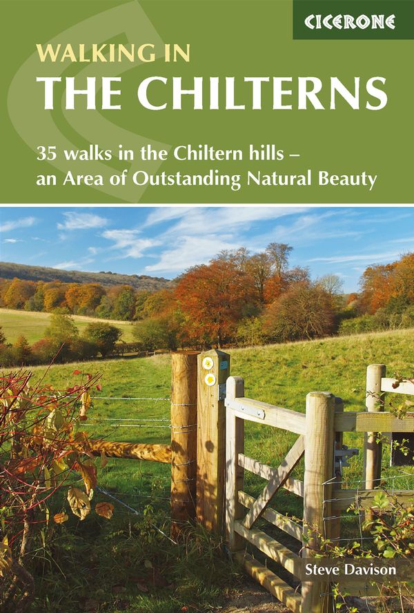
Wandelgids Chilterns walking guide - Cicerone
Gelegen ten westen van de hoofdstad london
Korte omschrijving
Wandelgids - Chilterns walking guide - Cicerone Productomschrijving: Deze plaats werd geklasseerd als gebied van uitmuntende schoonheid, of in Engelse termen beter gezegd, een "Area of Ousta...

Specificaties
- Uitgever: CICERONE Press
- ISBN-13: 9781786310187
- HOOFDCATEGORIEËN: Wandelgids
- Activiteiten: Wandelen, Hiking & Trekking
- Auteur: Steve Davison
- Regio: South & South East England
- Land: England
- AONB - Area of Outstanding Beauty: Chiltern Hills AONB
- Blz.: 224
- Schaal: 1:25000
- Afmeting: 12x17
- Editie: 2
- Taal: Engels
Volledige omschrijving
Wandelgids - Chilterns walking guide - Cicerone
Productomschrijving: Deze plaats werd geklasseerd als gebied van uitmuntende schoonheid, of in Engelse termen beter gezegd, een "Area of Oustanding Natural Beauty". Gelegen ten westen van de hoofdstad lonon is dit een soort getaway voor de londonaars die de stad even moe zijn, en de natuur willen opsnuiven. Steve Davison, is de auteur die deze wandelgids tot zijn recht bracht, en u een dikke 35 wandelingen voorstelt in de Chilterns AONB, verdeel tussen de 4 en 12 miles zoals ze zeggen in Engeland.
Engelse omschrijving: Guidebook to 35 walks in the Chiltern Hills of southern England. These chalk hills and ancient woodlands stretch from Reading and the Thames valley through Oxfordshire, Buckinghamshire and Hertfordshire to Luton. The selected walks, which range from 4 to 12 miles, showcase the best of this AONB and are as suitable for walkers of most abilities.
Seasons:
Spring and early summer are best for wild flowers; in autumn, the beech woods are clothed in golden-brown autumnal colours; a frosty winter's day gives impressive views.
Centres:
Aldbury, Amersham, Chesham, Dunstable, Goring, Great Hampden, Henley-on-Thames, High Wycombe, Ivinghoe, Nettlebed, Princes Risborough, Tring, Wallingford, Wendover, Whipsnade.
Difficulty:
Walks to suit most ages and abilities; no difficulties apart from some short steep uphill and downhill sections; can be muddy in winter.
Must See: Panoramic views from the crest of the Chilterns including Ivinghoe Beacon, Coombe Hill, Whiteleaf Hill and Watlington Hill; peaceful beech woods; riverside scenes along the River Thames, Chess, Gade and Misbourne; picturesque villages with thatched cottages, historic churches and cosy pubs.
.png)
Locatie op kaart
Overzichtskaarten

Area's of Outstanding Natural Beauty - AONB's UK
Area's of Outstanding Natural Beauty - AONB's UK

Producten op de overzichtskaart
Klik op een product om naar de detailpagina te gaan.
- Wandelgids - Guide to the Cotswolds AONB - AA
- Wandelkaart 24 - Chilterns AONB - AA
- Fietskaart- en Mtb kaart - The Cotswolds - Goldeneye
- Wandelgids - Cotswold classic walks guidebook - Goldeneye
- Wandelkaart - Cotswold South AONB - Goldeneye
- Wandelgids - Exploring the Cotswolds - Goldeneye
- Wandelgids - Cotswold Classic Walks - Goldeneye
- Wandelkaart - Cotswolds- Malverns & Forest of Dean - Goldeneye
- Wandelgids - The Cotswold Way 30 classic routes - Cicerone
- Wandelgids - Kent walking guide - Cicerone
- Wandelgids - North Downs Way Nat. trail - Cicerone
- Wandelgids - Chilterns walking guide - Cicerone
- Wandelgids - Suffolk coast & Heaths walks - Cicerone
- Wandelgids - North Downs Way - Map Booklet - Cicerone
- Wandelgids - North Pennines AONB walking guide - Cicerone
- Wandelgids - Ridgeway National Trail - Cicerone
- Wandelgids - Forest of Bowland & Pendle - Cicerone
- Wandelgids - Hampshire's Test Way walking guide - Cicerone
- Wandelgids & Fietsgids - The Cotswold AONB - Cicerone
- Wandelgids - Walking on the Gower - Cicerone
- Wandelgids - North Wessex Downs - Cicerone Press
- Wandelgids - Walking on the North Wessex Downs - Cicerone
- Wandelgids - Silverdale & Arnside AONB - Cicerone
- Wandelgids - The Kennet and Avon Canal walking guide - Cicerone
- Wandelgids - North Downs Way- 246 km - Trailblazer
- Wandelkaart OL2 - Yorkshire Dales- Southern & Western Areas - OSI
- Wandelkaart OL19 - Howgill Fells and Upper Eden Valley - OSI
- Wandelkaart OL21 - South Pennines - Yorkshire - OSI
- Wandelkaart OL31 - North Pennines- Teesdale & Weardale - OSI
- Wandelkaart OL40 - The Broads - OSI
- Wandelkaart OL41 - Forest of Bowland & Ribblesdale - OSI
- Wandelkaart OL45 - The Cotswolds AONB- Gloucestershire - OSI
- Wandelkaart 108 - Lower Tamer Valley & Plymouth- Cornwall- OSI
- Wandelkaart 115 - Exmouth & Sidmouth- Devon - OSI
- Wandelkaart 137 - Ashford- Kent downs AONB- England - OSI
- Wandelkaart 140 - Quantock Hills AONB- Somerset - OSI
- Wandelkaart 140 - Quantock Hills AONB & Bridgwater- Devon - OSI
- Wandelkaart 147 - Sevenoaks & Tonbridge- Kent - OSI
- Wandelkaart 164 - Gower AONB & Gwyr- South Wales - OSI
- Wandelkaart 164 - Gower AONB & Gwyr- Wales - OSI
- Wandelkaart 171 - Chiltern Hills West & Henley-on-Thames OSI
- Wandelkaart 171 - Chiltern Hills West AONB- Wycombe - OSI
- Wandelkaart 172 - Chiltern Hills East AONB- Wycombe - OSI
- Wandelkaart 181 - Chiltern Hills AONB North- England - OSI
- Wandelkaart 181 - Chiltern Hills North AONB- Wycombe - OSI
- Wandelkaart 190 - Malvern Hills & Bredon Hill - OSI
- Wandelkaart 190 - Malvern Hills AONB & Bredon Hill - OSI
- Wandelkaart 203 - Ludlow- Shropshire Hills AONB - OSI
- Wandelkaart 217 - Long Mynd & Wenlock Edge- Schropshire- OSI
- Wandelkaart 254 - Lleyn Peninsular East- North Wales - OSI
- Wandelkaart 261 - Boston- Lincolnshire AONB - OSI
- Wandelkaart 262 - Anglesey West- Wales AONB - OSI
- Wandelkaart 263 - Anglesey East AONB- Wales - OSI
- Wandelkaart 273 - Lincolnshire Wolds South AONB - OSI
- Wandelkaart 282 - Lincolnshire Wolds North AONB - OSI
- Wandelkaart 298 - Nidderdale AONB- Yorkshire - OSI
- Wandelkaart 298 - Nidderdale AONB North Yorkshire - OSI
- Wandelkaart 300 - Howardian Hills AONB - OSI
- Wandelkaart 300 - Howardian Hills AONB & Malton - OSI
- Wandelkaart - Mourne Mountains N. Ireland - Harvey maps
- Wandelkaart - Fietskaart Forest of Bowland - Harvey maps
- Wandelkaart XT40 - Anglesey Coastal Path N. Wales - Harvey Maps
- Wandelkaart XT40 - Pennine Way Noord - Harvey Maps
- Wandelkaart XT40 - Pennine Way Zuid - Harvey Maps
- Wandelgids Cotswold - Way Two-way trekking guide - Knife Edge
- Reisgids Oxford & the Cotswolds AONB - Edicola
- Reisgids Cotswolds England - Rough Guides
- Reisgids Go Slow- Sussex & the South Downs- Weald & Coast - Bradt
- Travelguide Oxford & The Cotswolds pocket guide - Lonely Planet
- Wandelgids - The Ridgeway National trail - Trailblazer
Artikelen uit dezelfde regio

Wandelgids Thames Valley walking guide - Cicerone • 9781852845704
Wandelgids - Thames Valley walking guide - Cicerone Productomschrijving: Deze handige gids biedt 25 avontuurlijke dagwandelingen in de Thames Valley, die betrekking hebben op de North Hampshire Downs, Berkshire en de zuidelijke Chilterns met gemakkelijke toegang tot Londen. De circulaire wandelingen variëren van 10 tot 18 mijl, waaronder een twee-daagse trot, evenals kortere route opties v…

Wandelgids The Kennet and Avon Canal walking guide - Cicerone • 9781852847869
The Kennet and Avon Canal walking guide - Cicerone Productomschrijving: Gids voor wandelen langs het Kennet & Avon Kanaal. De 94 mijl lange route van Reading naar Bristol is opgedeeld in 7 redelijk gemakkelijke etappes en omvat het UNESCO werelderfgoed Bath en de drijvende haven van Bristol. Er zijn ook 20 rondwandelingen opgenomen, variërend van 4¼ tot 9 mijl, waarbij de beste delen van h…

Wandelkaart Ridgeway National Trail SE England - Harvey maps • 9781851374786
Wandelkaart Ridgeway National Trail SE England - Harvey maps Productomschrijving: Toont de gehele route van de Ridgeway op één plan, vanaf Overton Hill in de buurt van Avebury in Wiltshire naar Ivinghoe Beacon, ten oosten van Tring in Hertfordshire 137 km (85 mijl). Geschikt voor wandelaars, fietsers en ruiters. Informatie over het vinden van accommodatie, camping, voedsel. Routebeschrijvi…

Wandelkaart South West Coast Path 1 - Harvey maps • 9781851375547
Wandelkaart - South West Coast Path 1 - XT40 - Harvey maps Productomschrijving: Een wandelkaart die het zuidelijk deel beschrijft van het LAW wandelpad in de regio Devon / Cornwall, van Minehead tot St-Ives. De route telt in zijn geheel maar liefst 1014km lange wandelpad, genaamd "West Coast Path". De gehele route werd opgesplitst in 3 delen, De ISBN nrs van alle drie de kaarten zijn hiero…

Wandelgids London to Walsingham Camino - Trailblazer • 9781912716319
Camino London to Walsingham England - Trailblazer Productomschrijving: Camino van Londen naar Walsingham - De pelgrimsgids - Voordat Hendrik VIII in 1538 de bedevaart en de verering van heiligen verbood, was de route van Londen naar het heiligdom van Walsingham in Norfolk de populairste pelgrimstocht in Engeland. Deze gids volgt een nieuw herontdekte route tussen de hoofdstad en het ou…