
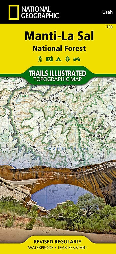
Wandelkaart 703 Manti-La Sal National forest - Natgeo
Het Manti–La Sal National Forest omvat meer dan 4,900 km
Korte omschrijving
TOPO Wandelkaart 703 - Manti-La Sal National forest - Nat Geo Productomschrijving: Het Manti–La Sal National Forest omvat meer dan 4,900 km, en is gelegen in centraal- en zuidoostelijke dee...

Specificaties
- Uitgever: National Geographic
- ISBN-13: 9781566953771
- HOOFDCATEGORIEËN: Wandelkaart
- Regio: Utah, USA
- Land: Verenigde Staten van Amerika (USA)
- Regionale parken: Manti-La Sal National Forest, Utah USA
- Schaal: 1:70000
- Afmeting: 10x19
- Taal: Engels
Volledige omschrijving
TOPO Wandelkaart 703 - Manti-La Sal National forest - Nat Geo
Productomschrijving: Het Manti–La Sal National Forest omvat meer dan 4,900 km, en is gelegen in centraal- en zuidoostelijke deel van Utah en het extreme westelijke deel van Colorado.
Engelse omschrijving: Expertly researched and created in cooperation with the U.S. Forest Service, Bureau of Land Management and others, National Geographic's Trails Illustrated map of Manti-La Sal National Forest provides unmatched detail of the discontiguous Moab and Monticello Ranger District areas of the forest. The map covers map popular points of interest, including Dark Canyon Wilderness, Natural Bridges National Monument, Blue Mountains and Cheesebox Canyon.
Outdoor enthusiasts will be able to get off the beaten track and back on again by following the map to clearly marked trailheads and then along precisely mapped trails, labeled either for hiking, motorcycle or ATV use, including The Kokopelli Trail. Trails in the Moab Ranger District also have mileage indicators. To assist in your navigation of the area, the map shows contour lines, elevations, labeled peaks, water features, selected waypoints and numbered Forest Service roads. Recreation features include areas for camping, boat launching, water skiing and fishing. The Unaweep-Tabeguache, Bicentennial and Trail of the Ancients Scenic Byways are also all marked. Every Trails Illustrated map is printed on "Backcountry Tough" waterproof, tear-resistant paper. A full UTM grid is printed on the map to aid with GPS navigation.
Other features found on this map include: Abajo Mountains, Abajo Peak, Bears Ears, Canyonlands National Park, Dark Canyon Wilderness, Glen Canyon National Recreation Area, Grand Gulch Plateau, La Sal Mountains, Manti-La Sal National Forest, Mount Peale, Paradox Valley.
.png)
Locatie op kaart
Overzichtskaarten

NAT GEO Utah trail maps
NAT GEO Utah trail maps

Producten op de overzichtskaart
Klik op een product om naar de detailpagina te gaan.
- Wandelkaart 210 Canyonlands NP - Utah - Natgeo
- Wandelkaart 211 Arches National Park- Utah - Natgeo
- Wandelkaart 214 Zion National Park - Natgeo
- Wandelkaart 219 Bryce Canyon NP Utah - Natgeo
- Wandelkaart 220 Dinosaur National Monument - Natgeo
- Wandelkaart 267 Capitol Reef NP Utah - Natgeo
- Wandelkaart 310 Canyonlands NP - Island in the Sky District
- Wandelkaart 311 Canyonlands NP - Needles District - Natgeo
- Wandelkaart 312 Canyonlands NP - Maze District - Natgeo
- Wandelkaart 703 Manti-La Sal National forest - Natgeo
- Wandelkaart 704 Flaming Gorge- Recreational Area - Utah
- Wandelkaart 709 Wasatch Front North Utah - Nat Geo
- Wandelkaart 710 Canyons of the Escalante NP - Nat Geo
- Wandelkaart 213 Glen Canyon & Capitol Reef NP - Nat Geo
NAT GEO Utah trail maps
NAT GEO Utah trail maps
Producten op de overzichtskaart
Klik op een product om naar de detailpagina te gaan.
- Wandelkaart 210 Canyonlands NP - Utah - Natgeo
- Wandelkaart 211 Arches National Park- Utah - Natgeo
- Wandelkaart 214 Zion National Park - Natgeo
- Wandelkaart 219 Bryce Canyon NP Utah - Natgeo
- Wandelkaart 220 Dinosaur National Monument - Natgeo
- Wandelkaart 267 Capitol Reef NP Utah - Natgeo
- Wandelkaart 310 Canyonlands NP - Island in the Sky District
- Wandelkaart 311 Canyonlands NP - Needles District - Natgeo
- Wandelkaart 312 Canyonlands NP - Maze District - Natgeo
- Wandelkaart 702 Cedar Mountain - Utah USA - Nat Geo
- Wandelkaart 703 Manti-La Sal National forest - Natgeo
- Wandelkaart 704 Flaming Gorge- Recreational Area - Utah
- Wandelkaart 705 Mount Dutton & Aquarius Plateau - Nat Geo
- Wandelkaart 213 Glen Canyon & Capitol Reef NP - Nat Geo
Artikelen uit dezelfde regio

Wandelkaart 714 Grand Staircase - Natgeo • 9781566956864
TOPO Wandelkaart 714 - Grand Staircase - Utah - Nat Geo Productomschrijving: Grand Staircase-Escalante National Monument is een gebied van 7571 km² in het zuiden van Utah in de Verenigde Staten. Er zijn drie belangrijke gebieden: de Grand Staircase, het Kaiparowits Plateau, en de Canyons van de Escalante. Engelse omschrijving: Outdoor enthusiasts seeking to enjoy the abundance of publ…

Wandelkaart 312 Canyonlands NP - Maze District - Natgeo • 9781566954624
Topografische Wandelkaart 312 - Canyonlands NP - Natgeo Productomschrijving: Canyonlands National Park is een Amerikaans nationaal park gelegen in het Zuidoosten van Utah, dichtbij de stad Moab. Het park omvat een kleurrijk landschap, geerodeerd in verschillende canyons door het water van de Colorado River. Het park is verdeeld in 4 districten: the Island in the Sky District, the Needles …

Wandelkaart 219 Bryce Canyon NP Utah - Natgeo • 9781566953207
TOPO Wandelkaart 219 - Bryce Canyon NP Utah - Natgeo Productomschrijving: Bryce Canyon Nationaal Park is een Amerikaans nationaal park gelegen in het zuidwesten van Utah. De hoofd atractie in het park is Bryce Canyon, die ondanks zijn naam, geen echte canyon is, maar een collectie van lange natuurlijke amphitheaters langs de oostelijke zijde van het Paunsaugunt Plateau. Engelse omschri…

Wandelkaart 505 Moab Greater Region - Utah USA - Nat Geo • 9781566959001
Wandelkaart Moab Utah USA - Nat Geo Productomschrijving: Moab is een zeer goed gekende locatie in het Amerikaanse Utah, tevens de hoofdplaats van Grand County. Op toeristisch vlak is Moab gekend voor zijn excursies naar de nabijgelegen natuurgebieden Arches en Canyonlands. Daarnaast is Moab de uitvalsbasis voor rafting op de Colorado river en tochten met de mountainbike, waarbij de Slickro…

Reisgids USA Southwest & National Parks - DK Eyewitness • 9780241365519
USA Southwest & National Parks Omvat: Arizona, Las Vegas, Southern Utah, the Four Corners & New Mexico. Productomschrijving: Staar naar de diepten van de Grand Canyon, ervaar de glitter en glamour van de Las Vegas strip, beklim de rotsachtige overspanningen van Arches National Park of wandel door het historische Santa Fe: alles wat u moet weten is overzichtelijk weergegeven in kleurgec…