
Wandelkaart 213 Glen Canyon & Capitol Reef NP - Nat Geo
Glen Canyon National Recreation Area & Capitol Reef NP
Korte omschrijving
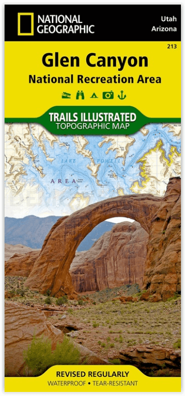
Wandelkaart Glen Canyon & Capitol Reef NP - Nat Geo Omvat: Bullfrog Creek, Cataract Canyon, Dirty Devil River, Escalante River, Glen Canyon, Glen Canyon Dam, Glen Canyon National Recreation ...

Specificaties
- Uitgever: National Geographic
- ISBN-13: 9781566953436
- HOOFDCATEGORIEËN: Wandelkaart
- Activiteiten: Wandelen, Hiking & Trekking
- Regio: Arizona, USA, Utah, USA
- Land: Verenigde Staten van Amerika (USA)
- Waterafstotende kaart: Nat Geo waterproof series
- Nationale parken: Capitol Reef NP, Utah USA
- Schaal: 1:90000
- Afmeting: 10x19
- Taal: Engels
Volledige omschrijving
Wandelkaart Glen Canyon & Capitol Reef NP - Nat Geo
Omvat: Bullfrog Creek, Cataract Canyon, Dirty Devil River, Escalante River, Glen Canyon, Glen Canyon Dam, Glen Canyon National Recreation Area, Kaibito Creek, Lake Powell, Mount Hillers, Navajo Creek, Paria River, Rainbow Plateau, Red Canyon, San Juan River, Smoky Mountain, Wahweap Creek, Wilson Mesa.
Engelse omschrijving: Let National Geographic's Trails Illustrated map of Glen Canyon National Recreation Area guide you over the hundreds of miles and 1.2 million acres of this historic, scenic and recreation rich area. Expertly researched and created in cooperation with the National Park Service and others, the map provides unparalleled detail of many popular points of interest, including Lake Powell, Colorado River, Antelope Island, Rainbow Bridge National Monument, Navajo Indian Reservation, Vermilion Cliffs National Monument and Trail of the Ancients Scenic Byway.
Since the recreation area has no maintained trails, you can navigate the area with the help of the map's detailed topography, including shaded relief, contour lines, elevations, labeled peaks and water features. For those who prefer to explore the area by water, Lake Powell is shown with bathymetric shading and contour lines along with correctly positioned and numbered buoys. Additionally, descriptions of Lake Powell marinas is provided along with their contact information. Other recreation features include boat and kayak launch points, campgrounds and scenic views.
Every Trails Illustrated map is printed on "Backcountry Tough" waterproof, tear-resistant paper. A full UTM grid is printed on the map to aid with GPS navigation.
Locatie op kaart
Overzichtskaarten

NAT GEO Arizona trail maps
NAT GEO Arizona trail maps

Producten op de overzichtskaart
Klik op een product om naar de detailpagina te gaan.
- Wandelkaart 213 Glen Canyon & Capitol Reef NP - Nat Geo
- Wandelkaart 224 Organ Pipe Cactus Nat. Monument Ariz. - Nat Geo
- Wandelkaart 261 Grand Canyon NP - Bright Angel - Arizona
- Wandelkaart 262 Grand Canyon East NP- Arizona - Nat Geo
- Wandelkaart 263 Grand Canyon West NP- Arizona - Nat Geo
- Wandelkaart 852 Hellsgate- Salome- Sierra Ancha Wilderness Areas

NAT GEO Utah trail maps
NAT GEO Utah trail maps

Producten op de overzichtskaart
Klik op een product om naar de detailpagina te gaan.
- Wandelkaart 210 Canyonlands NP - Utah - Natgeo
- Wandelkaart 211 Arches National Park- Utah - Natgeo
- Wandelkaart 214 Zion National Park - Natgeo
- Wandelkaart 219 Bryce Canyon NP Utah - Natgeo
- Wandelkaart 220 Dinosaur National Monument - Natgeo
- Wandelkaart 267 Capitol Reef NP Utah - Natgeo
- Wandelkaart 310 Canyonlands NP - Island in the Sky District
- Wandelkaart 311 Canyonlands NP - Needles District - Natgeo
- Wandelkaart 312 Canyonlands NP - Maze District - Natgeo
- Wandelkaart 703 Manti-La Sal National forest - Natgeo
- Wandelkaart 704 Flaming Gorge- Recreational Area - Utah
- Wandelkaart 709 Wasatch Front North Utah - Nat Geo
- Wandelkaart 710 Canyons of the Escalante NP - Nat Geo
- Wandelkaart 213 Glen Canyon & Capitol Reef NP - Nat Geo
NAT GEO Utah trail maps
NAT GEO Utah trail maps
Producten op de overzichtskaart
Klik op een product om naar de detailpagina te gaan.
- Wandelkaart 210 Canyonlands NP - Utah - Natgeo
- Wandelkaart 211 Arches National Park- Utah - Natgeo
- Wandelkaart 214 Zion National Park - Natgeo
- Wandelkaart 219 Bryce Canyon NP Utah - Natgeo
- Wandelkaart 220 Dinosaur National Monument - Natgeo
- Wandelkaart 267 Capitol Reef NP Utah - Natgeo
- Wandelkaart 310 Canyonlands NP - Island in the Sky District
- Wandelkaart 311 Canyonlands NP - Needles District - Natgeo
- Wandelkaart 312 Canyonlands NP - Maze District - Natgeo
- Wandelkaart 702 Cedar Mountain - Utah USA - Nat Geo
- Wandelkaart 703 Manti-La Sal National forest - Natgeo
- Wandelkaart 704 Flaming Gorge- Recreational Area - Utah
- Wandelkaart 705 Mount Dutton & Aquarius Plateau - Nat Geo
- Wandelkaart 213 Glen Canyon & Capitol Reef NP - Nat Geo
Artikelen uit dezelfde regio

Wandelkaart 210 Canyonlands NP - Utah - Natgeo • 9781566953269
TOPO Wandelkaart 210 - Canyonlands NP - Utah - Nat geo Productomschrijving: Canyonlands National Park is een Amerikaans nationaal park gelegen in het Zuidoosten van Utah, dichtbij de stad Moab. Het park omvat een kleurrijk landschap, geerodeerd in verschillende canyons door het water van de Colorado River. The park is verdeeld in 4 districten: the Island in the Sky District, the Needles d…

Wandelkaart 261 Grand Canyon NP - Bright Angel - Arizona • 9781566954952
TOPO Wandelkaart 261 - Grand Canyon NP - Bright Angel- Arizona Productomschrijving: De Grand Canyon is een zeer brede en diepe kloof in het noorden van de Amerikaanse staat Arizona. In de loop van miljoenen jaren heeft het water van de Colorado deze kloof in het landschap doen ontstaan. Deze extreme erosie werd mogelijk doordat het gebied waarin de kloof ligt steeds verder omhoog rees. …

Wandelkaart 704 Flaming Gorge- Recreational Area - Utah • 9781566954143
TOPO Wandelkaart 704 - Flaming Gorge- Recreational Area - Nat Geo Productomschrijving: Het Flaming Gorge National Recreation Area is een gebied rond het Flaming Gorge Reservoir en de Green River. Het ligt voor het grootste deel in het zuidwesten van de staat Wyoming en voor het overige deel in het noordoosten van de staat Utah van de Verenigde Staten. Deze National Recreation Area ligt ten…

Wandelkaart 219 Bryce Canyon NP Utah - Natgeo • 9781566953207
TOPO Wandelkaart 219 - Bryce Canyon NP Utah - Natgeo Productomschrijving: Bryce Canyon Nationaal Park is een Amerikaans nationaal park gelegen in het zuidwesten van Utah. De hoofd atractie in het park is Bryce Canyon, die ondanks zijn naam, geen echte canyon is, maar een collectie van lange natuurlijke amphitheaters langs de oostelijke zijde van het Paunsaugunt Plateau. Engelse omschri…

Wandelkaart 507 Moab Oost - Dewey Bridge & Sand Flats - Nat Geo • 9781566959025
Wandelkaart Moab Oost - Dewey Bridge & Sand Flats - Nat Geo Productomschrijving: Deze kaart omvat het Oostelijke gedeelte van het grote Moab recreatie gebied van het befamde National Geographic's Trails Illustrated. De kaart biedt een overzicht genummerd 507 op onderstaande kaart van het gebied. Het gebied omvat 3 kaarten met nummers, 505, 506 & 507. De 505 is de kaart die alles in één kee…