
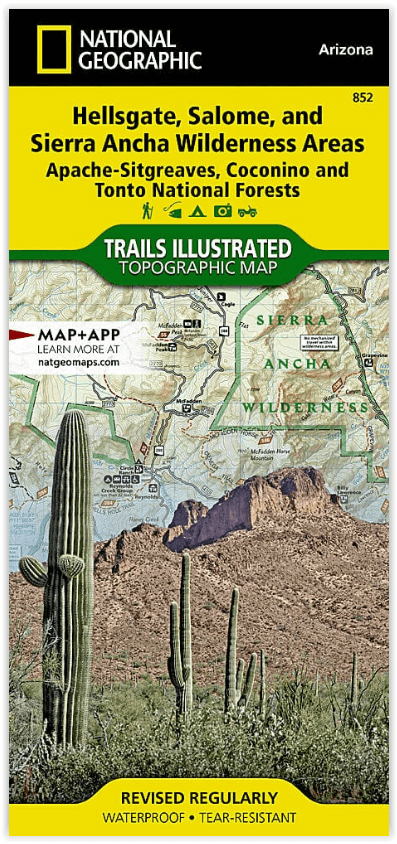
Wandelkaart 852 Hellsgate- Salome- Sierra Ancha Wilderness Areas
Coconino - Apache-Sitgreaves National Forests - Roosevelt Lake
Korte omschrijving
Hellsgate- Salome- Sierra Ancha Wilderness Areas - Nat Geo Productomschrijving: Tonto National Forest is een van de grootste nationale bossen in de Verenigde Staten en staat niet alleen beke...

Specificaties
- Uitgever: National Geographic
- ISBN-13: 9781566954860
- Activiteiten: Wandelen, Hiking & Trekking
- Regio: Arizona, USA
- Land: Verenigde Staten van Amerika (USA)
- Waterafstotende kaart: Nat Geo waterproof series
- Nationale parken: Tonto National Forest, Arizona USA
- Schaal: 1:70000
- Afmeting: 11x24
- Taal: Engels
- Reeks: National Geographic Trails Illustrated
Volledige omschrijving
Hellsgate- Salome- Sierra Ancha Wilderness Areas - Nat Geo
Productomschrijving: Tonto National Forest is een van de grootste nationale bossen in de Verenigde Staten en staat niet alleen bekend om zijn diversiteit aan terrein, flora en fauna, maar ook om zijn vele recreatieve mogelijkheden het hele jaar door. Deskundig onderzocht en gemaakt in samenwerking met de U.S. Forest Service, Bureau of Land Management en anderen, National Geographic's Trails Illustrated kaart van Hellsgate, Salome, en Sierra Ancha Wilderness Areas biedt ongeëvenaarde details van de noordoostelijke regio van het bos, samen met nabijgelegen gebieden in Coconino en Apache-Sitgreaves National Forests.
De kaart omvat veel populaire recreatiegebieden, waaronder Roosevelt Lake and Wildlife Area, Woods Canyon en Willow Springs Lakes, Mogollon Rim Area en Sierra Ancha Mountains.
Omvat: Aztec Peak, Coconino National Forest, Four Peaks, Four Peaks Wilderness, Hellsgate Wilderness, Mazatzal Mountains, Payson, Salome Wilderness, Salt River Canyon Wilderness, Sierra Ancha, Sierra Ancha Wilderness, Sitgreaves National Forest, Sombrero Peak, Theodore Roosevelt Lake, Tonto Basin, Tonto National Forest.
Engelse omschrijving: One of the largest national forests in the United States, Tonto National Forest is known not only for its diversity of terrain, flora and fauna but also for its numerous recreational opportunities throughout the year. Expertly researched and created in cooperation with the U.S. Forest Service, Bureau of Land Management and others, National Geographic's Trails Illustrated map of Hellsgate, Salome, and Sierra Ancha Wilderness Areas provides unmatched detail of the northeast region of the forest along with nearby areas in Coconino and Apache-Sitgreaves National Forests. The map's coverage includes many popular recreation areas, including Roosevelt Lake and Wildlife Area, Woods Canyon and Willow Springs Lakes, Mogollon Rim Area and Sierra Ancha Mountains.
Whether you explore the region on foot, skis, bike, horseback or motorized vehicle, you can get off the beaten path and back on again by following the map to clearly marked trails, which are labeled according to their designated usage, as well as the numbered Forest Service roads. The Highline, General Crook and Arizona Trails are all highlighted. Your navigation of the area will be aided by the map's contour lines, elevations, labeled peaks and summits, water features, selected waypoints and clear boundaries between public, private and tribal lands. Recreation points of interest include campgrounds and primitive camp sites, trailheads, fishing areas, boat launch and river access points, interpretive trails and scenic viewpoints.
Every Trails Illustrated map is printed on "Backcountry Tough" waterproof, tear-resistant paper. A full UTM grid is printed on the map to aid with GPS navigation.
Overzichtskaarten

NAT GEO Arizona trail maps
NAT GEO Arizona trail maps

Producten op de overzichtskaart
Klik op een product om naar de detailpagina te gaan.
- Wandelkaart 213 Glen Canyon & Capitol Reef NP - Nat Geo
- Wandelkaart 224 Organ Pipe Cactus Nat. Monument Ariz. - Nat Geo
- Wandelkaart 261 Grand Canyon NP - Bright Angel - Arizona
- Wandelkaart 262 Grand Canyon East NP- Arizona - Nat Geo
- Wandelkaart 263 Grand Canyon West NP- Arizona - Nat Geo
- Wandelkaart 852 Hellsgate- Salome- Sierra Ancha Wilderness Areas
Artikelen uit dezelfde regio

Wandelkaart 213 Glen Canyon & Capitol Reef NP - Nat Geo • 9781566953436
Wandelkaart Glen Canyon & Capitol Reef NP - Nat Geo Omvat: Bullfrog Creek, Cataract Canyon, Dirty Devil River, Escalante River, Glen Canyon, Glen Canyon Dam, Glen Canyon National Recreation Area, Kaibito Creek, Lake Powell, Mount Hillers, Navajo Creek, Paria River, Rainbow Plateau, Red Canyon, San Juan River, Smoky Mountain, Wahweap Creek, Wilson Mesa. Engelse omschrijving: Let Nationa…

Reisgids Arizona & the Grand Canyon - Insight Guides ENG • 9781839053122
Arizona & the Grand Canyon - Insight Guides Productomschrijving: Van het beslissen wanneer te vertrekken, tot het kiezen wat je wil zien als je er aankomt. Deze Insight Guides boek is alles wat je nodig hebt om uw reis te plannen en ervaar het beste van Arizona en de GrandCanyon, met diepgaande insider informatie over must-see, top attracties zoals Monument Valley, en verborgen culturele …

Wandelkaart 224 Organ Pipe Cactus Nat. Monument Ariz. - Nat Geo • 9781566952132
Wandelkaart Organ Pipe Cactus National Monument Productomschrijving: De verzameling van cactussen van over gans de wereld, een samenstelling van groot belang voor de regio en een enorme aantrekkingspool. Het park omvat een verzameling van cactussen die u nooit hebt gezien en is daarmee een echt wandelgebied met een omgeving als geen ander. Omvat: Diablo, Bates and Puerto Blanco Mounta…

Wandelkaart Apache Creek & Juniper Mesa Wilderness Area - Nat Geo • 9781566955164
Apache Creek - Juniper Mesa Arizona - Nat Geo Productomschrijving: De perfecte gezelschap voor al uw outdoor avonturen in Arizona. Met Prescott & Kaibab National Forests Op deze kaart staat ook: Big Chino Valley, Chino Valley, Granite Mountain, Granite Mountain (AZ) Wilderness, Juniper Mesa Wilderness, Juniper Mountains, Kaibab National Forest, Lonesome Valley, Prescott National Forest…

Reisgids USA Southwest & National Parks - DK Eyewitness • 9780241365519
USA Southwest & National Parks Omvat: Arizona, Las Vegas, Southern Utah, the Four Corners & New Mexico. Productomschrijving: Staar naar de diepten van de Grand Canyon, ervaar de glitter en glamour van de Las Vegas strip, beklim de rotsachtige overspanningen van Arches National Park of wandel door het historische Santa Fe: alles wat u moet weten is overzichtelijk weergegeven in kleurgec…