
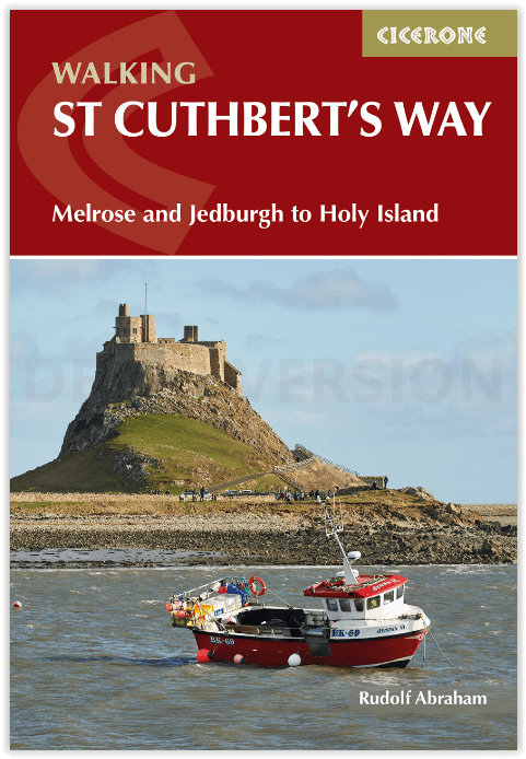
Wandelgids St Cuthbert's Way - Cicerone
Melrose tot Holy Island (Lindisfarne) of verder naar Berwick-upon
Korte omschrijving
Wandelgids St Cuthbert's Way - Cicerone Productomschrijving: Deze wandelgids beschrijft de lange afstand St Cuthbert's Way door het ongerepte landschap van Northumberland en de Borders. De 1...

Specificaties
- Uitgever: CICERONE Press
- ISBN-13: 9781786311566
- HOOFDCATEGORIEËN: Wandelgids
- Activiteiten: Wandelen, Hiking & Trekking
- Auteur: Rudolf Abraham
- Regio: Northumberland, Engeland
- Land: England
- Lange afstand wandelroutes: St. Cuthbert's Way (100 km)
- Nationale parken: Northumberland NP, England
- AONB - Area of Outstanding Beauty: Northumberland coast AONB
- Blz.: 112
- Afmeting: 12x17
- Editie: 1
- Taal: Engels
Volledige omschrijving
Wandelgids St Cuthbert's Way - Cicerone
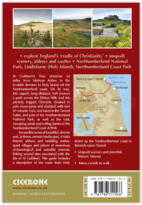
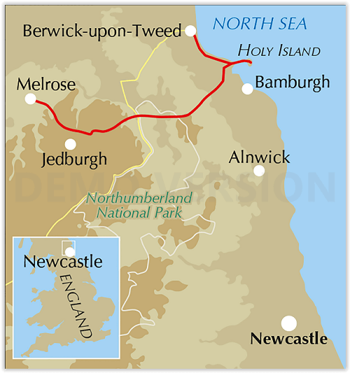
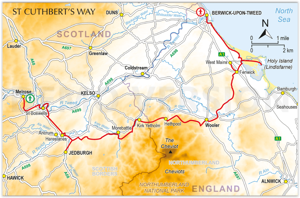
Productomschrijving: Deze wandelgids beschrijft de lange afstand St Cuthbert's Way door het ongerepte landschap van Northumberland en de Borders. De 100 km lange route begint in Melrose en doorkruist de ruige rotsen en heidevelden van de Cheviot Hills, gaat door het Northumberland National Park naar het sfeervolle Lindisfarne (Holy Island). De tocht kan binnen een week worden gelopen, hoewel er ruimte is om de etappes in te korten of te verlengen, afhankelijk van de route. Inclusief een optie om door te gaan naar Berwick-upon-Tweed op de laatste etappe van het Northumberland Coast Path.
Omvat: Holy Island, Lindisfarne Castle and Priory, Northumberland Coast AONB, Melrose Abbey, Jedburgh Abbey, the Cheviots, Northumberland National Park, Eildon Hills, River Tweed, Kirk Yetholm, Wideopen Hill, College Valley, Yeavering Bell, St Cuthbert’s Cave, Scottish Borders.
Engelse omschrijving: This guide describes the long-distance St Cuthbert's Way through the unspoilt scenery of Northumberland and the Borders. The 100km (62 mile) route begins at Melrose and crosses the rugged crags and heather moorland of the Cheviot Hills, passing through Northumberland National Park to the atmospheric Lindisfarne (Holy Island). It can be walked within a week, although there is scope for shortening or lengthening the stages to suit different itineraries. Includes an option to continue to Berwick-upon-Tweed on the final stage of the Northumberland Coast Path.
The guidebook is crammed with interesting snippets of information, alongside indispensable practical details of transport and accommodation in the area. With varied scenery and a rich history encompassing spectacular castles, medieval abbeys and Roman remains, this is one of Britain's most beautiful corners to explore on foot.
Seasons
Spring, summer, autumn, with temperatures at their highest in July; late autumn for birdlife; expect snow on higher ground in winter
Centres
Melrose, Jedburgh, Kirk Yetholm, Wooler, Holy Island (Lindisfarne), Berwick-Upon-Tweed
Difficulty
There are no special difficulties to encounter when walking St Cuthbert’s Way, though a reasonable level of fitness is assumed. Keep an eye on weather forecasts when crossing the Cheviots. Crossing to Holy Island must be timed to coincide with low tide.
Must See
Holy Island (Lindisfarne), Lindisfarne Castle and Priory, Northumberland Coast AONB, Melrose Abbey, Jedburgh Abbey, the Cheviots, Northumberland National Park, Eildon Hills, River Tweed, Kirk Yetholm, Wideopen Hill, College Valley, Yeavering Bell, St Cuthbert’s Cave, Scottish Borders.
Artikelen uit dezelfde regio

Wandelgids St Oswald's Way & Northumberland Coast Path - Cicerone • 9781786311559
St Oswald's Way & Northumberland Coast Path - Cicerone Productomschrijving: Deze gids beschrijft de St Oswald's Way en Northumberland Coast Paths, beide langeafstandswandelpaden door Northumberland. St Oswald's Way (156 km, 97 mijl) begint in Heavenfield en doorkruist delen van het Northumberland National Park en bezoekt Hadrian's Wall, de Simonside Hills en de prachtige Coquet Valley, voo…

Wandelkaart Northumberland - Harvey Maps • 9781851376681
Wandelkaart Northumberland - Harvey Maps Productomschrijving: De Gehele route op één kaart! - Het Northumberland Coast Path strekt zich uit over 103 km van Cresswell in het zuiden naar Berwick-upon-Tweed in het noorden, waarna het Berwickshire Coastal Path 48 km (28 m) verdergaat naar Cockburnspath. Beide routes staan op deze kaart en ze maken deel uit van het Noordzeepad. Het Northumb…

Wandelkaart 340 Active - Holy Island & Bamburgh - OSI • 9780319475768
Wandelkaart Holy Island & Bamburgh - Explorer Active Productomschrijving: Holy Island en Bamburgh zijn 2 aan de kust liggende eilanden/archipel die de interesse trekt van velen in het teken van natuur bezoek, wandelen of fietsen. De locatie is zeer mooi wat de natuur betreft. Omvat: Cheswick, Ancroft, Haggerston, Bowsden, Beal, Fenwick, Holy Island, Holburn, Doddington, Belford, Waren …


Wandelkaart OL43 Hadrian's Wall - OSI • 9780319475621
Wandelkaart Hadrian's Wall - England Productomschrijving: Wandel in de shaduw van de romeinen en ontdek dit eeuwen oud monument van om en bij de 2000 jaar oud. Hoogtepunten omvatten: Gilsland, Corbridge, Haltwhistle, Humshaugh, Hexham, Haydon Bridge, Bardon Mill, Greenlea lough, Housesteads, Chesters Roman Fort & Vindolanda. Een van de klassieke wandelingen van Engeland, en één die genotte…

Wandelkaart XT25 Cheviot Hills - Harvey Maps • 9781851376094
Wandelkaart Cheviot Hills - Harvey Maps Productomschrijving: Ideaal voor The Cheviot, Windy Gyle en het noordelijke deel van Northumberland National Park. Omvat: Wooler, Kirk Yetholm, Breamish Valley en Harthope Valley - Lichtgewicht, gedetailleerd, duidelijk en makkelijk te lezen - Geprint op sterk, 100% watervast en scheurbestendig papier - Toont de horeca voor na je dagtrip …