
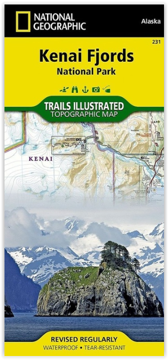
Wandelkaart 231 Kenai Fjords NP- Alaska - Nat Geo
In dit park liggen de Harding Icefields
Korte omschrijving
TOPO Wandelkaart 231 - Kenai Fjords NP- Alaska - Nat Geo Productomschrijving: Kenai Fjords National Park is een nationaal park in de Amerikaanse staat Alaska, gelegen op het Kenai-schiereila...

Specificaties
- Uitgever: National Geographic
- ISBN-13: 9781566953856
- HOOFDCATEGORIEËN: Wandelkaart
- Regio: Alaska, USA
- Land: Verenigde Staten van Amerika (USA)
- Nationale parken: Kenai Fjords NP, Alaska USA
- Schaal: 1:110000
- Afmeting: 10x19, 11x24
- Taal: Engels
Volledige omschrijving
TOPO Wandelkaart 231 - Kenai Fjords NP- Alaska - Nat Geo
Productomschrijving: Kenai Fjords National Park is een nationaal park in de Amerikaanse staat Alaska, gelegen op het Kenai-schiereiland. Grote delen van de Kenai Mountains worden beschermd in het park. In het park ligt het Harding Icefield, een van de grootste ijsvelden van de Verenigde Staten.
Engelse omschrijving: National Geographic's Trails Illustrated map of Kenai Fjords National Park is an essential travel companion for outdoor enthusiasts looking to explore the pristine scenery in this area of southern Alaska. Expertly researched and created in partnership with the National Park Service, U.S. Forest Service and others, the map covers popular recreation and adventure points of interest, such as Harding Icefield, Exit Glacier, Resurrection River and Bay, as well as the adjacent Kenai National Wildlife Refuge, Kachemak Bay State Park and Wilderness Park, Chugach National Forest and Skilak Wildlife Recreation Area. Inset maps of Exit Glacier and Seward provide extra detail of these areas.
The map will guide your exploration, whether on land or on water. Hikers, bikers and ATVers will find clearly marked trails with mileage markers, in addition to contour lines, elevations, labeled peaks, glaciers and crevasses. The Iditarod National Historic Trail and Seward Highway Scenic Byway are both marked. Boaters and kayakers will benefit from the sounding information, tidal flats, boating hazard areas, island locations and pinpointed seabed formation warnings, beacons, anchorage spots and boat ramps. Other recreation points of interest include trailheads, campgrounds, public cabins, food storage lockers, ski trails, waterfalls and scenic viewpoints. The map also includes background information, QR codes for real-time weather and essential contact information.Every Trails Illustrated map is printed on "Backcountry Tough" waterproof, tear-resistant paper. A full UTM grid is printed on the map to aid with GPS navigation.
Other features found on this map include: Aialik Bay, Bear Glacier, Chernof Glacier, Chiswell Islands, Chugach National Forest, Harris Bay, Kenai Fjords National Park, Kenai Lake, Kenai Mountains, Kenai Peninsula, McCarty Glacier, Nuka Bay, Nuka Island, Pye Islands, Resurrection Bay, Skilak Glacier, Skilak Lake, Tustumena Glacier.
Locatie op kaart
Overzichtskaarten

NAT GEO Alaska trails map
NAT GEO Alaska trails map

Producten op de overzichtskaart
Klik op een product om naar de detailpagina te gaan.
- Wandelkaart 231 Kenai Fjords NP- Alaska - Nat Geo
- Wandelkaart 248 Katmai NP- Alaska - Nat Geo
- Wandelkaart 254 Chilkoot Trail - Klondike Gold Rush - Nat Geo
- Wandelkaart 255 Glacier Bay NP- Alaska - Nat Geo
- Wandelkaart 257 Gates of the Arctic NP- Alaska - Nat Geo
- Wandelkaart 760 Kenai National Wildlife Refuge - Alaska - Nat Geo
- Wandelkaart 761 Prince William Sound West - Alaska - Nat Geo
- Wandelkaart 763 Kachemak Bay State Park - Alaska - Nat Geo
Artikelen uit dezelfde regio

Reisgids Alaska - Insight Guides ENG • 9781789198713
Reisgids Alaska USA - Insight Guides Productomschrijving: Van het beslissen wanneer te gaan, om te kiezen wat te zien als je aankomt, deze Insight Guides uitgave is alles wat je nodig hebt om uw reis te plannen en ervaar het beste van Alaska, met diepgaande inside-informatie over must-see, top attracties zoals Denali en verborgen culturele juweeltjes zoals Flattop Mountain. Engelse om…

Wandelkaart 761 Prince William Sound West - Alaska - Nat Geo • 9781566954204
TOPO Wandelkaart 761 - Prince William Sound, West - Alaska - National Geographic Productomschrijving: De Prince William Sound is een deel van de Golf van Alaska gelegen ten zuiden van de Amerikaanse staat Alaska. De Prince William Sound heeft een kustlijn van een kleine 5000 kilometer en ligt ten oosten van het Kenai-schiereiland. In het oosten, noorden en westen wordt de Prince William So…

Wandelkaart 763 Kachemak Bay State Park - Alaska - Nat Geo • 9781566950749
Wandelkaart Kachemak Bay State Park, Homer Alaska Omvat: Anchor Point, Chugach Islands, Fox River, Gore Point, Kachemak Bay, Kalgin Island, Kenai Fjords National Park, Kennedy Entrance, Nuka Bay, Nuka Island, Point Adam, Point Pogibshi, Port Dick, Tustumena Lake. Engelse omschrijving: Outdoor enthusiasts exploring the various public recreation lands in the southwestern part of the Kena…

Wandelkaart 257 Gates of the Arctic NP- Alaska - Nat Geo • 9781566953764
TOPO Wandelkaart 257 - Gates of the Arctic NP - Alaska Productomschrijving: Het Gates of the Arctic National Park and Preserve is een nationaal park ten noorden van de noordpoolcirkel in de Amerikaanse staat Alaska. Het is het meest noordelijk gelegen en op een na grootste nationale park van de Verenigde Staten. Met een oppervlakte van 34.287 km² is het park iets kleiner dan Zwitserland. …

Wandelkaart 248 Katmai NP- Alaska - Nat Geo • 9781566952903
TOPO Wandelkaart 248 - Katmai NP- Alaska - Nat Geo Productomschrijving: Katmai National Park is een Amerikaans nationaal park in het zuiden van de staat Alaska, gelegen op het Alaska-schiereiland. Het ligt ongeveer 450 kilometer ten zuidwesten van de stad Anchorage. Het gebied is alleen per boot of vliegtuig te bereiken. Engelse omschrijving: Known for its large population of bears an…